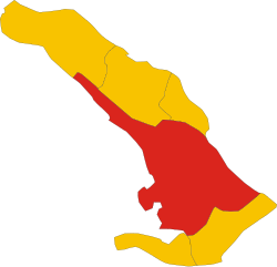
Хрпелье-Козина (Hrpelje–Kozina Municipality, Občina Hrpelje - Kozina)

- община Словении
 Hiking in Хрпелье-Козина
The Municipality of Hrpelje-Kozina in Slovenia offers a variety of hiking opportunities characterized by scenic landscapes, diverse terrain, and rich natural and cultural heritage. Here are some highlights for hikers in this area:
Trails and Natural Features
-
Hiking Trails: The region has several hiking trails that cater to different levels of experience, from easy strolls to more challenging hikes. Popular trails often lead through forests, hills, and valleys, showcasing the area's natural beauty.
-
Mountain Range: The nearby Karst Plateau offers spectacular views and unique geological formations, including karst caves and cliffs. Notable peaks provide excellent vantage points for panoramic views of the surrounding countryside.
-
Soca Valley: While not directly in Hrpelje-Kozina, access points to the stunning Soca Valley are within a reasonable distance. This area is famous for its emerald green rivers and exceptional outdoor activities.
-
Natural Reserves: The region hosts various protected areas where hikers can immerse themselves in nature and potentially spot local wildlife.
Cultural Aspects
-
Historical Sites: Along many trails, you will come across historical landmarks and cultural sites, including old churches, fortifications, and traditional Slovenian villages.
-
Local Cuisine: After a day of hiking, consider enjoying local Slovene cuisine in nearby restaurants that feature regional specialties.
Practical Information
-
Best Time to Hike: The best months for hiking in this region are typically late spring to early autumn (May to October), when the weather is most favorable.
-
What to Bring: Make sure you have appropriate hiking gear, including sturdy footwear, weather-appropriate clothing, sufficient water, and snacks. A map or GPS device can also be helpful.
-
Safety & Regulations: Always stay on marked trails, respect local wildlife, and follow any guidelines provided by local authorities to preserve the natural environment.
Overall, the Municipality of Hrpelje-Kozina offers a blend of beautiful landscapes, cultural experiences, and a welcome atmosphere for all types of hikers. Whether you're seeking a peaceful day hike or a more challenging trek, you'll find options that allow you to explore this unique Slovenian region.
- Страна:

- Почтовый код: 6240
- Код автомобильного номера: KP
- Координаты: 45° 35' 0" N, 13° 59' 0" E


- GPS треки (wikiloc): [Ссылка]
- Высота над уровнем моря: 497 м m
- Площадь: 192.2 кв.км
- Веб сайт: http://www.hrpelje-kozina.si/
- Википедия английская: wiki(en)
- Википедия национальная: wiki(sl)
- Хранилище Wikidata: Wikidata: Q556206
- Катеория в википедии: [Ссылка]
- код Freebase: [/m/0bmz4t]
- код GeoNames: Альт: [3239050]
- ISO 3166-2: SI-035
- FIPS 10-4: SI35
Граничит с регионами:


Сан-Дорлиго-делла-Валле
- коммуна в Италии
Hiking in Сан-Дорлиго-делла-Валле
San Dorligo della Valle, located in the Friuli Venezia Giulia region of Italy, offers a range of hiking opportunities surrounded by beautiful landscapes and rich biodiversity. The area is characterized by its mix of Mediterranean and mountainous terrain, providing various trails for different skill levels....
- Страна:

- Почтовый код: 34018
- Телефонный код: 040
- Код автомобильного номера: TS
- Координаты: 45° 37' 21" N, 13° 51' 28" E
- GPS треки (wikiloc): [Ссылка]
- Высота над уровнем моря: 106 м m
- Площадь: 25 кв.км
- Население: 5754
- Веб сайт: [Ссылка]
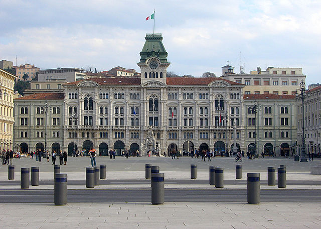
Триест
- город в Италии
Hiking in Триест
Trieste, a picturesque city located in northeastern Italy, offers a unique blend of cultural heritage and stunning natural landscapes, making it an excellent destination for hiking enthusiasts. Here’s an overview of the hiking opportunities around Trieste:...
- Страна:
- Почтовый код: 34151; 34150; 34149; 34148; 34147; 34146; 34145; 34144; 34143; 34142; 34141; 34140; 34139; 34138; 34137; 34136; 34135; 34134; 34133; 34132; 34131; 34130; 34129; 34128; 34127; 34126; 34125; 34124; 34123; 34122; 34121
- Телефонный код: 040
- Код автомобильного номера: TS
- Координаты: 45° 38' 10" N, 13° 48' 15" E
- GPS треки (wikiloc): [Ссылка]
- Высота над уровнем моря: 2 м m
- Площадь: 85.11 кв.км
- Население: 204234
- Веб сайт: [Ссылка]