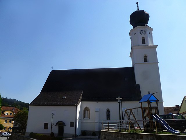
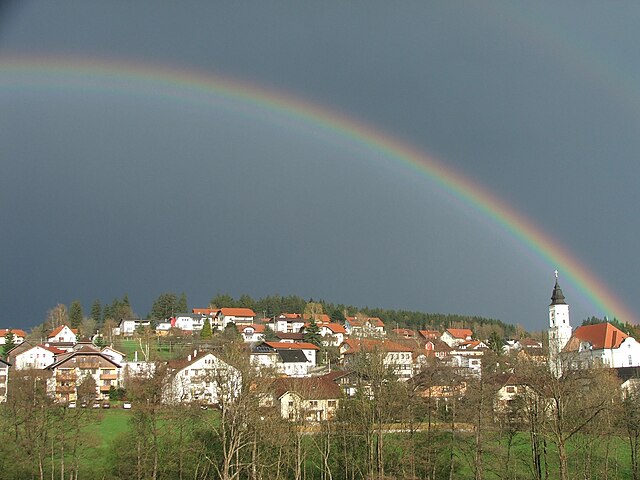
Наттернбах (Natternbach, Natternbach)
 Hiking in Наттернбах
Natternbach is a picturesque village located in the Upper Austria region, surrounded by beautiful natural scenery, making it a great spot for hiking enthusiasts. Here are some insights into hiking in and around Natternbach:
Trails
-
Local Paths: Natternbach features several well-marked local hiking trails that vary in difficulty and length. These trails often lead through lush forests, alongside meandering rivers, and past charming countryside landscapes.
-
Scenic Routes: Many routes provide breathtaking views of the surrounding hills and valleys, particularly in the spring and summer when the flora is in full bloom.
-
Regional Hiking Networks: Natternbach is also part of larger regional hiking networks, allowing hikers to embark on longer treks that connect to nearby towns and villages.
Points of Interest
-
Historical Sites: You may encounter historical landmarks along your hike, including old churches and traditional farms that showcase the region's culture.
-
Wildlife: The area is home to diverse wildlife, so keep an eye out for various bird species, deer, and other animals, especially in quieter, less disturbed areas.
Hiking Tips
-
Preparation: Always check the weather before you head out, as conditions can change quickly in the mountains. Wear suitable hiking clothes and sturdy shoes.
-
Hydration and Nutrition: Carry sufficient water and snacks, especially for longer hikes.
-
Navigation: A good map or navigation app can be helpful since signage varies from trail to trail.
Local Guides
Consider hiring a local guide if you're unfamiliar with the area. They can provide valuable insights into the best trails and hidden gems.
Conclusion
Hiking in Natternbach offers a fantastic opportunity to experience the natural beauty of Upper Austria. Whether you're a beginner looking for a leisurely walk or an experienced hiker seeking challenging terrain, there is a trail for everyone!
- Страна:

- Почтовый код: 4723
- Телефонный код: 07278
- Код автомобильного номера: GR
- Координаты: 48° 23' 51" N, 13° 45' 0" E


- GPS треки (wikiloc): [Ссылка]
- Высота над уровнем моря: 434 м m
- Площадь: 30.9 кв.км
- Население: 2305
- Веб сайт: http://www.natternbach.at/
- Википедия русская: wiki(ru)
- Википедия английская: wiki(en)
- Википедия национальная: wiki(de)
- Хранилище Wikidata: Wikidata: Q679118
- Катеория в википедии: [Ссылка]
- код Freebase: [/m/03gv571]
- код GeoNames: Альт: [7873147]
- код VIAF: Альт: [237294465]
- код GND: Альт: [4123821-7]
- код австрийского муниципалитета: [40816]
Граничит с регионами:

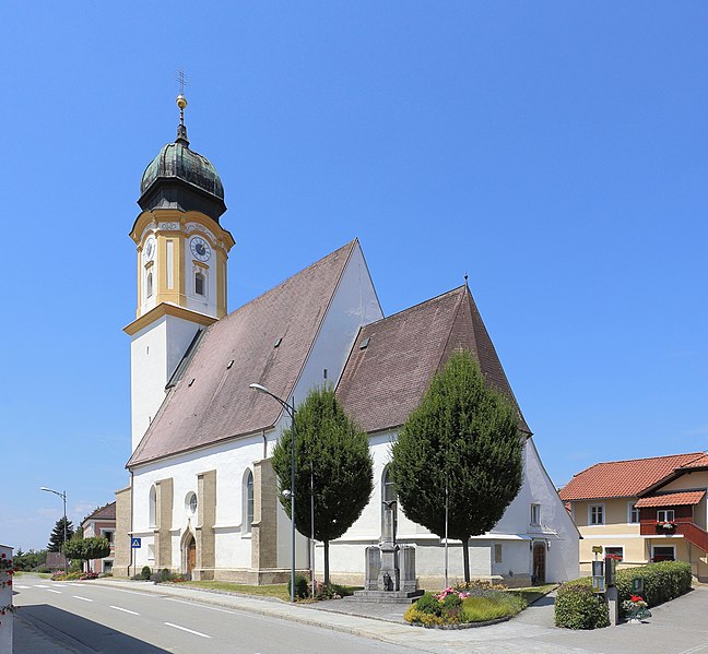
Пойербах
Hiking in Пойербах
Peuerbach, a small town in Upper Austria, offers a charming environment for hiking enthusiasts. Surrounded by beautiful landscapes, rolling hills, and lush greenery, it's an excellent destination for both beginner and experienced hikers....
- Страна:
- Почтовый код: 4722
- Телефонный код: 07276
- Код автомобильного номера: GR
- Координаты: 48° 20' 44" N, 13° 46' 27" E
- GPS треки (wikiloc): [Ссылка]
- Высота над уровнем моря: 390 м m
- Площадь: 39.4 кв.км
- Население: 4483
- Веб сайт: [Ссылка]
Штеген
Hiking in Штеген
Steegen, located in Belgium, offers a variety of picturesque hiking opportunities. While it is not as widely known as some other European hiking destinations, its scenic landscapes and charming rural areas make it a great spot for outdoor enthusiasts....
- Страна:
- Почтовый код: 4722
- Телефонный код: 07276
- Код автомобильного номера: GR
- Координаты: 48° 20' 24" N, 13° 45' 55" E
- GPS треки (wikiloc): [Ссылка]
- Высота над уровнем моря: 380 м m
- Площадь: 13.2 кв.км
- Население: 1049
- Веб сайт: [Ссылка]
Энценкирхен
Hiking in Энценкирхен
Enzenkirchen is a scenic area located in Austria, known for its beautiful landscapes and outdoor recreational opportunities, including hiking. Although it may not be as well-known as some of Austria’s larger hiking destinations, it offers a charming experience for those looking to explore the countryside....
- Страна:
- Почтовый код: 4761
- Телефонный код: 07762
- Код автомобильного номера: SD
- Координаты: 48° 23' 0" N, 13° 39' 0" E
- GPS треки (wikiloc): [Ссылка]
- Высота над уровнем моря: 373 м m
- Площадь: 23 кв.км
- Население: 1772
- Веб сайт: [Ссылка]

Нойкирхен-на-Вальде
Hiking in Нойкирхен-на-Вальде
Neukirchen am Walde is a charming municipality located in Bavaria, Germany, nestled in the picturesque landscape of the Bavarian Forest. This region offers a variety of hiking opportunities for both beginners and seasoned hikers. Here are some highlights of hiking in Neukirchen am Walde:...
- Страна:
- Почтовый код: 4724
- Телефонный код: 07278
- Код автомобильного номера: GR
- Координаты: 48° 24' 21" N, 13° 46' 55" E
- GPS треки (wikiloc): [Ссылка]
- Высота над уровнем моря: 555 м m
- Площадь: 15.8 кв.км
- Население: 1633
- Веб сайт: [Ссылка]
Санкт-Виллибальд
Hiking in Санкт-Виллибальд
Sankt Willibald, located in Bavaria, Germany, is a charming area known for its scenic landscapes and hiking opportunities. The region is characterized by its beautiful rolling hills, lush forests, and picturesque views, making it ideal for both novice and experienced hikers....
- Страна:
- Почтовый код: 4762
- Телефонный код: 07762
- Код автомобильного номера: SD
- Координаты: 48° 22' 0" N, 13° 41' 0" E
- GPS треки (wikiloc): [Ссылка]
- Высота над уровнем моря: 455 м m
- Площадь: 15 кв.км
- Население: 1100
- Веб сайт: [Ссылка]


Санкт-Эгиди
Hiking in Санкт-Эгиди
Sankt Aegidi, located in Austria, offers a variety of hiking opportunities that allow you to enjoy the stunning landscapes of the region. The area is characterized by its picturesque rolling hills, lush green meadows, and scenic views of the surrounding mountains....
- Страна:
- Почтовый код: 4725
- Телефонный код: 07717
- Код автомобильного номера: SD
- Координаты: 48° 29' 0" N, 13° 44' 0" E
- GPS треки (wikiloc): [Ссылка]
- Высота над уровнем моря: 599 м m
- Площадь: 29 кв.км
- Население: 1556
- Веб сайт: [Ссылка]
Копфинг
Hiking in Копфинг
Kopfing im Innkreis, located in Austria's Upper Austria region, offers a charming environment for hiking enthusiasts. The area is characterized by beautiful landscapes, rolling hills, and serene natural settings, making it perfect for a variety of hiking trails suitable for different skill levels....
- Страна:
- Почтовый код: 4794
- Телефонный код: 07763
- Код автомобильного номера: SD
- Координаты: 48° 25' 59" N, 13° 39' 0" E
- GPS треки (wikiloc): [Ссылка]
- Высота над уровнем моря: 547 м m
- Площадь: 33.34 кв.км
- Население: 2008
- Веб сайт: [Ссылка]