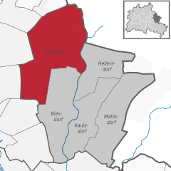
Ной-Хоэншёнхаузен (Neu-Hohenschönhausen, Neu-Hohenschönhausen)

- район в Берлине
 Hiking in Ной-Хоэншёнхаузен
Neu-Hohenschönhausen is a district located in the northeastern part of Berlin, Germany. While it is primarily an urban area known for its residential neighborhoods, parks, and recreational spaces, there are still opportunities for hiking and enjoying nature nearby, particularly in green spaces and surrounding areas.
Hiking Opportunities in and around Neu-Hohenschönhausen:
-
Parks and Green Spaces:
- Volkspark Prenzlauer Berg: Although not directly in Neu-Hohenschönhausen, this park is relatively close and offers hiking paths along with beautiful green areas for walking.
- Landschaftspark Herzberge: A bit further out, this park features natural landscapes that can provide a pleasant hiking experience.
-
Lake Areas:
- Lakes in the Region: Several lakes can be found in the vicinity, such as the Woltersdorfer Lake or the clear waters of Lake Tegel. These areas often have trails that offer scenic hiking routes.
-
Nature Reserves:
- Berliner Stadtforst: The City Forest encompasses large green spaces suitable for longer walks and hikes, featuring dense woods and trails.
-
Cycle and Hike Routes:
- Many of Berlin's cycling paths double as hiking trails. The cycling routes along the Spree and other rivers often have adjacent walking paths, providing an enjoyable way to explore the city's landscape.
Tips for Hiking in Neu-Hohenschönhausen:
- Plan Your Route: Make use of local maps or mobile apps to find the best trails and parks in the area.
- Check Weather Conditions: Berlin weather can be unpredictable, so be prepared for changes in weather.
- Wear Appropriate Footwear: Comfortable, sturdy shoes are essential whether you are hiking on urban trails or in more natural environments.
- Stay Hydrated and Snack Ready: Bring enough water and snacks, particularly if you are planning a longer hike.
- Explore Further: Consider using public transport to get to more extensive hiking areas outside of Neu-Hohenschönhausen, like the surrounding nature reserves in Brandenburg.
Although Neu-Hohenschönhausen may not be known for dramatic hiking trails, it offers a mix of urban and natural experiences perfect for day hikes and leisurely walks.
- Страна:

- Координаты: 52° 33' 48" N, 13° 30' 18" E


- GPS треки (wikiloc): [Ссылка]
- Высота над уровнем моря: 55 м m
- Площадь: 5.16 кв.км
- Население: 53374
- Википедия английская: wiki(en)
- Википедия национальная: wiki(de)
- Хранилище Wikidata: Wikidata: Q569866
- Галерея изображений в википедии: [Ссылка]
- Катеория в википедии: [Ссылка]
- код Freebase: [/m/0brzz09]
- код GeoNames: Альт: [8334622]
- ID отношения в OpenStreetMap: [413420]
- идентификатор местоположения ArchINFORM: [3625]
Граничит с регионами:


Вартенберг
- район в Берлине
Hiking in Вартенберг
Wartenberg is a district located in the northeastern part of Berlin, known for its more residential and green areas compared to the bustling city center. While it may not be a well-known hiking destination like some national parks or renowned trails, there are still several opportunities for outdoor activity and exploration in and around Wartenberg....
- Страна:
- Координаты: 52° 34' 45" N, 13° 31' 15" E
- GPS треки (wikiloc): [Ссылка]
- Высота над уровнем моря: 58 м m
- Площадь: 6.92 кв.км


Мальхов
- район в Берлине
Hiking in Мальхов
Malchow is a district in the northeastern part of Berlin, situated at the confluence of the Malchower See and the Wuhle River. While it may not be a traditional hiking hotspot like national parks or mountainous regions, it offers some lovely opportunities for walking and enjoying nature, especially along its waterways and parks....
- Страна:
- Координаты: 52° 34' 45" N, 13° 29' 0" E
- GPS треки (wikiloc): [Ссылка]
- Высота над уровнем моря: 57 м m
- Площадь: 1.54 кв.км
- Население: 508


Пригородный посёлок Мальхов
- район в Берлине
Hiking in Пригородный посёлок Мальхов
Stadtrandsiedlung Malchow is a charming area located in the outskirts of Berlin, characterized by its natural beauty and access to various outdoor activities, including hiking. Here’s a breakdown of what you can expect when hiking in this area:...
- Страна:
- Координаты: 52° 34' 20" N, 13° 28' 0" E
- GPS треки (wikiloc): [Ссылка]
- Высота над уровнем моря: 47 м m
- Площадь: 5.68 кв.км


Фалькенберг
- район в Берлине
Hiking in Фалькенберг
Falkenberg is a district located in the eastern part of Berlin, known for its relatively tranquil environment compared to the bustling city center. While it may not be as famous for hiking as some larger nature parks or forested areas, there are still opportunities to explore the natural beauty nearby....
- Страна:
- Координаты: 52° 34' 15" N, 13° 32' 45" E
- GPS треки (wikiloc): [Ссылка]
- Высота над уровнем моря: 56 м m
- Площадь: 3.06 кв.км


Альт-Хоэншёнхаузен
- район в Берлине
Hiking in Альт-Хоэншёнхаузен
Alt-Hohenschönhausen, a district in the northeastern part of Berlin, Germany, may not be a traditional hiking destination, but it does offer some good opportunities for walking and exploring green spaces. Here are some points to consider if you're looking to hike or walk in this area:...
- Страна:
- Координаты: 52° 32' 55" N, 13° 30' 27" E
- GPS треки (wikiloc): [Ссылка]
- Высота над уровнем моря: 55 м m
- Площадь: 9.33 кв.км
- Население: 42609


Вайсензе
- район в Берлине
Hiking in Вайсензе
Weissensee is a district in the northeastern part of Berlin, known for its large lake, Weissensee, which is a popular destination for both locals and tourists looking to enjoy nature and outdoor activities. While Weissensee is not traditionally associated with extensive hiking trails like some of the larger natural parks or forested areas, it offers some lovely spots for walking and enjoying the outdoors....
- Страна:
- Координаты: 52° 33' 0" N, 13° 28' 0" E
- GPS треки (wikiloc): [Ссылка]
- Высота над уровнем моря: 53 м m
- Площадь: 7.93 кв.км
- Население: 51699
- Веб сайт: [Ссылка]

Марцан
- район в Берлине
Hiking in Марцан
Marzahn, a district located in the northeastern part of Berlin, Germany, is not typically known as a hiking destination in the traditional sense, as it is more urbanized compared to other areas. However, there are still opportunities for walking and exploring nature in and around this district....
- Страна:
- Почтовый код: 12689; 12687; 12685; 12681; 12679
- Координаты: 52° 32' 45" N, 13° 33' 45" E
- GPS треки (wikiloc): [Ссылка]
- Высота над уровнем моря: 62 м m
- Площадь: 19.54 кв.км
- Население: 106640