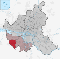
Нойенфельде (Neuenfelde, Neuenfelde)

- квартал в Гамбурге
 Hiking in Нойенфельде
Neuenfelde is a district located in the Hamburg-Harburg region of Germany. While it is primarily a residential area, it is surrounded by beautiful natural landscapes, making it a suitable spot for hiking and outdoor activities.
Hiking Opportunities in Neuenfelde:
-
Scenic Trails:
- The area features several scenic trails that take you through charming farmland, alongside rivers, and into forests. Look for paths that follow the Este River for picturesque views and opportunities to observe wildlife.
-
Nature Reserves:
- Nearby nature reserves, such as the "Landschaftsschutzgebiet Este," offer well-marked hiking trails. These areas are ideal for exploring local flora and fauna.
-
Local Parks:
- There are several parks in and around Neuenfelde, where you can enjoy leisurely hikes or more vigorous walks. These parks often have walking paths and are perfect for family outings.
-
Cultural Sites:
- Incorporate some cultural elements into your hike. Check out historical sites or local landmarks in the area, providing insight into the region's history while enjoying the outdoors.
Hiking Tips:
- Trail Maps: Before heading out, consider downloading a trail map or using a hiking app to stay on track.
- Weather Preparedness: Check the weather forecast and dress appropriately, as conditions can change. Layering is usually a good strategy.
- Hydration and Snacks: Bring water and some snacks to keep your energy up during your hike.
- Respect Nature: Always practice Leave No Trace principles—stay on designated trails, avoid disturbing wildlife, and carry away everything you bring with you.
Getting There:
- Neuenfelde is accessible via public transport from various parts of Hamburg, making it easy to plan a day hike.
Whether you're looking for a peaceful walk or a more challenging trek, Neuenfelde and its surroundings offer a lovely blend of nature and tranquility. Enjoy your hiking adventure!
- Страна:

- Координаты: 53° 30' 53" N, 9° 47' 44" E


- GPS треки (wikiloc): [Ссылка]
- Высота над уровнем моря: 2 м m
- Площадь: 15.5 кв.км
- Население: 4671
- Википедия английская: wiki(en)
- Википедия национальная: wiki(de)
- Хранилище Wikidata: Wikidata: Q3518
- Галерея изображений в википедии: [Ссылка]
- Катеория в википедии: [Ссылка]
- Карты в википедии: [Ссылка]
- код Freebase: [/m/02q1xfj]
- код Freebase: [/m/02q1xfj]
- код Freebase: [/m/02q1xfj]
- код Freebase: [/m/02q1xfj]
- код GeoNames: Альт: [2865735]
- код GeoNames: Альт: [2865735]
- код GeoNames: Альт: [2865735]
- код GeoNames: Альт: [2865735]
- код VIAF: Альт: [239583456]
- код VIAF: Альт: [239583456]
- код VIAF: Альт: [239583456]
- код VIAF: Альт: [239583456]
- код GND: Альт: [4291247-7]
- код GND: Альт: [4291247-7]
- код GND: Альт: [4291247-7]
- код GND: Альт: [4291247-7]
- идентификатор местоположения ArchINFORM: [16545]
- идентификатор местоположения ArchINFORM: [16545]
- идентификатор местоположения ArchINFORM: [16545]
- идентификатор местоположения ArchINFORM: [16545]
Граничит с регионами:


Финкенвердер
- район Гамбурга
Hiking in Финкенвердер
Finkenwerder is a district in Hamburg, Germany, located on the Elbe River. While it is primarily known as a residential and industrial area, it offers some pleasant opportunities for walking and enjoying nature, especially along the river....
- Страна:
- Почтовый код: 21129
- Координаты: 53° 32' 24" N, 9° 49' 48" E
- GPS треки (wikiloc): [Ссылка]
- Высота над уровнем моря: 4 м m
- Площадь: 19.3 кв.км


Кранц
- квартал в Гамбурге
Hiking in Кранц
Cranz is a charming district located on the outskirts of Hamburg, known for its picturesque landscapes and natural beauty. While it may not be a traditional hiking destination with extensive mountain trails, there are several opportunities for pleasant walks and hikes in and around Cranz....
- Страна:
- Телефонный код: 040
- Координаты: 53° 32' 13" N, 9° 46' 50" E
- GPS треки (wikiloc): [Ссылка]
- Высота над уровнем моря: 1 м m
- Площадь: 1.3 кв.км
- Население: 857


Francop
Hiking in Francop
It seems there might be a misunderstanding regarding the name "Francop." There’s no widely recognized hiking destination or region by that name in popular hiking resources. However, it’s possible you could be referring to a specific locality not well-documented or known by a different name....
- Страна:
- Телефонный код: 040
- Координаты: 53° 30' 29" N, 9° 51' 10" E
- GPS треки (wikiloc): [Ссылка]
- Высота над уровнем моря: -2 м m
- Площадь: 9.1 кв.км

Нойграбен-Фишбек
- квартал в Гамбурге
Hiking in Нойграбен-Фишбек
Neugraben-Fischbek is a district located in the southern part of Hamburg, Germany. While it may not be as well-known for hiking as some of the more mountainous regions, it does offer some opportunities for outdoor activities and exploration. Here are some insights into hiking in and around Neugraben-Fischbek:...
- Страна:
- Почтовый код: 21149; 21147
- Координаты: 53° 28' 21" N, 9° 50' 9" E
- GPS треки (wikiloc): [Ссылка]
- Высота над уровнем моря: 1 м m
- Площадь: 22.5 кв.км
- Население: 28991
- Веб сайт: [Ссылка]