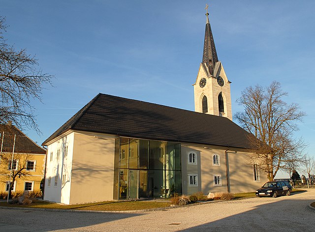
Нойхофен-на-Кремсе (Neuhofen an der Krems, Neuhofen an der Krems)
 Hiking in Нойхофен-на-Кремсе
Neuhofen an der Krems, located in Upper Austria within the district of Linz-Land, offers a picturesque setting for hiking enthusiasts. The area is characterized by rolling hills, lush forests, and peaceful landscapes, making it an ideal destination for both casual walkers and more experienced hikers.
Hiking Trails
-
Local Trails: Neuhofen has several well-marked hiking trails that cater to different skill levels. These trails often wind through forests and past charming farms, providing glimpses of the region's natural beauty.
-
Krems Nature Reserve: Nearby nature reserves, like the Krems Nature Reserve, allow for scenic hikes where you can enjoy diverse flora and fauna. Look for opportunities to observe local wildlife and enjoy the serenity of the natural environment.
-
Connecting Routes: Neuhofen's location provides access to broader hiking networks, allowing you to connect with trails leading to other nearby towns and attractions. This makes it possible to plan longer hikes or multi-day adventures.
Hiking Tips
-
Preparation: Always check the weather and trail conditions before heading out. Dress in layers and wear appropriate footwear.
-
Maps and Guides: Carry a map or a hiking app to navigate the trails effectively. Local visitor centers often have resources available.
-
Safety: Inform someone about your hiking plans and expected return time, especially if you plan on hiking alone.
-
Respect Nature: Stay on marked paths, dispose of waste properly, and be mindful of wildlife.
Attractions
In addition to hiking, you can explore the culture and history of Neuhofen an der Krems. The town's charming architecture and local eateries provide a pleasant way to rest and recharge after a day on the trails.
Whether you're looking for a leisurely stroll or a more challenging hike, Neuhofen an der Krems offers a beautiful backdrop for your outdoor adventures in Upper Austria.
- Страна:

- Почтовый код: 4501
- Телефонный код: 07227
- Код автомобильного номера: LL
- Координаты: 48° 8' 1" N, 14° 14' 0" E


- GPS треки (wikiloc): [Ссылка]
- Высота над уровнем моря: 303 м m
- Площадь: 18.2 кв.км
- Население: 6269
- Веб сайт: http://www.neuhofen-krems.at/
- Википедия русская: wiki(ru)
- Википедия английская: wiki(en)
- Википедия национальная: wiki(de)
- Хранилище Wikidata: Wikidata: Q686368
- Катеория в википедии: [Ссылка]
- код Freebase: [/m/03gv6n7]
- код GeoNames: Альт: [7873166]
- код VIAF: Альт: [243845592]
- идентификатор местоположения ArchINFORM: [43941]
- место в MusicBrainz: [e1d5d2f9-3dbe-4c10-adab-d3f259cb42c1]
- код австрийского муниципалитета: [41014]
Граничит с регионами:

Ансфельден
Hiking in Ансфельден
Ansfelden, located in Austria near Linz, offers a variety of hiking trails suitable for different skill levels. The region features picturesque landscapes, including lush forests, rolling hills, and scenic views of the surrounding areas, making it an excellent destination for nature enthusiasts....
- Страна:
- Код автомобильного номера: LL
- Координаты: 48° 12' 30" N, 14° 17' 20" E
- GPS треки (wikiloc): [Ссылка]
- Высота над уровнем моря: 289 м m
- Площадь: 31.33 кв.км
- Население: 16194
- Веб сайт: [Ссылка]
Пибербах
Hiking in Пибербах
Piberbach is a beautiful hiking area located in Austria, particularly known for its scenic landscapes and lush natural surroundings. The region offers a variety of hiking trails that cater to different skill levels, making it an ideal destination for both novice and experienced hikers....
- Страна:
- Почтовый код: 4533
- Телефонный код: 07228
- Код автомобильного номера: LL
- Координаты: 48° 6' 55" N, 14° 13' 36" E
- GPS треки (wikiloc): [Ссылка]
- Высота над уровнем моря: 320 м m
- Площадь: 17 кв.км
- Население: 1902
- Веб сайт: [Ссылка]

Санкт-Мариен
Hiking in Санкт-Мариен
Sankt Marien is a picturesque area, often associated with beautiful natural landscapes suitable for hiking. While there may not be extensive information available specifically for a location named Sankt Marien (given there are several places with similar names across Europe), if we consider it to be a town or region in areas like Germany or Austria, it generally offers a variety of hiking opportunities....
- Страна:
- Почтовый код: 4502
- Телефонный код: 07227
- Код автомобильного номера: LL
- Координаты: 48° 8' 47" N, 14° 16' 32" E
- GPS треки (wikiloc): [Ссылка]
- Высота над уровнем моря: 338 м m
- Площадь: 38 кв.км
- Население: 4769
- Веб сайт: [Ссылка]


Пуккинг
Hiking in Пуккинг
Pucking is a small municipality in Austria, located in the upper Austrian region of Pucking. While it may not be universally recognized as a hiking hotspot, it is surrounded by beautiful landscapes that can provide opportunities for outdoor enthusiasts....
- Страна:
- Почтовый код: 4055
- Телефонный код: 07229
- Код автомобильного номера: LL
- Координаты: 48° 11' 21" N, 14° 11' 1" E
- GPS треки (wikiloc): [Ссылка]
- Высота над уровнем моря: 286 м m
- Площадь: 19.81 кв.км
- Население: 3904
- Веб сайт: [Ссылка]

Альхаминг
Hiking in Альхаминг
Allhaming is a small municipality located in Austria, specifically in the state of Upper Austria. While it may not be as well-known as larger cities or national parks, the surrounding region offers opportunities for hiking that can be quite enjoyable....
- Страна:
- Почтовый код: 4511
- Телефонный код: 07227
- Код автомобильного номера: LL
- Координаты: 48° 9' 1" N, 14° 10' 2" E
- GPS треки (wikiloc): [Ссылка]
- Высота над уровнем моря: 341 м m
- Площадь: 14 кв.км
- Население: 1174
- Веб сайт: [Ссылка]

Кематен-на-Кремсе
Hiking in Кематен-на-Кремсе
Kematen an der Krems is a charming municipality located in Upper Austria, surrounded by beautiful landscapes that make it an excellent destination for hiking enthusiasts. The region features a variety of trails suited for different skill levels, including leisurely walks and more challenging hikes....
- Страна:
- Почтовый код: 4531
- Телефонный код: 07228
- Код автомобильного номера: LL
- Координаты: 48° 6' 41" N, 14° 11' 32" E
- GPS треки (wikiloc): [Ссылка]
- Высота над уровнем моря: 327 м m
- Площадь: 21 кв.км
- Население: 2790
- Веб сайт: [Ссылка]