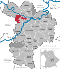
Нойштадт-на-Дунае (Neustadt an der Donau, Neustadt an der Donau)

 Hiking in Нойштадт-на-Дунае
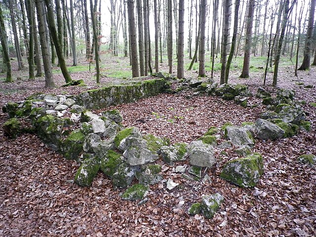
Neustadt an der Donau, located in Bavaria, Germany, is a charming area that offers a variety of hiking opportunities, thanks to its scenic landscapes, historic sites, and proximity to the Danube River. Here's what you should know when planning your hiking adventures in and around Neustadt an der Donau:
Trails and Routes
-
Danube Cycle Path: While primarily a cycling route, the Danube Cycle Path runs alongside the river and offers beautiful views, making it suitable for walking as well. The flat terrain makes it accessible for hikers of all levels.
-
Nearby Nature Reserves: The area is surrounded by natural beauty, including the Danube Floodplains Nature Reserve. Here, you can explore various trails that take you through lush forests, wetlands, and diverse wildlife.
-
Altmühltal Nature Park: Located a short distance away, this park offers numerous well-marked hiking trails, ranging from easy strolls to more challenging hikes. The trails often lead you through picturesque valleys, past limestone cliffs, and historical castles.
-
Local Hiking Routes: There are several local circular hiking routes that start and finish in Neustadt. These trails typically range from 5 to 15 kilometers and offer a mix of scenic views, forests, and agricultural landscapes.
Best Time to Hike
The best time to hike in Neustadt an der Donau is during the spring (March to June) and early autumn (September to October). During these periods, the weather is generally mild and pleasant, and you can enjoy the blooming nature in spring or the colorful foliage in autumn.
Preparation and Tips
- Gear: Wear comfortable, weather-appropriate clothing and sturdy hiking shoes. Bring a backpack with water, snacks, a map (or a GPS device), and a first aid kit.
- Weather: Check the weather forecast before your hike; conditions can change rapidly in the region.
- Safety: Stay on marked trails and be mindful of your surroundings, especially in areas where wildlife may be present.
- Local Attractions: Consider incorporating visits to historical sites such as the town's churches or castles, which can enrich your hiking experience.
Community and Resources
The local community is often welcoming to hikers, and you may find organized hikes or outings through local clubs. Always check for any hiking apps or local websites that provide updates on trail conditions and suggest routes.
Overall, hiking in Neustadt an der Donau can be a delightful way to experience Bavaria's natural beauty and rich history. Whether you're a experienced hiker or a casual walker, there are plenty of options to enjoy the outdoors!
- Страна:

- Почтовый код: 93333
- Телефонный код: 09445
- Код автомобильного номера: KEH
- Координаты: 48° 48' 25" N, 11° 46' 10" E


- GPS треки (wikiloc): [Ссылка]
- Высота над уровнем моря: 357 м m
- Площадь: 93.55 кв.км
- Население: 9811
- Веб сайт: http://www.neustadt-donau.de
- Википедия русская: wiki(ru)
- Википедия английская: wiki(en)
- Википедия национальная: wiki(de)
- Хранилище Wikidata: Wikidata: Q269010
- Катеория в википедии: [Ссылка]
- код Freebase: [/m/09xvd5]
- код GeoNames: Альт: [6559212]
- код BNF: [15569644d]
- код VIAF: Альт: [144697029]
- ID отношения в OpenStreetMap: [956656]
- код GND: Альт: [4041930-7]
- идентификатор местоположения ArchINFORM: [14751]
- код LCNAF: Альт: [nr96040965]
- код Historical Gazetteer: [NEUNAUJN58VT]
- Bavarikon ID: [ODB_A00001498]
- идентификатор муниципалитетов в Германии: 09273152
- код GNS: -1832819
Граничит с регионами:


Абенсберг
- город в Германии
Hiking in Абенсберг
Abensberg, located in Bavaria, Germany, is a charming small town known for its rich history and beautiful landscapes, making it a nice destination for hikers. Here are some highlights and tips for hiking in and around Abensberg:...
- Страна:
- Почтовый код: 93326
- Телефонный код: 09443
- Код автомобильного номера: KEH
- Координаты: 48° 48' 39" N, 11° 51' 34" E
- GPS треки (wikiloc): [Ссылка]
- Высота над уровнем моря: 370 м m
- Площадь: 60.27 кв.км
- Население: 13540
- Веб сайт: [Ссылка]


Мюнксмюнстер
Hiking in Мюнксмюнстер
Münchsmünster, located in Bavaria, Germany, offers a peaceful escape for hiking enthusiasts looking for serene landscapes and a touch of nature. The area is characterized by its picturesque countryside, rolling hills, and lush forests, making it an excellent destination for both novice and experienced hikers....
- Страна:
- Почтовый код: 85126
- Телефонный код: 08402
- Код автомобильного номера: PAF
- Координаты: 48° 45' 51" N, 11° 41' 28" E
- GPS треки (wikiloc): [Ссылка]
- Высота над уровнем моря: 357 м m
- Площадь: 16.21 кв.км
- Население: 2922
- Веб сайт: [Ссылка]


Альтманштайн
Hiking in Альтманштайн
Altmannstein, located in Bavaria, Germany, is a wonderful destination for hiking enthusiasts. Nestled in the picturesque landscape of the Danube Valley, this area offers a variety of trails suitable for different skill levels. Here are some key points about hiking in Altmannstein:...
- Страна:
- Почтовый код: 93336
- Телефонный код: 09446; 08468
- Код автомобильного номера: EI
- Координаты: 48° 54' 0" N, 11° 39' 0" E
- GPS треки (wikiloc): [Ссылка]
- Высота над уровнем моря: 388 м m
- Площадь: 114.29 кв.км
- Население: 5892
- Веб сайт: [Ссылка]


Кельхайм
Hiking in Кельхайм
Kelheim, located in Bavaria, Germany, is a fantastic destination for hikers and nature enthusiasts. It is situated at the confluence of the Danube and Altmühl Rivers, surrounded by picturesque landscapes, limestone cliffs, and a variety of hiking trails that cater to all levels of experience. Here are some highlights and tips for hiking in Kelheim:...
- Страна:
- Почтовый код: 93309
- Телефонный код: 09441
- Код автомобильного номера: KEH
- Координаты: 48° 55' 0" N, 11° 52' 0" E
- GPS треки (wikiloc): [Ссылка]
- Высота над уровнем моря: 345 м m
- Площадь: 76.68 кв.км
- Население: 16716
- Веб сайт: [Ссылка]


Зигенбург
Hiking in Зигенбург
Siegenburg, located in Bavaria, Germany, offers a unique hiking experience with its picturesque landscapes and charming countryside. The area features a variety of trails suitable for different skill levels, making it an excellent destination for both casual hikers and more experienced trekkers....
- Страна:
- Почтовый код: 93354
- Телефонный код: 09444
- Код автомобильного номера: KEH
- Координаты: 48° 45' 0" N, 11° 51' 0" E
- GPS треки (wikiloc): [Ссылка]
- Высота над уровнем моря: 392 м m
- Площадь: 27.84 кв.км
- Население: 2384
- Веб сайт: [Ссылка]


Пфёрринг
Hiking in Пфёрринг
Pförring, located in Bavaria, Germany, is a quaint town surrounded by scenic landscapes that can be appealing for hikers. While there may not be extensive hiking trails specifically in Pförring itself, the surrounding areas offer beautiful countryside and potential routes for outdoor enthusiasts....
- Страна:
- Почтовый код: 85104; W-8071; 8071
- Телефонный код: 08403
- Код автомобильного номера: EI
- Координаты: 48° 48' 30" N, 11° 41' 24" E
- GPS треки (wikiloc): [Ссылка]
- Высота над уровнем моря: 356 м m
- Площадь: 43.54 кв.км
- Население: 2881
- Веб сайт: [Ссылка]


Dürnbucher Forst
Hiking in Dürnbucher Forst
Dürnbucher Forst, located near the urban area of Regensburg in Bavaria, Germany, is a beautiful destination for hiking enthusiasts. The forest is characterized by its lush greenery, diverse plant life, and serene atmosphere, making it ideal for nature walks and outdoor activities. Here are some key points to consider if you’re planning a hike in Dürnbucher Forst:...
- Страна:
- Координаты: 48° 44' 0" N, 11° 44' 0" E
- GPS треки (wikiloc): [Ссылка]
Hienheimer Forst
Hiking in Hienheimer Forst
Hienheimer Forst is a beautiful forested area located in Germany, primarily known for its picturesque landscapes and rich biodiversity. When planning a hiking trip in Hienheimer Forst, here are some key points to consider:...
- Страна:
- Координаты: 48° 54' 0" N, 11° 44' 0" E
- GPS треки (wikiloc): [Ссылка]