Нидершёневайде (Niederschöneweide, Niederschöneweide)

- район в Берлине
 Hiking in Нидершёневайде
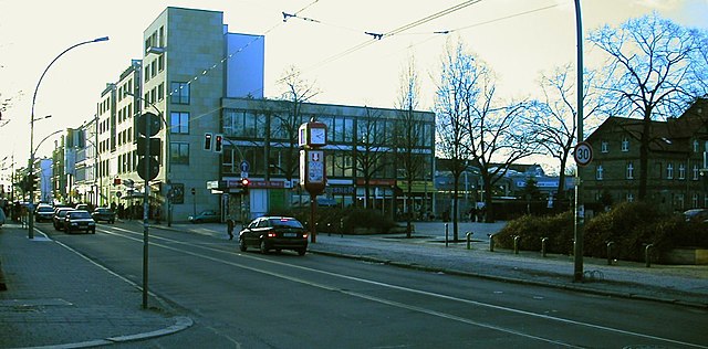
Niederschöneweide is a district in the southern part of Berlin, Germany, located along the banks of the River Spree. While it may not be as widely recognized as a traditional hiking destination compared to other more nature-centric areas, it offers some unique opportunities for outdoor activities and exploration.
Hiking Opportunities in Niederschöneweide
-
Riverside Trails: The Spree River runs through Niederschöneweide, providing scenic paths along its banks. These trails are suitable for walking and can be enjoyable for a leisurely hike while taking in the view of the river and the urban landscape.
-
Nearby Parks: Check out local parks such as the Treptower Park and Plänterwald, which are just a short distance away. These areas feature woodlands, meadows, and walking paths that can offer a more nature-oriented hiking experience.
-
Urban Hiking: Given that Niederschöneweide is part of Berlin, you can also engage in urban hiking, exploring the architecture, street art, and the unique vibe of the district. Walking tours can include notable sites such as industrial buildings and historical landmarks.
-
Green Spaces: Within Niederschöneweide, there are several smaller green spaces and area gardens that can offer a break from the urban environment and a chance to enjoy a stroll amidst greenery.
-
Access to Public Transport: The district is well connected through public transportation, making it easy to access other hiking trails in Berlin and surrounding areas, such as the Sachsenhausen forest or other nature reserves in Brandenburg.
Tips for Hiking in Niederschöneweide
- Footwear: Wear comfortable shoes suitable for walking, whether you're on pavement or natural trails.
- Hydration and Snacks: Always carry water and snacks, especially if you're planning on a longer hike.
- Local Weather: Check the weather conditions before heading out to ensure you're prepared for any changes.
- Map or GPS: Having a map or a GPS on your device can help you navigate urban trails and find points of interest.
While Niederschöneweide may not be a conventional hiking location, it provides an interesting blend of urban exploration and access to nature, making it a worthwhile spot for outdoor enthusiasts interested in discovering a different side of Berlin.
- Страна:

- Координаты: 52° 27' 22" N, 13° 30' 47" E


- GPS треки (wikiloc): [Ссылка]
- Высота над уровнем моря: 36 м m
- Площадь: 3.49 кв.км
- Население: 10446
- Википедия английская: wiki(en)
- Википедия национальная: wiki(de)
- Хранилище Wikidata: Wikidata: Q644062
- Галерея изображений в википедии: [Ссылка]
- Катеория в википедии: [Ссылка]
- код Freebase: [/m/0bwlb7w]
- код GeoNames: Альт: [2862890]
- код VIAF: Альт: [147423872]
- код GND: Альт: [7633735-2]
- идентификатор местоположения ArchINFORM: [43225]
- код TGN: [1005204]
Граничит с регионами:


Кёпеник
- район в Берлине
Hiking in Кёпеник
Köpenick is a district in the southeast of Berlin, Germany, and is known for its beautiful natural landscapes, historic architecture, and proximity to water. While Köpenick itself is more urban than rural, there are several opportunities for hiking and outdoor activities in and around the area. Here are some highlights for hiking in Köpenick:...
- Страна:
- Почтовый код: 12587; 12559; 12557; 12555; 12459
- Координаты: 52° 26' 45" N, 13° 34' 38" E
- GPS треки (wikiloc): [Ссылка]
- Высота над уровнем моря: 32 м m
- Площадь: 34.9 кв.км
- Население: 62569

Адлерсхоф
- район в Берлине
Hiking in Адлерсхоф
Adlershof is a neighborhood in Berlin, Germany, primarily known for its historical significance and technological developments. While it may not be renowned for hiking in the traditional sense, there are several opportunities for outdoor activities and exploring nature in nearby areas....
- Страна:
- Координаты: 52° 26' 16" N, 13° 32' 51" E
- GPS треки (wikiloc): [Ссылка]
- Высота над уровнем моря: 37 м m
- Площадь: 6.11 кв.км
- Население: 15294


Баумшуленвег
- район в Берлине
Hiking in Баумшуленвег
Baumschulenweg is a neighborhood located in the Treptow-Köpenick district of Berlin, Germany. While it may not be well-known as a traditional hiking destination, there are several outdoor opportunities in and around the area for those looking to enjoy nature and scenic walks....
- Страна:
- Координаты: 52° 27' 54" N, 13° 29' 10" E
- GPS треки (wikiloc): [Ссылка]
- Высота над уровнем моря: 37 м m
- Площадь: 4.82 кв.км
- Население: 17186


Обершёневайде
- район в Берлине
Hiking in Обершёневайде
Oberschöneweide is a district in the borough of Treptow-Köpenick in Berlin, Germany. While it's primarily known for its industrial history and urban environment, there are still opportunities for hiking and enjoying nature in and around the area....
- Страна:
- Координаты: 52° 27' 43" N, 13° 30' 54" E
- GPS треки (wikiloc): [Ссылка]
- Высота над уровнем моря: 36 м m
- Площадь: 6.18 кв.км
- Население: 18919


Йоханнисталь
- район в Берлине
Hiking in Йоханнисталь
Johannisthal is a district in Berlin that is primarily known for its residential areas and proximity to green spaces rather than hiking trails. However, you can still enjoy outdoor activities and lighter hiking options in and around the area....
- Страна:
- Координаты: 52° 26' 36" N, 13° 30' 8" E
- GPS треки (wikiloc): [Ссылка]
- Высота над уровнем моря: 37 м m
- Площадь: 6.54 кв.км