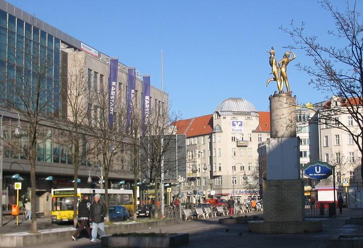
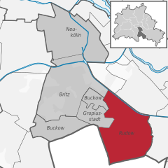
Баумшуленвег (Baumschulenweg, Baumschulenweg)

- район в Берлине
 Hiking in Баумшуленвег
Baumschulenweg is a neighborhood located in the Treptow-Köpenick district of Berlin, Germany. While it may not be well-known as a traditional hiking destination, there are several outdoor opportunities in and around the area for those looking to enjoy nature and scenic walks.
Nearby Parks and Natural Areas
-
Wuhlheide Park: Located close to Baumschulenweg, Wuhlheide is a large park that offers various trails for walking, running, or biking. It's a great spot for casual hikes and also features a beautiful forested area, playgrounds, and even an open-air stage for concerts.
-
Müggelsee: A short distance from Baumschulenweg, Müggelsee is a large lake surrounded by forests, making it an excellent destination for longer hikes, cycling, and water activities. The trails around the lake provide picturesque views and opportunities to immerse yourself in nature.
-
Grunewald Forest: Although a bit farther away, Grunewald is one of the largest forests in Berlin and offers many hiking trails of varying lengths and difficulties. It's a great place for a day hike, with options to explore its numerous pathways and enjoy the serene environment.
Tips for Hiking in Baumschulenweg
- Trail Maps: Utilize local maps or hiking apps to find trails that suit your skill level and interests.
- Seasonal Considerations: Spring and fall are particularly lovely times to explore the area, but summer can offer vibrant greenery, and winter may afford a unique, peaceful landscape.
- Prepare for Urban Areas: Keep in mind that Baumschulenweg is an urban neighborhood, so some trails may lead through residential areas or transit routes. Always be mindful of your surroundings.
- Public Transport Access: Berlin has an excellent public transport system. If parts of your hiking plans take you outside Baumschulenweg, it’s easy to reach other natural areas via train or bus.
Conclusion
While Baumschulenweg may not offer traditional hiking experiences, it serves as a gateway to lovely parks and natural spots that are well suited for walking and light hiking. Whether you're looking for a leisurely stroll or a more vigorous hike, there are options nearby to enjoy the beauty of nature in Berlin.
- Страна:

- Координаты: 52° 27' 54" N, 13° 29' 10" E


- GPS треки (wikiloc): [Ссылка]
- Высота над уровнем моря: 37 м m
- Площадь: 4.82 кв.км
- Население: 17186
- Википедия английская: wiki(en)
- Википедия национальная: wiki(de)
- Хранилище Wikidata: Wikidata: Q644363
- Галерея изображений в википедии: [Ссылка]
- Катеория в википедии: [Ссылка]
- Карты в википедии: [Ссылка]
- код Freebase: [/m/0bwl240]
- код GeoNames: Альт: [2951935]
- код VIAF: Альт: [233909457]
- код GND: Альт: [4846360-7]
- идентификатор местоположения ArchINFORM: [43229]
Граничит с регионами:

Нойкёльн
- район Берлина
Hiking in Нойкёльн
Neukölln, a vibrant district in Berlin, Germany, is not typically known for traditional hiking trails like those found in mountainous regions. However, there are several spots within and around Neukölln where you can enjoy nature walks, green spaces, and urban hiking experiences....
- Страна:
- Почтовый код: 12059; 12057; 12055; 12053; 12051; 12049; 12047; 12045; 12043
- Координаты: 52° 28' 53" N, 13° 26' 7" E
- GPS треки (wikiloc): [Ссылка]
- Высота над уровнем моря: 55 м m
- Площадь: 11.7 кв.км
- Население: 167248


Бриц
- район в Берлине
Hiking in Бриц
Britz is a neighborhood located in the borough of Neukölln in Berlin, Germany. It is not particularly known for hiking in the traditional sense, as it is more urban and residential in nature. However, there are some fantastic parks and green areas nearby that offer opportunities for leisurely walks and nature exploration....
- Страна:
- Почтовый код: 12359; 12347
- Координаты: 52° 27' 0" N, 13° 26' 0" E
- GPS треки (wikiloc): [Ссылка]
- Высота над уровнем моря: 44 м m
- Площадь: 12.4 кв.км
- Население: 41613

Плентервальд
- район в Берлине
Hiking in Плентервальд
Plänterwald is a beautiful green area located in Berlin, Germany, particularly known for its scenic landscapes and unique blend of nature and urban environment. While it may not be the first location that comes to mind for hiking, it offers a number of trails and paths that can be enjoyable for walkers and nature enthusiasts....
- Страна:
- Координаты: 52° 28' 47" N, 13° 28' 31" E
- GPS треки (wikiloc): [Ссылка]
- Высота над уровнем моря: 31 м m
- Площадь: 3.01 кв.км
Рудов
- район в Берлине
Hiking in Рудов
Rudow is a district in the borough of Neukölln in Berlin, Germany. Although it is primarily an urban area and not known for traditional hiking, there are opportunities for walks and exploring nature in and around the district. Here are some options and tips for hiking or walking in and around Rudow:...
- Страна:
- Почтовый код: 12357; 12355; 12353
- Координаты: 52° 25' 0" N, 13° 30' 0" E
- GPS треки (wikiloc): [Ссылка]
- Высота над уровнем моря: 38 м m
- Площадь: 11.8 кв.км
- Население: 41618


Нидершёневайде
- район в Берлине
Hiking in Нидершёневайде
Niederschöneweide is a district in the southern part of Berlin, Germany, located along the banks of the River Spree. While it may not be as widely recognized as a traditional hiking destination compared to other more nature-centric areas, it offers some unique opportunities for outdoor activities and exploration....
- Страна:
- Координаты: 52° 27' 22" N, 13° 30' 47" E
- GPS треки (wikiloc): [Ссылка]
- Высота над уровнем моря: 36 м m
- Площадь: 3.49 кв.км
- Население: 10446


Обершёневайде
- район в Берлине
Hiking in Обершёневайде
Oberschöneweide is a district in the borough of Treptow-Köpenick in Berlin, Germany. While it's primarily known for its industrial history and urban environment, there are still opportunities for hiking and enjoying nature in and around the area....
- Страна:
- Координаты: 52° 27' 43" N, 13° 30' 54" E
- GPS треки (wikiloc): [Ссылка]
- Высота над уровнем моря: 36 м m
- Площадь: 6.18 кв.км
- Население: 18919


Йоханнисталь
- район в Берлине
Hiking in Йоханнисталь
Johannisthal is a district in Berlin that is primarily known for its residential areas and proximity to green spaces rather than hiking trails. However, you can still enjoy outdoor activities and lighter hiking options in and around the area....
- Страна:
- Координаты: 52° 26' 36" N, 13° 30' 8" E
- GPS треки (wikiloc): [Ссылка]
- Высота над уровнем моря: 37 м m
- Площадь: 6.54 кв.км