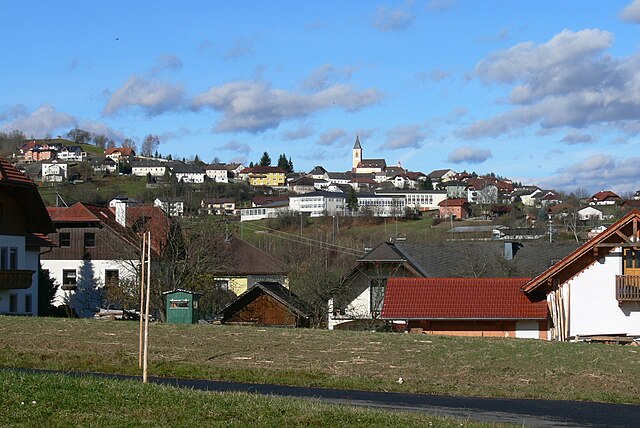
Эппинг (Oepping, Oepping)

 Hiking in Эппинг
Oepping, while not widely recognized as a major hiking destination, offers some scenic opportunities for outdoor enthusiasts looking for a peaceful experience in nature. The region is likely characterized by woodlands, rolling hills, and possibly some rivers or lakes, which provide a serene backdrop for hiking excursions.
Here are a few tips for hiking in Oepping or similar areas:
-
Trails: Before heading out, check local maps or apps to identify marked trails. You might find shorter loops or longer paths that can be suited to different skill levels.
-
Landscape: Depending on the terrain, be aware of elevation changes and any potentially challenging sections. It's good to know the area you're hiking in, especially if you're unfamiliar with the paths.
-
Wildlife: Keep an eye out for local wildlife. Hiking can be a great way to experience the natural world, so bring your camera or binoculars if you're interested in birdwatching or spotting animals.
-
Weather: Check the weather forecast before leaving. Conditions can change rapidly, and it's essential to be prepared with appropriate clothing and gear.
-
Safety: Always hike with a buddy if possible and let someone know your plans. Carry a map, compass, and a first aid kit, and make sure to pack enough water and snacks for your hike.
-
Respect Nature: Follow Leave No Trace principles to minimize your impact on the environment and preserve the beauty of the trails for future hikers.
If you have specific areas in mind around Oepping or particular trails you're interested in, feel free to ask for more targeted information!
- Страна:

- Почтовый код: 4151
- Телефонный код: 07289
- Код автомобильного номера: RO
- Координаты: 48° 36' 14" N, 13° 56' 46" E


- GPS треки (wikiloc): [Ссылка]
- Высота над уровнем моря: 629 м m
- Площадь: 23 кв.км
- Население: 1510
- Веб сайт: http://www.oepping.at/
- Википедия русская: wiki(ru)
- Википедия английская: wiki(en)
- Википедия национальная: wiki(de)
- Хранилище Wikidata: Wikidata: Q693620
- Катеория в википедии: [Ссылка]
- код Freebase: [/m/03gv9_5]
- код GeoNames: Альт: [7872114]
- код VIAF: Альт: [234355714]
- код GND: Альт: [4801241-5]
- код австрийского муниципалитета: [41325]
Граничит с регионами:
Rohrbach-Berg
Hiking in Rohrbach-Berg
Rohrbach-Berg, located in Upper Austria, offers a variety of hiking opportunities that showcase the region’s natural beauty, lush landscapes, and scenic views. Here are some highlights and tips for hiking in this area:...
- Страна:
- Почтовый код: 4150
- Телефонный код: 07289
- Код автомобильного номера: RO
- Координаты: 48° 34' 24" N, 13° 59' 30" E
- GPS треки (wikiloc): [Ссылка]
- Высота над уровнем моря: 605 м m
- Площадь: 37.9 кв.км
- Население: 5134
- Веб сайт: [Ссылка]

Aigen-Schlägl
Hiking in Aigen-Schlägl
Aigen-Schlägl, located in the scenic region of Austria, offers some beautiful hiking opportunities, especially for those looking to explore the lush landscapes and picturesque nature typical of the area. Here are some key points about hiking in Aigen-Schlägl:...
- Страна:
- Почтовый код: 4160
- Телефонный код: 07281
- Код автомобильного номера: RO
- Координаты: 48° 38' 48" N, 13° 58' 21" E
- GPS треки (wikiloc): [Ссылка]
- Высота над уровнем моря: 596 м m
- Площадь: 45.99 кв.км
- Население: 3212
- Веб сайт: [Ссылка]

Зарлайнсбах
Hiking in Зарлайнсбах
Sarleinsbach is a picturesque village located in the Mühlviertel region of Upper Austria, known for its stunning natural landscapes and excellent hiking opportunities. Here are some highlights about hiking in and around Sarleinsbach:...
- Страна:
- Почтовый код: 4152
- Телефонный код: 07283
- Код автомобильного номера: RO
- Координаты: 48° 32' 50" N, 13° 54' 19" E
- GPS треки (wikiloc): [Ссылка]
- Высота над уровнем моря: 561 м m
- Площадь: 37 кв.км
- Население: 2284
- Веб сайт: [Ссылка]
Пайльштайн-им-Мюльфиртель
Hiking in Пайльштайн-им-Мюльфиртель
Peilstein im Mühlviertel is a charming village in the Mühlviertel region of Austria, surrounded by beautiful landscapes that offer numerous hiking opportunities. The area is characterized by its rolling hills, dense forests, and picturesque views of the Danube Valley....
- Страна:
- Почтовый код: 4153
- Телефонный код: 07287
- Код автомобильного номера: RO
- Координаты: 48° 37' 6" N, 13° 53' 41" E
- GPS треки (wikiloc): [Ссылка]
- Высота над уровнем моря: 584 м m
- Площадь: 23 кв.км
- Население: 1541
- Веб сайт: [Ссылка]