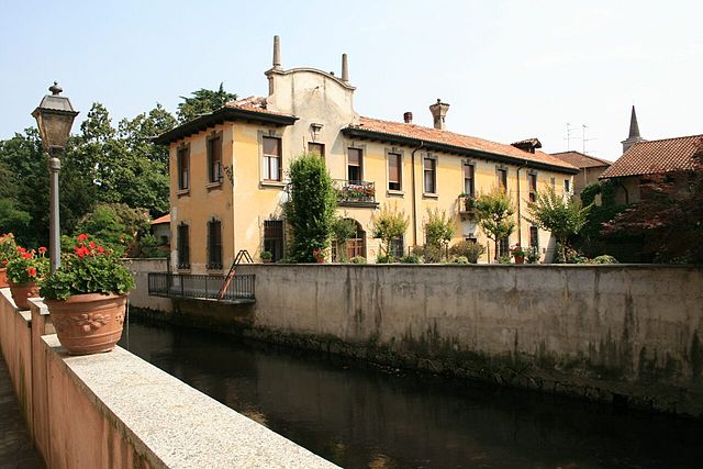
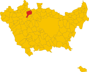
Ориджо (Origgio, Origgio)
.svg)
- коммуна Италии
 Hiking in Ориджо
Origgio, located in the Lombardy region of Italy, is surrounded by beautiful landscapes and offers various opportunities for hiking and outdoor activities. While it may not be as well-known for hiking as some other regions in Italy, there are still some lovely trails and outdoor spots nearby that you can explore.
Hiking Opportunities in and around Origgio:
-
Parco Regionale della Pineta di Tradate:
- This regional park is close to Origgio and offers a variety of trails surrounded by woods and nature. The park features well-marked trails suitable for all levels of hikers. You might encounter local wildlife and enjoy the peaceful atmosphere.
-
Monte Barro Regional Park:
- A bit farther from Origgio, this park offers breathtaking views and diverse hiking trails. It’s great for those looking to explore more rugged terrain. The trails vary in difficulty and provide stunning panoramas of Lake Como, especially from the higher points.
-
Saronno:
- Situated just a short distance from Origgio, Saronno has trails that may lead you through the countryside and local vineyards. It’s a wonderful area for walking and experiencing the region’s charm.
-
Lombardy Lakes:
- If you're willing to travel a bit farther, the lakes in Lombardy, such as Lake Como and Lake Maggiore, have numerous hiking trails with stunning lake views. These hikes can range from easy walks along the shore to more challenging hikes in the surrounding mountains.
Tips for Hiking in the Area:
- Weather: Always check the weather before heading out, as conditions can change, especially in the hilly areas.
- Footwear: Wear proper hiking boots for comfort and safety on the trails.
- Trail Maps: Carry a map or use a hiking app to navigate the trails effectively.
- Hydration and Snacks: Bring enough water and snacks, especially for longer hikes.
- Respect Nature: Follow Leave No Trace principles to help preserve the natural beauty of the area.
Local Culture:
Aside from hiking, Origgio offers a glimpse into traditional Italian life with its historic architecture and local cuisine. Making time to explore the town after your hikes can be a rewarding experience.
Whether you're looking for a leisurely stroll or a more challenging hike, Origgio and its surroundings have something to offer for every nature enthusiast.
- Страна:

- Почтовый код: 21040
- Телефонный код: 02
- Код автомобильного номера: VA
- Координаты: 45° 35' 49" N, 9° 1' 6" E


- GPS треки (wikiloc): [Ссылка]
- Высота над уровнем моря: 191 м m
- Площадь: 7.92 кв.км
- Население: 7827
- Веб сайт: http://www.comune.origgio.va.it
- Википедия русская: wiki(ru)
- Википедия английская: wiki(en)
- Википедия национальная: wiki(it)
- Хранилище Wikidata: Wikidata: Q40375
- Катеория в википедии: [Ссылка]
- код Freebase: [/m/0ghzl9]
- код GeoNames: Альт: [6536107]
- код BNF: [12290409v]
- код VIAF: Альт: [138527288]
- ID отношения в OpenStreetMap: [45379]
- код LCNAF: Альт: [n93123263]
- WOEID: [719577]
- UN/LOCODE: [ITORG]
- код ISTAT: 012109
- кадастровый код Италии: G103
Граничит с регионами:
Убольдо
- коммуна Италии
Hiking in Убольдо
Uboldo is a small town located in the Lombardy region of Italy, near the foothills of the Alps. While Uboldo itself may not be a famous hiking destination, there are several nearby trails and natural areas that you can explore. Here are some tips and suggestions for hiking in and around Uboldo:...
- Страна:
- Почтовый код: 21040
- Телефонный код: 02
- Код автомобильного номера: VA
- Координаты: 45° 37' 0" N, 9° 0' 0" E
- GPS треки (wikiloc): [Ссылка]
- Высота над уровнем моря: 205 м m
- Площадь: 10.74 кв.км
- Население: 10565
- Веб сайт: [Ссылка]
Каронно-Пертузелла
- коммуна Италии
Hiking in Каронно-Пертузелла
Caronno Pertusella, located in the Lombardy region of Italy, is not primarily known as a hiking destination, but it does offer access to various natural areas and nearby trails that can be enjoyable for outdoor enthusiasts. Here are some key points to consider for hiking in and around Caronno Pertusella:...
- Страна:
- Почтовый код: 21042
- Телефонный код: 02
- Код автомобильного номера: VA
- Координаты: 45° 36' 0" N, 9° 3' 0" E
- GPS треки (wikiloc): [Ссылка]
- Высота над уровнем моря: 194 м m
- Площадь: 8.4 кв.км
- Население: 17775
- Веб сайт: [Ссылка]


Саронно
- коммуна Италии
Hiking in Саронно
Saronno, located in the Lombardy region of northern Italy, is not primarily known as a hiking destination, but it does have access to some beautiful trails and natural areas nearby. Here are a few points to consider if you're looking to hike around Saronno:...
- Страна:
- Почтовый код: 21047
- Телефонный код: 02
- Код автомобильного номера: VA
- Координаты: 45° 37' 32" N, 9° 2' 13" E
- GPS треки (wikiloc): [Ссылка]
- Высота над уровнем моря: 212 м m
- Площадь: 11.06 кв.км
- Население: 39419
- Веб сайт: [Ссылка]
Нервьяно
- коммуна Италии
Hiking in Нервьяно
Nerviano is a charming town located in the Lombardy region of Italy, not far from Milan. While it might not be known as a traditional hiking destination, there are various areas nearby where hiking enthusiasts can enjoy some outdoor activities....
- Страна:
- Почтовый код: 20014
- Телефонный код: 0331
- Код автомобильного номера: MI
- Координаты: 45° 33' 0" N, 8° 59' 0" E
- GPS треки (wikiloc): [Ссылка]
- Высота над уровнем моря: 175 м m
- Площадь: 13.26 кв.км
- Население: 17270
- Веб сайт: [Ссылка]
Черро-Магжиоре
- коммуна Италии
Hiking in Черро-Магжиоре
Cerro Maggiore is a beautiful hiking destination located in the Lombardy region of Italy, near the town of the same name. This area is known for its scenic landscapes, diverse flora, and excellent trails that cater to various skill levels. Here are some key points to consider when planning a hike in Cerro Maggiore:...
- Страна:
- Почтовый код: 20023
- Телефонный код: 0331
- Код автомобильного номера: MI
- Координаты: 45° 36' 0" N, 8° 57' 0" E
- GPS треки (wikiloc): [Ссылка]
- Высота над уровнем моря: 205 м m
- Площадь: 10.12 кв.км
- Население: 15224
- Веб сайт: [Ссылка]


Лайнате
- коммуна Италии
Hiking in Лайнате
Lainate is a charming town in the Lombardy region of Italy, located not far from Milan. While Lainate itself might not be widely known for extensive hiking trails, there are several opportunities for outdoor enthusiasts in the surrounding area....
- Страна:
- Почтовый код: 20020
- Телефонный код: 02
- Код автомобильного номера: MI
- Координаты: 45° 34' 0" N, 9° 2' 0" E
- GPS треки (wikiloc): [Ссылка]
- Высота над уровнем моря: 176 м m
- Площадь: 12.93 кв.км
- Население: 25754
- Веб сайт: [Ссылка]