
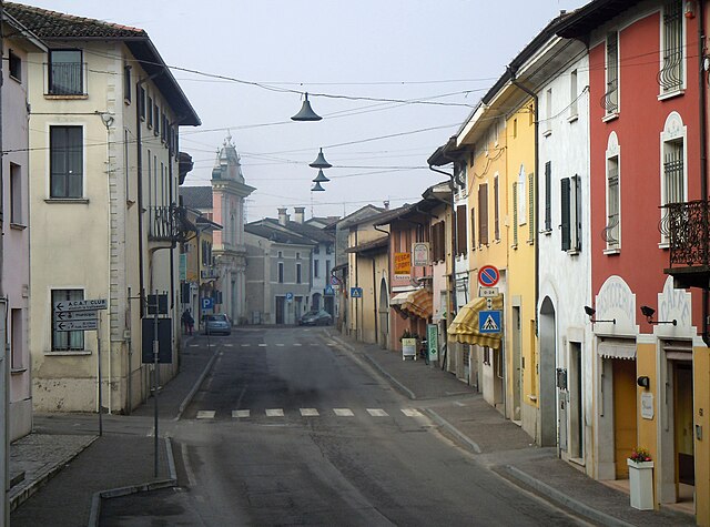
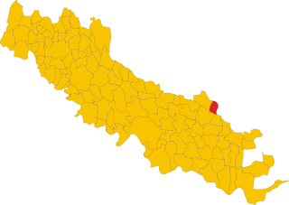
Остиано (Ostiano, Ostiano)
.svg)
- коммуна Италии
 Hiking in Остиано
Ostiano, located in the Lombardy region of Italy, offers a unique opportunity for hiking enthusiasts to explore its scenic landscapes and local culture. While Ostiano itself may not be as widely recognized for extensive hiking trails as some other Italian regions, it serves as a gateway to the surrounding areas that are rich in natural beauty and potential hiking routes.
Nearby Hiking Opportunities:
-
Oglio River Park: Located nearby, this park features trails that follow the Oglio River. It's an ideal spot for leisurely hikes and birdwatching, with paths that weave through forests and wetlands.
-
The Franciacorta Region: A bit further afield, this region is renowned for its vineyards and rolling hills. There are several hiking trails that offer stunning views of the countryside, as well as opportunities to taste local wines.
-
Cremona: Just a short drive away, the city of Cremona has parks and riverside walks which provide a delightful hiking experience combined with cultural sightseeing.
Tips for Hiking in Ostiano:
- Trail Maps: Be sure to obtain local maps or guides, which may be available at tourist information centers. It can help you find trails that match your skill level.
- Weather Preparedness: Check the weather before heading out. The region can experience varied weather patterns, so appropriate clothing and gear are essential.
- Local Flora and Fauna: As you hike, take time to appreciate the local wildlife and plant species. The region is known for its biodiversity.
- Respect Nature: Follow Leave No Trace principles to keep the trails and natural spaces beautiful for future hikers.
Cultural Experience:
While hiking, take the opportunity to explore the local culture. You might encounter small towns, historical sites, and local cuisine that reflects the rich heritage of the region.
Conclusion:
While Ostiano may not be a well-known hiking destination, it offers access to nearby natural areas that are perfect for outdoor enthusiasts. Whether you're looking for a peaceful walk along the river or a more challenging hike through rolling hills, the region provides beautiful scenery and a chance to immerse yourself in Italian culture.
- Страна:

- Почтовый код: 26032
- Телефонный код: 0372
- Код автомобильного номера: CR
- Координаты: 45° 13' 0" N, 10° 15' 0" E


- GPS треки (wikiloc): [Ссылка]
- Высота над уровнем моря: 43 м m
- Площадь: 19.49 кв.км
- Население: 2945
- Веб сайт: http://www.comune.ostiano.cr.it/
- Википедия русская: wiki(ru)
- Википедия английская: wiki(en)
- Википедия национальная: wiki(it)
- Хранилище Wikidata: Wikidata: Q43003
- Катеория в википедии: [Ссылка]
- код Freebase: [/m/0gjzcd]
- код GeoNames: Альт: [6537217]
- код VIAF: Альт: [149674854]
- ID отношения в OpenStreetMap: [44458]
- место в MusicBrainz: [66c21281-d673-4e53-a16a-d5366fe1c5d1]
- UN/LOCODE: [ITOT7]
- код ISTAT: 019064
- кадастровый код Италии: G185
Граничит с регионами:
Гамбара
- коммуна Италии
Hiking in Гамбара
Gambara is a small town located in the Lombardy region of Italy, known for its picturesque countryside, charming landscapes, and proximity to various natural areas suitable for hiking. While Gambara itself may not have extensive hiking trails, it serves as a great gateway to explore the surrounding areas that offer beautiful hiking experiences....
- Страна:
- Почтовый код: 25020
- Телефонный код: 030
- Код автомобильного номера: BS
- Координаты: 45° 15' 22" N, 10° 17' 40" E
- GPS треки (wikiloc): [Ссылка]
- Высота над уровнем моря: 51 м m
- Площадь: 31.59 кв.км
- Население: 4743
- Веб сайт: [Ссылка]

Пральбоино
- коммуна Италии
Hiking in Пральбоино
Pralboino is a small town located in the Lombardy region of Italy. While it may not be as well-known as some of the larger towns in the area, it offers opportunities for hiking and outdoor activities. Here are some insights about hiking in and around Pralboino:...
- Страна:
- Почтовый код: 25020
- Телефонный код: 030
- Код автомобильного номера: BS
- Координаты: 45° 16' 6" N, 10° 13' 6" E
- GPS треки (wikiloc): [Ссылка]
- Высота над уровнем моря: 47 м m
- Площадь: 17.16 кв.км
- Население: 2938
- Веб сайт: [Ссылка]

Сенига
- коммуна Италии
Hiking in Сенига
Seniga is a charming area located in the Lombardy region of Italy, offering beautiful landscapes and opportunities for hiking enthusiasts. Though it might not be as widely known as some other hiking destinations, it provides a unique blend of scenery, culture, and outdoor activities....
- Страна:
- Почтовый код: 25020
- Телефонный код: 030
- Код автомобильного номера: BS
- Координаты: 45° 14' 36" N, 10° 10' 41" E
- GPS треки (wikiloc): [Ссылка]
- Высота над уровнем моря: 48 м m
- Площадь: 13.57 кв.км
- Население: 1437
- Веб сайт: [Ссылка]


Габбьонета-Бинануова
- коммуна Италии
Hiking in Габбьонета-Бинануова
Gabbioneta-Binanuova is a small municipality in the province of Cremona in Lombardy, Italy. While it may not be as well-known as some major hiking destinations, the surrounding area offers some natural beauty and opportunities for outdoor activities, including hiking....
- Страна:
- Почтовый код: 26030
- Телефонный код: 0372
- Код автомобильного номера: CR
- Координаты: 45° 13' 0" N, 10° 13' 0" E
- GPS треки (wikiloc): [Ссылка]
- Высота над уровнем моря: 38 м m
- Площадь: 15.71 кв.км
- Население: 860
- Веб сайт: [Ссылка]
Пессина-Кремонезе
- коммуна Италии
Hiking in Пессина-Кремонезе
Pessina Cremonese is a small municipality located in the province of Cremona in the Lombardy region of Italy. While it's not a popular hiking destination like some of the more mountainous areas in Italy, it still offers opportunities for those looking to enjoy scenic outdoor activities in a serene rural environment....
- Страна:
- Почтовый код: 26030
- Телефонный код: 0372
- Код автомобильного номера: CR
- Координаты: 45° 11' 0" N, 10° 15' 0" E
- GPS треки (wikiloc): [Ссылка]
- Высота над уровнем моря: 42 м m
- Площадь: 22.02 кв.км
- Население: 626
- Веб сайт: [Ссылка]

Волонго
- коммуна Италии
Hiking in Волонго
Volongo isn't a widely recognized hiking destination, and it seems there might be some confusion regarding its location or its prominence in hiking circles. However, if you're looking for information about hiking in a specific place—perhaps a region, a park, or a mountain range in a country—please provide more details so I can assist you better....
- Страна:
- Почтовый код: 26030
- Телефонный код: 0372
- Код автомобильного номера: CR
- Координаты: 45° 12' 42" N, 10° 18' 9" E
- GPS треки (wikiloc): [Ссылка]
- Высота над уровнем моря: 43 м m
- Площадь: 8.12 кв.км
- Население: 525
- Веб сайт: [Ссылка]