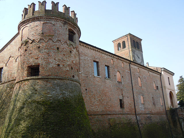
Сенига (Seniga, Seniga)
.svg)
- коммуна Италии
 Hiking in Сенига
Seniga is a charming area located in the Lombardy region of Italy, offering beautiful landscapes and opportunities for hiking enthusiasts. Though it might not be as widely known as some other hiking destinations, it provides a unique blend of scenery, culture, and outdoor activities.
Hiking Trails
-
Scenic Routes: The area around Seniga features a variety of hiking trails that cater to different skill levels, from easy walks to more challenging treks. Many trails offer stunning views of the surrounding countryside, vineyards, and historical sites.
-
Nature Reserves: Consider exploring nearby nature reserves and parks, where you can immerse yourself in local flora and fauna. These areas often have marked trails and informative signage.
-
Cultural Trails: Some paths may take you through historical villages and vineyards, allowing you to experience the local culture and possibly stop for a wine tasting along the way.
Tips for Hiking in Seniga
- Check the Weather: Weather can change quickly in the mountains, so it’s essential to check the forecast before heading out and to dress in layers.
- Bring Necessary Gear: Ensure you have proper hiking footwear, a map or GPS device, and plenty of water and snacks.
- Respect Nature: Stay on marked trails, carry out what you bring in, and follow local regulations to protect the environment.
- Local Guides: If you’re unfamiliar with the area, consider hiring a local guide who can provide valuable insights about the region and enhance your experience.
Best Time to Visit
The ideal time for hiking in Seniga is typically spring (April to June) and fall (September to October), when temperatures are mild and the scenery is particularly beautiful.
Nearby Attractions
After your hike, you may want to explore local attractions, such as historical sites or sample some delicious regional cuisine. Enjoying a meal at a local trattoria can be a great way to unwind after a day on the trails.
If you're planning a trip to Seniga, researching specific trails and local tips will help you make the most of your hiking adventure!
- Страна:

- Почтовый код: 25020
- Телефонный код: 030
- Код автомобильного номера: BS
- Координаты: 45° 14' 36" N, 10° 10' 41" E


- GPS треки (wikiloc): [Ссылка]
- Высота над уровнем моря: 48 м m
- Площадь: 13.57 кв.км
- Население: 1437
- Веб сайт: http://www.comune.seniga.bs.it/
- Википедия русская: wiki(ru)
- Википедия английская: wiki(en)
- Википедия национальная: wiki(it)
- Хранилище Wikidata: Wikidata: Q111749
- Катеория в википедии: [Ссылка]
- код Freebase: [/m/04d2x4]
- код GeoNames: Альт: [6540619]
- ID отношения в OpenStreetMap: [44527]
- UN/LOCODE: [ITZHW]
- код ISTAT: 017177
- кадастровый код Италии: I607
Граничит с регионами:
Альфьанелло
- коммуна Италии
Hiking in Альфьанелло
Alfianello is a charming municipality located in the Lombardy region of Italy, known for its picturesque landscapes and rural character. Hiking in this area can offer a mix of tranquil countryside, historical sites, and natural beauty. While there may not be extensive, well-marked hiking trails specifically in Alfianello, you can still enjoy some beautiful walks and explore the surrounding regions....
- Страна:
- Почтовый код: 25020
- Телефонный код: 030
- Код автомобильного номера: BS
- Координаты: 45° 16' 0" N, 10° 9' 0" E
- GPS треки (wikiloc): [Ссылка]
- Высота над уровнем моря: 48 м m
- Площадь: 13 кв.км
- Население: 2494
- Веб сайт: [Ссылка]
Мильцано
- коммуна Италии
Hiking in Мильцано
Milzano is a small town located in the Lombardy region of Italy, known for its beautiful landscapes and proximity to the surrounding countryside. While it may not be as widely recognized as a hiking destination compared to larger national parks or mountain ranges, it offers several opportunities for outdoor enthusiasts. Here’s a guide on hiking in and around Milzano:...
- Страна:
- Почтовый код: 25020
- Телефонный код: 030
- Код автомобильного номера: BS
- Координаты: 45° 16' 29" N, 10° 11' 59" E
- GPS треки (wikiloc): [Ссылка]
- Высота над уровнем моря: 49 м m
- Площадь: 8.49 кв.км
- Население: 1764
- Веб сайт: [Ссылка]

Пральбоино
- коммуна Италии
Hiking in Пральбоино
Pralboino is a small town located in the Lombardy region of Italy. While it may not be as well-known as some of the larger towns in the area, it offers opportunities for hiking and outdoor activities. Here are some insights about hiking in and around Pralboino:...
- Страна:
- Почтовый код: 25020
- Телефонный код: 030
- Код автомобильного номера: BS
- Координаты: 45° 16' 6" N, 10° 13' 6" E
- GPS треки (wikiloc): [Ссылка]
- Высота над уровнем моря: 47 м m
- Площадь: 17.16 кв.км
- Население: 2938
- Веб сайт: [Ссылка]


Габбьонета-Бинануова
- коммуна Италии
Hiking in Габбьонета-Бинануова
Gabbioneta-Binanuova is a small municipality in the province of Cremona in Lombardy, Italy. While it may not be as well-known as some major hiking destinations, the surrounding area offers some natural beauty and opportunities for outdoor activities, including hiking....
- Страна:
- Почтовый код: 26030
- Телефонный код: 0372
- Код автомобильного номера: CR
- Координаты: 45° 13' 0" N, 10° 13' 0" E
- GPS треки (wikiloc): [Ссылка]
- Высота над уровнем моря: 38 м m
- Площадь: 15.71 кв.км
- Население: 860
- Веб сайт: [Ссылка]
Скандолара-Рипа-д'Ольо
- коммуна Италии
Hiking in Скандолара-Рипа-д'Ольо
Scandolara Ripa d'Oglio is a charming village located in the Lombardy region of Italy, characterized by its beautiful natural landscapes and proximity to the Oglio River. While the immediate area may not be as widely known as other hiking destinations, it offers opportunities for outdoor activities and exploration in its surroundings....
- Страна:
- Почтовый код: 26047
- Телефонный код: 0372
- Код автомобильного номера: CR
- Координаты: 45° 13' 0" N, 10° 9' 0" E
- GPS треки (wikiloc): [Ссылка]
- Высота над уровнем моря: 47 м m
- Площадь: 5.72 кв.км
- Население: 572
- Веб сайт: [Ссылка]

Остиано
- коммуна Италии
Hiking in Остиано
Ostiano, located in the Lombardy region of Italy, offers a unique opportunity for hiking enthusiasts to explore its scenic landscapes and local culture. While Ostiano itself may not be as widely recognized for extensive hiking trails as some other Italian regions, it serves as a gateway to the surrounding areas that are rich in natural beauty and potential hiking routes....
- Страна:
- Почтовый код: 26032
- Телефонный код: 0372
- Код автомобильного номера: CR
- Координаты: 45° 13' 0" N, 10° 15' 0" E
- GPS треки (wikiloc): [Ссылка]
- Высота над уровнем моря: 43 м m
- Площадь: 19.49 кв.км
- Население: 2945
- Веб сайт: [Ссылка]