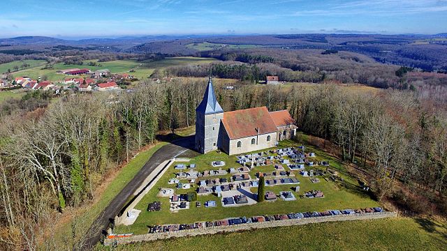
Palantine (Palantine)

- коммуна во Франции
 Hiking in Palantine
Palatine, a suburb of Chicago in Cook County, Illinois, offers a few options for hiking and enjoying the outdoors, though it might not be known for rugged terrain or extensive trails like some more mountainous areas. Here are some places you might consider for hiking and outdoor activities in and around Palatine:
-
Twin Lakes Recreation Area: This is a popular spot in Palatine that features pedestrian paths around two lakes. While it may not be a traditional hiking trail, the area offers scenic views and opportunities for wildlife observation. It’s great for walking, jogging, and light hiking.
-
Harewood Park: Another local spot where you can enjoy shaded walking paths. This park can be a nice option for a leisurely hike.
-
Village of Palatine Parks: The village has numerous parks, many of which have paved trails and natural areas that are good for short hikes and walks. Parks like Cedar Park and Columbian Park offer nice outdoor spaces for casual hiking.
-
Nearby Forest Preserves: If you’re willing to venture a bit further, the Cook County Forest Preserves offer extensive hiking opportunities. Places like the Salt Creek Park District and the Busse Woods Nature Preserve in nearby Elk Grove Village have numerous trails that are great for hiking.
-
Bike Trails: If you're open to biking, the Palatine bicycle trails also offer beautiful routes that can be enjoyed on foot. These trails can provide longer distances for those looking to explore more.
When hiking in this area, be sure to dress appropriately for the weather and bring plenty of water. Additionally, it's always a good idea to check local resources or websites for specific trail conditions and park information. Always practice Leave No Trace principles to help maintain the beauty of these outdoor spaces!
- Страна:

- Почтовый код: 25440
- Координаты: 47° 5' 21" N, 5° 56' 36" E


- GPS треки (wikiloc): [Ссылка]
- Площадь: 4.31 кв.км
- Население: 64
- Википедия английская: wiki(en)
- Википедия национальная: wiki(fr)
- Хранилище Wikidata: Wikidata: Q631072
- Катеория в википедии: [Ссылка]
- код Freebase: [/m/03mgxxz]
- код Freebase: [/m/03mgxxz]
- код GeoNames: Альт: [2988749]
- код GeoNames: Альт: [2988749]
- номер SIREN: [212504435]
- номер SIREN: [212504435]
- код BNF: [15252669b]
- код BNF: [15252669b]
- код муниципалитета INSEE: 25443
- код муниципалитета INSEE: 25443
Граничит с регионами:


Lavans-Quingey
- коммуна во Франции
Hiking in Lavans-Quingey
Lavans-Quingey is a charming commune located in the Jura department of France, surrounded by stunning natural landscapes that are ideal for hiking enthusiasts. This area is characterized by its rolling hills, dense forests, and scenic viewpoints, making it a great destination for outdoor activities....
- Страна:
- Почтовый код: 25440
- Координаты: 47° 5' 20" N, 5° 52' 37" E
- GPS треки (wikiloc): [Ссылка]
- Площадь: 5.9 кв.км
- Население: 208


Cessey
Hiking in Cessey
Cessey is not widely recognized as a specific hiking destination, so it might be a small town or area that isn't heavily documented in hiking literature. However, if you're referring to a particular region or are looking for guidance on hiking in hiking-friendly areas near where "Cessey" might be located, I’d suggest considering a few general tips and information:...
- Страна:
- Почтовый код: 25440
- Координаты: 47° 6' 31" N, 5° 54' 51" E
- GPS треки (wikiloc): [Ссылка]
- Площадь: 7.53 кв.км
- Население: 340


Charnay
- коммуна во Франции
Hiking in Charnay
Charnay, located in the Doubs department in the Bourgogne-Franche-Comté region of eastern France, is a picturesque area that offers a variety of hiking opportunities amidst beautiful landscapes....
- Страна:
- Почтовый код: 25440
- Координаты: 47° 7' 39" N, 5° 57' 20" E
- GPS треки (wikiloc): [Ссылка]
- Площадь: 5.66 кв.км
- Население: 478


Goux-sous-Landet
- коммуна во Франции
Hiking in Goux-sous-Landet
Goux-sous-Landet is a picturesque village located in the Jura region of France, known for its stunning natural landscapes, rolling hills, and vibrant forests. Hiking in this area offers a mix of serene trails, scenic views, and opportunities to experience the local flora and fauna....
- Страна:
- Почтовый код: 25440
- Координаты: 47° 4' 50" N, 5° 56' 1" E
- GPS треки (wikiloc): [Ссылка]
- Площадь: 5.42 кв.км
- Население: 84


Rouhe
- коммуна во Франции
Hiking in Rouhe
Rouhe, known for its beautiful landscapes and tranquil nature, offers a variety of hiking opportunities for all skill levels. While specific trails and routes may vary, here are some general tips and information to consider when hiking in this area:...
- Страна:
- Почтовый код: 25440
- Координаты: 47° 4' 59" N, 5° 57' 50" E
- GPS треки (wikiloc): [Ссылка]
- Площадь: 4.19 кв.км
- Население: 85
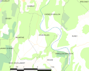
Courcelles
Hiking in Courcelles
Courcelles, located in the Doubs department of the Bourgogne-Franche-Comté region in eastern France, is surrounded by beautiful natural landscapes that make it an appealing destination for hiking enthusiasts. Here are some highlights about hiking in and around Courcelles:...
- Страна:
- Почтовый код: 25440
- Координаты: 47° 5' 38" N, 5° 57' 25" E
- GPS треки (wikiloc): [Ссылка]
- Высота над уровнем моря: 360 м m
- Площадь: 3.61 кв.км
- Население: 111