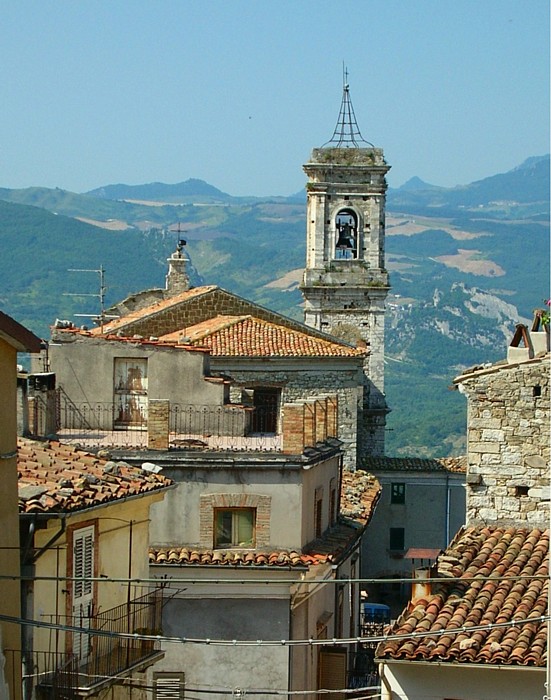
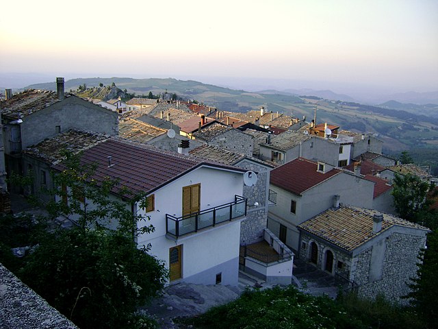
Пеннадомо (Pennadomo, Pennadomo)
.svg)
- коммуна Италии
 Hiking in Пеннадомо
Pennadomo, located in the Province of L'Aquila in the Abruzzo region of Italy, is a wonderful spot for hiking enthusiasts. The area is known for its stunning natural landscapes, including lush forests, rolling hills, and breathtaking views of the surrounding Apennine mountains.
Hiking Trails:
-
Sentiero della Madonna del Monte: This trail takes you through beautiful woodland and offers views of the valley below. It's a moderate hike, suitable for intermediate hikers.
-
Pizzo di Sevo: A popular destination for hikers, Pizzo di Sevo provides panoramic views of the surrounding areas and the chance to encounter local wildlife. The trail can be steep in parts, so it's advisable to have proper footwear and some hiking experience.
-
Valle dell'Ombra: This is a more tranquil hike that follows a stream through a forested area. It's a perfect choice for families or those looking for a leisurely day out in nature.
Best Time to Hike:
The best time for hiking in Pennadomo is during the spring (April to June) and early autumn (September to October) when the weather is mild and the landscapes are vibrant with wildflowers. Summer can get quite hot, while winter may bring snow to the higher elevations.
Tips:
- Gear Up: Wear sturdy hiking boots and bring appropriate gear, including plenty of water, snacks, and a first-aid kit.
- Navigation: Familiarize yourself with the maps of the area or use a hiking app to help find your way.
- Respect Nature: Follow Leave No Trace principles by staying on marked paths, avoiding littering, and respecting wildlife.
Local Culture:
While in Pennadomo, consider exploring the local cuisine, which is heavily influenced by traditional Abruzzese dishes. Dishes often feature local meats, cheeses, and pasta, providing a great way to rejuvenate after a day of hiking.
Whether you're an experienced hiker or a beginner, Pennadomo offers a variety of trails and natural beauty that can cater to different skill levels and preferences. Enjoy your hiking adventure!
- Страна:

- Почтовый код: 66040
- Телефонный код: 0872
- Код автомобильного номера: CH
- Координаты: 42° 0' 0" N, 14° 19' 0" E


- GPS треки (wikiloc): [Ссылка]
- Высота над уровнем моря: 460 м m
- Площадь: 11.02 кв.км
- Население: 251
- Веб сайт: http://www.comunepennadomo.com/
- Википедия русская: wiki(ru)
- Википедия английская: wiki(en)
- Википедия национальная: wiki(it)
- Хранилище Wikidata: Wikidata: Q51261
- Катеория в википедии: [Ссылка]
- код Freebase: [/m/0fg3c8]
- код GeoNames: Альт: [6538883]
- ID отношения в OpenStreetMap: [41696]
- код ISTAT: 069063
- кадастровый код Италии: G434
Граничит с регионами:
Монтебелло-суль-Сангро
- коммуна Италии
Hiking in Монтебелло-суль-Сангро
Montebello sul Sangro is a charming municipality located in the Abruzzo region of Italy, surrounded by stunning natural landscapes that are perfect for hiking enthusiasts. Here’s what you can expect when hiking in and around Montebello sul Sangro:...
- Страна:
- Почтовый код: 66040
- Телефонный код: 0872
- Код автомобильного номера: CH
- Координаты: 41° 59' 0" N, 14° 20' 0" E
- GPS треки (wikiloc): [Ссылка]
- Высота над уровнем моря: 810 м m
- Площадь: 5.38 кв.км
- Население: 88
- Веб сайт: [Ссылка]

Бомба
- коммуна Италии
Hiking in Бомба
Bomba is a charming small town located in the province of Chieti in the Abruzzo region of Italy. Nestled within the foothills of the Appennine mountains and surrounded by stunning natural landscapes, it offers a variety of hiking opportunities for both beginners and experienced hikers....
- Страна:
- Почтовый код: 66042
- Телефонный код: 0872
- Код автомобильного номера: CH
- Координаты: 42° 2' 0" N, 14° 22' 0" E
- GPS треки (wikiloc): [Ссылка]
- Высота над уровнем моря: 424 м m
- Площадь: 17.26 кв.км
- Население: 785
- Веб сайт: [Ссылка]


Чивиталупарелла
- коммуна Италии
Hiking in Чивиталупарелла
Civitaluparella is a charming village located in the Abruzzo region of Italy, known for its stunning natural landscapes and historic architecture. It offers various hiking opportunities that cater to different skill levels, allowing hikers to explore the beautiful surroundings, including mountains, forests, and rivers....
- Страна:
- Почтовый код: 66040
- Телефонный код: 0872
- Код автомобильного номера: CH
- Координаты: 41° 57' 0" N, 14° 18' 0" E
- GPS треки (wikiloc): [Ссылка]
- Высота над уровнем моря: 903 м m
- Площадь: 22.46 кв.км
- Население: 327
- Веб сайт: [Ссылка]

Монтенеродомо
- коммуна Италии
Hiking in Монтенеродомо
Montenerodomo is a charming village located in the Abruzzo region of Italy, surrounded by stunning natural landscapes that are perfect for hiking enthusiasts. Here are some key points to consider if you're thinking about hiking in and around Montenerodomo:...
- Страна:
- Почтовый код: 66010
- Телефонный код: 0872
- Код автомобильного номера: CH
- Координаты: 41° 59' 0" N, 14° 15' 0" E
- GPS треки (wikiloc): [Ссылка]
- Высота над уровнем моря: 1165 м m
- Площадь: 30 кв.км
- Население: 656
- Веб сайт: [Ссылка]


Торричелла-Пелинья
- коммуна Италии
Hiking in Торричелла-Пелинья
Torricella Peligna is a picturesque village located in the Abruzzo region of Italy. Nestled in the Apennine Mountains, it is surrounded by stunning natural landscapes, making it an excellent destination for hiking enthusiasts. Here are some highlights and tips for hiking in Torricella Peligna:...
- Страна:
- Почтовый код: 66019
- Телефонный код: 0872
- Код автомобильного номера: CH
- Координаты: 42° 1' 0" N, 14° 16' 0" E
- GPS треки (wikiloc): [Ссылка]
- Высота над уровнем моря: 910 м m
- Площадь: 36.11 кв.км
- Население: 1292
- Веб сайт: [Ссылка]

Вилла-Санта-Мария
- коммуна Италии
Hiking in Вилла-Санта-Мария
Villa Santa Maria is a beautiful destination located in the heart of Italy, surrounded by stunning landscapes that make it an excellent spot for hiking and outdoor activities. The area is characterized by rolling hills, lush forests, and breathtaking views of the surrounding mountains....
- Страна:
- Почтовый код: 66047
- Телефонный код: 0872
- Код автомобильного номера: CH
- Координаты: 41° 57' 5" N, 14° 21' 5" E
- GPS треки (wikiloc): [Ссылка]
- Высота над уровнем моря: 390 м m
- Площадь: 16.23 кв.км
- Население: 1338
- Веб сайт: [Ссылка]