
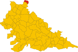
Пескьера-дель-Гарда (Peschiera del Garda, Peschiera del Garda)
- коммуна Италии
 Hiking in Пескьера-дель-Гарда
Peschiera del Garda, located on the southeastern shore of Lake Garda in Italy, is not only a picturesque town known for its charming canals and historical architecture but also an excellent base for hiking enthusiasts. The surrounding landscapes offer a variety of trails, ranging from easy walks to more challenging hikes, suitable for all skill levels.
Hiking Trails and Areas
-
Morrone Plateau: This area provides several trails, allowing hikers to explore lush woods and enjoy panoramic views of Lake Garda. The trails here are generally well-marked and vary in difficulty.
-
Parco Giardino Sigurtà: While not a traditional hiking experience, this beautifully landscaped park is perfect for leisurely walks. You can enjoy the gardens, ponds, and numerous walking paths, making it ideal for families or those looking for a more relaxed outing.
-
Monte Baldo: Just a short distance from Peschiera del Garda, you can reach the Monte Baldo mountain range. The cable car from Malcesine is popular for accessing higher trails with breathtaking views over Lake Garda. Here, you can find numerous hiking routes, including easier trails suitable for beginners and more challenging ones for experienced hikers.
-
Sentiero del Vino e dell'Olio: This scenic hiking trail leads through vineyards and olive groves and is a great way to experience the local culture and cuisine. You can enjoy stunning views over the lake while sampling local wines and olive oils.
Tips for Hiking in Peschiera del Garda
-
Season: The best times for hiking are in spring (April to June) and autumn (September to October) when the weather is mild.
-
Gear: Wear appropriate hiking footwear, and bring a day pack with water, snacks, a first-aid kit, and sun protection.
-
Local Information: Check with local tourist information centers for maps, trail updates, and guided hiking options.
-
Respect Nature: Follow the Leave No Trace principles, stay on marked trails, and respect wildlife.
Getting There
Peschiera del Garda is easily accessible by train and is well connected to other major towns around Lake Garda. Public transport and local taxi services make it easy to reach trailheads.
Whether you're looking for a relaxed stroll, a challenging hike, or the chance to enjoy incredible views, Peschiera del Garda and its surroundings offer a rich hiking experience. Enjoy your adventure!
- Страна:

- Почтовый код: 37010; 37019
- Телефонный код: 045
- Код автомобильного номера: VR
- Координаты: 45° 26' 19" N, 10° 41' 19" E


- GPS треки (wikiloc): [Ссылка]
- Высота над уровнем моря: 68 м m
- Площадь: 18.27 кв.км
- Население: 10583
- Веб сайт: http://www.peschieradelgarda.org
- Википедия русская: wiki(ru)
- Википедия английская: wiki(en)
- Википедия национальная: wiki(it)
- Хранилище Wikidata: Wikidata: Q47649
- Галерея изображений в википедии: [Ссылка]
- Катеория в википедии: [Ссылка]
- код Freebase: [/m/04d31n]
- код GeoNames: Альт: [6536265]
- код VIAF: Альт: [148904523]
- ID отношения в OpenStreetMap: [44964]
- место в MusicBrainz: [59d69134-cece-44a4-93bf-c68d13faf1e3]
- WOEID: [12681000]
- UN/LOCODE: [ITPLU]
- код в энциклопедии «Британника онлайн»: [place/Peschiera-del-Garda]
- код Цифрового атласа Римской империи: [14225]
- код ISTAT: 023059
- кадастровый код Италии: G489
Граничит с регионами:

Дезенцано-дель-Гарда
- коммуна Италии
Hiking in Дезенцано-дель-Гарда
Desenzano del Garda, located on the southern shore of Lake Garda in Italy, offers a beautiful landscape for hiking enthusiasts. The area is characterized by a mix of rolling hills, vineyards, olive groves, and stunning lake views, making it a fantastic destination for outdoor activities....
- Страна:
- Почтовый код: 25015
- Телефонный код: 030
- Код автомобильного номера: BS
- Координаты: 45° 28' 8" N, 10° 32' 6" E
- GPS треки (wikiloc): [Ссылка]
- Высота над уровнем моря: 96 м m
- Площадь: 59.26 кв.км
- Население: 28982
- Веб сайт: [Ссылка]

Поццоленго
- коммуна Италии
Hiking in Поццоленго
Pozzolengo is a charming village located in the Lombardy region of Italy, near Lake Garda. The surrounding area offers a variety of hiking opportunities, characterized by beautiful landscapes, vineyards, olive groves, and historic sites....
- Страна:
- Почтовый код: 25010
- Телефонный код: 030
- Код автомобильного номера: BS
- Координаты: 45° 24' 25" N, 10° 38' 2" E
- GPS треки (wikiloc): [Ссылка]
- Высота над уровнем моря: 135 м m
- Площадь: 21.33 кв.км
- Население: 3558
- Веб сайт: [Ссылка]

Сирмионе
- коммуна Италии
Hiking in Сирмионе
Sirmione, a charming town located on the southern shore of Lake Garda in Italy, is known for its stunning scenery, historical sites, and relaxed atmosphere. While Sirmione itself is not primarily known for extensive hiking trails, there are several beautiful walks and nearby hiking opportunities that you can explore....
- Страна:
- Почтовый код: 25019
- Телефонный код: 030
- Код автомобильного номера: BS
- Координаты: 45° 28' 10" N, 10° 36' 22" E
- GPS треки (wikiloc): [Ссылка]
- Высота над уровнем моря: 68 м m
- Площадь: 26.25 кв.км
- Население: 8243
- Веб сайт: [Ссылка]

Понти-суль-Минчо
- коммуна Италии
Hiking in Понти-суль-Минчо
Ponti sul Mincio is a picturesque village in the Lombardy region of northern Italy, located near the Mincio River. This area is renowned for its natural beauty, historical significance, and opportunities for outdoor activities such as hiking....
- Страна:
- Почтовый код: 46040
- Телефонный код: 0376
- Код автомобильного номера: MN
- Координаты: 45° 23' 0" N, 10° 42' 0" E
- GPS треки (wikiloc): [Ссылка]
- Высота над уровнем моря: 113 м m
- Площадь: 11.72 кв.км
- Население: 2417
- Веб сайт: [Ссылка]


Кастельнуово-дель-Гарда
- коммуна Италии
Hiking in Кастельнуово-дель-Гарда
Castelnuovo del Garda, located near Lake Garda in Italy, offers beautiful hiking opportunities with stunning landscapes, diverse trails, and rich natural beauty. Here are some key points about hiking in the area:...
- Страна:
- Почтовый код: 37014
- Телефонный код: 045
- Код автомобильного номера: VR
- Координаты: 45° 26' 0" N, 10° 46' 0" E
- GPS треки (wikiloc): [Ссылка]
- Высота над уровнем моря: 130 м m
- Площадь: 34.43 кв.км
- Население: 13137
- Веб сайт: [Ссылка]


Валеджо-суль-Минчо
- коммуна Италии
Hiking in Валеджо-суль-Минчо
Valeggio sul Mincio is a charming town in northern Italy, located along the Mincio River in the province of Verona. The area is known for its beautiful landscapes, rich history, and the nearby Sigurtà Botanical Park, making it a great destination for hiking enthusiasts. Here are some key points about hiking in and around Valeggio sul Mincio:...
- Страна:
- Почтовый код: 37060; 37067
- Телефонный код: 045
- Код автомобильного номера: VR
- Координаты: 45° 21' 0" N, 10° 44' 0" E
- GPS треки (wikiloc): [Ссылка]
- Высота над уровнем моря: 88 м m
- Площадь: 63.96 кв.км
- Население: 15424
- Веб сайт: [Ссылка]