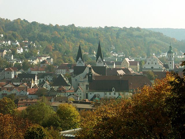
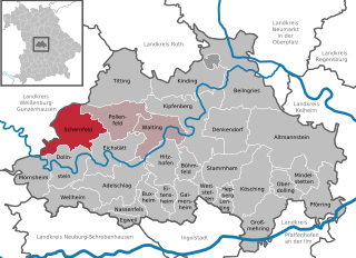
Полленфельд (Pollenfeld, Pollenfeld)

 Hiking in Полленфельд
Pollenfeld, located in Bavaria, Germany, is surrounded by beautiful natural landscapes and offers various hiking opportunities. While not as well-known as some of the larger hiking regions in Germany, it serves as an excellent point for exploring the Franconian countryside and the nearby natural reserves.
Popular Hiking Trails
-
Local Nature Trails: Pollenfeld features several trails that can be explored, ranging from easy family-friendly walks to more challenging routes. These trails often meander through forests, fields, and along streams, providing a scenic experience with local flora and fauna.
-
Nearby Alm Trails: If you're up for a short drive, the Alps are not far away from Pollenfeld. Areas like the Fränkische Schweiz (Franconian Switzerland) have famed trails with remarkable rock formations and stunning views that can be a great day trip for serious hikers.
-
Historical Trails: Some trails may also incorporate historical landmarks, showcasing the region's rich culture and history. Look for routes that pass by ancient churches, ruins, or historic sites.
Tips for Hiking in Pollenfeld
-
Seasonal Considerations: Spring and autumn are particularly beautiful times for hiking, with wildflowers blooming and autumn foliage. Summer can be warm, while winters may bring snow, impacting trail conditions.
-
Equipment: Waterproof hiking shoes and weather-appropriate clothing are essential, especially in variable weather conditions. A hiking pole can be beneficial on uneven terrain.
-
Local Maps and Guides: It's wise to carry a map of local trails or download a hiking app. Local tourism offices often have guides and information on trail conditions.
-
Respect Nature: Stay on designated paths, follow local wildlife protection guidelines, and carry out any trash to help preserve the natural beauty of the area.
Conclusion
Hiking in Pollenfeld offers a peaceful escape into nature, with the chance to explore the Bavarian landscape. Whether you are looking for a casual stroll or an adventurous trek, Pollenfeld provides a great base to experience Bavaria's outdoor beauty.
- Страна:

- Почтовый код: 85131
- Телефонный код: 08421
- Код автомобильного номера: EI
- Координаты: 48° 57' 0" N, 11° 12' 0" E


- GPS треки (wikiloc): [Ссылка]
- Высота над уровнем моря: 534 м m
- Площадь: 45.66 кв.км
- Население: 2903
- Веб сайт: http://www.pollenfeld.de
- Википедия русская: wiki(ru)
- Википедия английская: wiki(en)
- Википедия национальная: wiki(de)
- Хранилище Wikidata: Wikidata: Q627460
- Катеория в википедии: [Ссылка]
- код Freebase: [/m/02q1gl9]
- код GeoNames: Альт: [2852856]
- код VIAF: Альт: [150739919]
- ID отношения в OpenStreetMap: [943533]
- код GND: Альт: [4324543-2]
- Bavarikon ID: [ODB_A00009244]
- идентификатор муниципалитетов в Германии: 09176155
Граничит с регионами:

Айхштетт
- город в Германии
Hiking in Айхштетт
Eichstätt, located in the heart of Bavaria, Germany, offers a variety of hiking opportunities that showcase its stunning natural landscapes, historical sites, and unique limestone formations. Here are some highlights and tips for hiking in the Eichstätt area:...
- Страна:
- Почтовый код: 85072
- Телефонный код: 08421
- Код автомобильного номера: EI
- Координаты: 48° 53' 31" N, 11° 11' 2" E
- GPS треки (wikiloc): [Ссылка]
- Высота над уровнем моря: 371 м m
- Площадь: 47.84 кв.км
- Население: 13788
- Веб сайт: [Ссылка]


Райтенбух
Hiking in Райтенбух
Raitenbuch is a picturesque village located in Bavaria, Germany, near the borders of the scenic Allgäu region. Hiking in and around Raitenbuch offers a range of trails, suitable for various skill levels, showcasing the natural beauty of the Bavarian countryside, including rolling hills, lush forests, and stunning views of the Alps....
- Страна:
- Почтовый код: 91790
- Телефонный код: 09147
- Код автомобильного номера: WUG
- Координаты: 49° 0' 53" N, 11° 7' 35" E
- GPS треки (wikiloc): [Ссылка]
- Высота над уровнем моря: 559 м m
- Площадь: 38.2 кв.км
- Население: 1206
- Веб сайт: [Ссылка]

Шернфельд
Hiking in Шернфельд
Schernfeld, located in Bavaria, Germany, is a charming area surrounded by picturesque landscapes, making it a great location for hiking enthusiasts. The region offers a combination of scenic routes that cater to various skill levels, from leisurely walks to more challenging trails....
- Страна:
- Почтовый код: 85132
- Телефонный код: 08422; 08421
- Код автомобильного номера: EI
- Координаты: 48° 54' 0" N, 11° 6' 0" E
- GPS треки (wikiloc): [Ссылка]
- Высота над уровнем моря: 548 м m
- Площадь: 52.22 кв.км
- Население: 3181
- Веб сайт: [Ссылка]