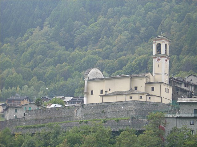
Посталезио (Postalesio, Postalesio)
.svg)
- коммуна Италии
 Hiking in Посталезио
Postalesio is a charming destination for hikers, located in the Valtellina valley in northern Italy. It's surrounded by the stunning Alps, and offers a range of hiking trails that cater to different skill levels, from gentle walks to more challenging routes.
Popular Hiking Trails:
-
Sentiero delle Cime di Postalesio: This is a scenic trail that offers breathtaking views of the Valtellina valley and surrounding peaks. It's a moderately challenging hike that typically takes a half day to complete.
-
Monte Ganda: For those looking for a more strenuous hike, the trail to Monte Ganda offers rewarding panoramic views but requires a good level of fitness. The ascent can be steep, but the views from the summit are worth the effort.
-
Trail to the Malga di Postalesio: This is a family-friendly trail that leads to an alpine pasture. It's relatively easy, making it perfect for families with children or those looking for a more leisurely hike. The route is well-marked, and you can often see local wildlife along the way.
Best Time to Hike:
The best time to hike in Postalesio is generally from late spring to early autumn (May to October). During this period, the weather is milder, and the trails are usually snow-free. However, it's essential to check local conditions as some trails may still retain snow in the early spring.
Preparation and Safety:
- Footwear: Wear sturdy hiking boots that provide good ankle support.
- Water and Snacks: Carry enough water and snacks, especially for longer hikes.
- Weather: Always check the weather forecast before heading out, as mountain weather can change rapidly.
- Map and Compass: While many trails are marked, it's a good idea to carry a map or a GPS device.
Local Guidelines:
Respect the local environment by sticking to marked trails, avoiding picking plants, and following any specific regulations from the local managing authorities.
Enjoy your hiking adventure in Postalesio! The stunning natural beauty and fresh mountain air will make for a memorable experience.
- Страна:

- Почтовый код: 23010
- Телефонный код: 0342
- Код автомобильного номера: SO
- Координаты: 46° 10' 0" N, 9° 47' 0" E


- GPS треки (wikiloc): [Ссылка]
- Высота над уровнем моря: 516 м m
- Площадь: 10.58 кв.км
- Население: 666
- Веб сайт: http://www.comune.postalesio.so.it
- Википедия русская: wiki(ru)
- Википедия английская: wiki(en)
- Википедия национальная: wiki(it)
- Хранилище Wikidata: Wikidata: Q39066
- Катеория в википедии: [Ссылка]
- код Freebase: [/m/0gj3ld]
- код GeoNames: Альт: [6540166]
- код VIAF: Альт: [239709670]
- ID отношения в OpenStreetMap: [46946]
- UN/LOCODE: [ITZQK]
- код ISTAT: 014053
- кадастровый код Италии: G937
Граничит с регионами:
Чедраско
- коммуна Италии
Hiking in Чедраско
Cedrasco is a small municipality located in the Valtellina valley in the Lombardy region of Italy. It is surrounded by stunning natural scenery, making it a great destination for hiking enthusiasts. Here are some highlights about hiking in and around Cedrasco:...
- Страна:
- Почтовый код: 23010
- Телефонный код: 0342
- Код автомобильного номера: SO
- Координаты: 46° 9' 0" N, 9° 46' 0" E
- GPS треки (wikiloc): [Ссылка]
- Высота над уровнем моря: 287 м m
- Площадь: 14.42 кв.км
- Население: 442
- Веб сайт: [Ссылка]

Торре-ди-Санта-Мария
- коммуна Италии
Hiking in Торре-ди-Санта-Мария
Torre di Santa Maria, located in the beautiful region of Lombardy in northern Italy, is an excellent destination for hiking enthusiasts. Nestled in the Valtellina valley, it is surrounded by stunning landscapes, including mountains, valleys, and lush forests....
- Страна:
- Почтовый код: 23020
- Телефонный код: 0342
- Код автомобильного номера: SO
- Координаты: 46° 14' 0" N, 9° 51' 0" E
- GPS треки (wikiloc): [Ссылка]
- Высота над уровнем моря: 795 м m
- Площадь: 44.24 кв.км
- Население: 752
- Веб сайт: [Ссылка]


Бербенно-ди-Вальтеллина
- коммуна Италии
Hiking in Бербенно-ди-Вальтеллина
Berbenno di Valtellina, located in the Valtellina Valley of Northern Italy, is a beautiful area that offers a variety of hiking opportunities. Surrounded by the stunning Alps and characterized by its charming villages, verdant landscapes, and rich cultural heritage, it is an ideal destination for hikers of all levels....
- Страна:
- Почтовый код: 23010
- Телефонный код: 0342
- Код автомобильного номера: SO
- Координаты: 46° 10' 0" N, 9° 45' 0" E
- GPS треки (wikiloc): [Ссылка]
- Высота над уровнем моря: 370 м m
- Площадь: 35.6 кв.км
- Население: 4151
- Веб сайт: [Ссылка]
Фузине
- коммуна Италии
Hiking in Фузине
Fusine, located in the Julian Alps of northeastern Italy, is a stunning destination for hiking enthusiasts. The area is known for its picturesque landscapes, crystal-clear alpine lakes, and diverse flora and fauna. Here are some highlights and tips for hiking in Fusine:...
- Страна:
- Почтовый код: 23010
- Телефонный код: 0342
- Код автомобильного номера: SO
- Координаты: 46° 8' 58" N, 9° 44' 59" E
- GPS треки (wikiloc): [Ссылка]
- Высота над уровнем моря: 285 м m
- Площадь: 37 кв.км
- Население: 575
- Веб сайт: [Ссылка]


Кастьоне-Андевенно
- коммуна Италии
Hiking in Кастьоне-Андевенно
Castione Andevenno is a charming village located in the Valtellina valley in the Lombardy region of Italy. It offers several hiking opportunities that appeal to various skill levels, providing breathtaking views of the surrounding mountains and countryside....
- Страна:
- Почтовый код: 23012
- Телефонный код: 0342
- Код автомобильного номера: SO
- Координаты: 46° 10' 0" N, 9° 48' 0" E
- GPS треки (wikiloc): [Ссылка]
- Высота над уровнем моря: 468 м m
- Площадь: 17.03 кв.км
- Население: 1575
- Веб сайт: [Ссылка]
Кайоло
- коммуна Италии
Hiking in Кайоло
Caiolo is a charming village located in the Valtellina valley in northern Italy, known for its beautiful landscapes and rich outdoor activities, including hiking. Here are some highlights and tips for hiking in and around Caiolo:...
- Страна:
- Почтовый код: 23010
- Телефонный код: 0342
- Код автомобильного номера: SO
- Координаты: 46° 9' 0" N, 9° 48' 0" E
- GPS треки (wikiloc): [Ссылка]
- Высота над уровнем моря: 335 м m
- Площадь: 32.97 кв.км
- Население: 1085
- Веб сайт: [Ссылка]