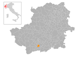
Праростино (Prarostino, Prarostino)

- коммуна Италии
 Hiking in Праростино
Prarostino is a charming village located in the Piedmont region of Italy, nestled within the Susa Valley and surrounded by the breathtaking landscapes of the Italian Alps. It is an excellent destination for hiking enthusiasts, thanks to its diverse trails and stunning natural beauty.
Hiking Trails:
-
Trail to Monte Pome Cavanis: This is a rewarding hike that leads you up to the summit of Monte Pome Cavanis, where you can enjoy panoramic views of the surrounding valleys and mountains. The trail is moderately challenging, making it suitable for hikers with some experience.
-
Val di Susa Trails: The surrounding area of Val di Susa offers a network of trails ranging from easy walks to challenging treks. You can choose from scenic routes that wind through forests, past rivers, and along alpine meadows.
-
Historic Routes: Some trails in the Prarostino area connect to historic paths, including old trade routes and pilgrimage trails. Walking these routes can provide insight into local history and traditional Italian mountain culture.
Tips for Hiking in Prarostino:
-
Seasonal Considerations: The best time for hiking in this region is typically from late spring to early autumn when the weather is more stable, and trails are clear of snow. Always check trail conditions before setting out, especially in spring and autumn.
-
Local Guides: If you’re inexperienced or want to learn more about the region, consider hiring a local guide. They can offer valuable insights into the flora, fauna, and history of the area.
-
Gear: Make sure to wear appropriate hiking shoes, bring enough water, and pack snacks. Weather can change rapidly in the mountains, so it's wise to dress in layers and carry a light rain jacket.
-
Respect Nature: Follow the “Leave No Trace” principles to minimize your impact on the environment. Stay on marked trails and don’t disturb wildlife.
Local Attractions:
After a day of hiking, you can explore the local culture in Prarostino, where you may find quaint restaurants serving traditional Piedmontese cuisine. Enjoy local dishes, such as agnolotti and other pasta specialties, to replenish your energy.
Overall, Prarostino offers a wealth of hiking opportunities, making it an excellent choice for both novice and experienced hikers looking to enjoy the stunning natural beauty of the Italian Alps.
- Страна:

- Почтовый код: 10060
- Телефонный код: 0121
- Код автомобильного номера: TO
- Координаты: 44° 52' 0" N, 7° 16' 0" E


- GPS треки (wikiloc): [Ссылка]
- Высота над уровнем моря: 738 м m
- Площадь: 10.51 кв.км
- Население: 1271
- Веб сайт: http://www.comune.prarostino.to.it/
- Википедия русская: wiki(ru)
- Википедия английская: wiki(en)
- Википедия национальная: wiki(it)
- Хранилище Wikidata: Wikidata: Q10207
- Катеория в википедии: [Ссылка]
- код Freebase: [/m/0g8knp]
- код GeoNames: Альт: [6542380]
- ID отношения в OpenStreetMap: [43729]
- идентификатор местоположения ArchINFORM: [9534]
- код ISTAT: 001205
- кадастровый код Италии: G986
Граничит с регионами:
Сан-Джермано-Кизоне
- коммуна Италии
Hiking in Сан-Джермано-Кизоне
San Germano Chisone is a charming village located in the Piedmont region of Italy, nestled in the Susa Valley and surrounded by the breathtaking Alpine landscape. Hiking in this area offers a range of trails suitable for various skill levels, allowing you to experience the stunning natural beauty and rich culture of the region....
- Страна:
- Почтовый код: 10065
- Телефонный код: 0121
- Код автомобильного номера: TO
- Координаты: 44° 54' 0" N, 7° 14' 0" E
- GPS треки (wikiloc): [Ссылка]
- Высота над уровнем моря: 488 м m
- Площадь: 15.86 кв.км
- Население: 1776
- Веб сайт: [Ссылка]

Сан-Секондо-ди-Пинероло
- коммуна в Италии
Hiking in Сан-Секондо-ди-Пинероло
San Secondo di Pinerolo is a charming municipality in the Piedmont region of Italy, located near the foothills of the Susa Valley and the broader Alps. Hiking in this area offers a mix of scenic views, historical sites, and a rich natural environment. Here’s what you can expect:...
- Страна:
- Почтовый код: 10060
- Телефонный код: 0121
- Код автомобильного номера: TO
- Координаты: 44° 52' 0" N, 7° 18' 0" E
- GPS треки (wikiloc): [Ссылка]
- Высота над уровнем моря: 413 м m
- Площадь: 12.57 кв.км
- Население: 3632
- Веб сайт: [Ссылка]


Ангронья
- коммуна Италии
Hiking in Ангронья
Angrogna, located in the Piedmont region of northern Italy, is an excellent destination for hiking enthusiasts. Nestled in the Susa Valley, it offers breathtaking landscapes, rich history, and an array of trails suited for various skill levels. Here are some key highlights about hiking in Angrogna:...
- Страна:
- Почтовый код: 10060
- Телефонный код: 0121
- Код автомобильного номера: TO
- Координаты: 44° 51' 0" N, 7° 13' 0" E
- GPS треки (wikiloc): [Ссылка]
- Высота над уровнем моря: 782 м m
- Площадь: 38.88 кв.км
- Население: 868
- Веб сайт: [Ссылка]


Брикеразио
- коммуна Италии
Hiking in Брикеразио
Bricherasio is a charming hilltop town located in the Piedmont region of Italy, surrounded by beautiful natural landscapes, making it an excellent place for hiking enthusiasts. The area offers a variety of trails that cater to different levels of experience, from leisurely walks to more challenging hikes....
- Страна:
- Почтовый код: 10060
- Телефонный код: 0121
- Код автомобильного номера: TO
- Координаты: 44° 49' 28" N, 7° 18' 23" E
- GPS треки (wikiloc): [Ссылка]
- Высота над уровнем моря: 400 м m
- Площадь: 22.76 кв.км
- Население: 4608
- Веб сайт: [Ссылка]