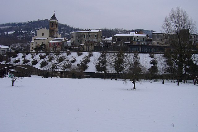
Преторо (Pretoro, Pretoro)
.svg)
- коммуна Италии
 Hiking in Преторо
Pretoro is a picturesque village located in the Abruzzo region of Italy, known for its stunning landscapes and outdoor recreational opportunities. Nestled in the Majella National Park, it offers a range of hiking trails that cater to various skill levels, making it a great destination for both novice and experienced hikers.
Hiking Trails and Areas
-
Majella National Park: The park surrounding Pretoro is a hiker's paradise, featuring diverse flora and fauna as well as breathtaking scenery. There are numerous trails that crisscross the park, ranging from easy walks to challenging climbs.
-
Sentiero del Lupo (Wolf Trail): This trail is popular among hikers and is known for its panoramic views. It winds through forested areas and offers a chance to spot local wildlife, including deer and various bird species.
-
The Cascate del Verde: This trail leads to the beautiful Green Waterfalls, a great spot for photography and a refreshing break after your hike. The trail offers a mix of forest paths and rocky terrain, making it an exciting adventure.
-
Piana dei Cavalli: For those looking for more challenging hikes, the Piana dei Cavalli offers breathtaking vistas of the surrounding mountains, ideal for passionate hikers looking to explore more rugged terrain.
Tips for Hiking in Pretoro
- Weather Considerations: Always check the weather forecast before heading out, as trails can be slippery or difficult to navigate in wet conditions.
- Gear: Wear appropriate hiking boots, pack plenty of water, and bring snacks. A first-aid kit and weather-proof clothing are also recommended.
- Navigation: Familiarize yourself with the trails through maps or local guides. Some trails may not be well-marked, so having a GPS or a compass can be helpful.
- Respect Nature: As in all natural parks, it’s important to follow Leave No Trace principles – pack out what you pack in and respect wildlife.
Local Culture and Attractions
After a day of hiking, you can enjoy the local cuisine, which features delicious Abruzzese dishes. Don't miss the opportunity to sample regional wines and visit quaint local shops. Pretoro also has historical sites and cultural landmarks that can enrich your visit.
Overall, Pretoro provides a fantastic hiking experience with its stunning scenery and well-maintained trails, making it an ideal spot for nature lovers and outdoor enthusiasts.
- Страна:

- Почтовый код: 66010
- Телефонный код: 0871
- Код автомобильного номера: CH
- Координаты: 42° 12' 59" N, 14° 8' 35" E


- GPS треки (wikiloc): [Ссылка]
- Высота над уровнем моря: 560 м m
- Площадь: 26.13 кв.км
- Население: 965
- Веб сайт: http://www.comune.pretoro.ch.it/
- Википедия русская: wiki(ru)
- Википедия английская: wiki(en)
- Википедия национальная: wiki(it)
- Хранилище Wikidata: Wikidata: Q51268
- Катеория в википедии: [Ссылка]
- код Freebase: [/m/0874gk]
- код GeoNames: Альт: [6537491]
- код VIAF: Альт: [247855539]
- ID отношения в OpenStreetMap: [41823]
- место в MusicBrainz: [db5a6739-df78-4022-8eba-c6eb2a3ff19a]
- WOEID: [721319]
- код ISTAT: 069069
- кадастровый код Италии: H052
Граничит с регионами:

Фара-Фильорум-Петри
- коммуна Италии
Hiking in Фара-Фильорум-Петри
Fara Filiorum Petri is a charming village located in the Abruzzo region of Italy, known for its picturesque landscapes and rich natural beauty. Hiking in and around Fara Filiorum Petri offers a range of trails that cater to different skill levels, allowing hikers to experience the stunning scenery typical of the Apennine Mountains....
- Страна:
- Почтовый код: 66010
- Телефонный код: 0871
- Код автомобильного номера: CH
- Координаты: 42° 14' 54" N, 14° 11' 9" E
- GPS треки (wikiloc): [Ссылка]
- Высота над уровнем моря: 227 м m
- Площадь: 14.96 кв.км
- Население: 1986
- Веб сайт: [Ссылка]


Пеннапьедимонте
- коммуна Италии
Hiking in Пеннапьедимонте
Pennapiedimonte is a charming village located in the Abruzzo region of Italy, known for its stunning natural landscapes and rich biodiversity. The surrounding area offers various hiking opportunities that cater to different skill levels, making it a fantastic destination for both novice and experienced hikers....
- Страна:
- Почтовый код: 66010
- Телефонный код: 0871
- Код автомобильного номера: CH
- Координаты: 42° 9' 8" N, 14° 11' 41" E
- GPS треки (wikiloc): [Ссылка]
- Высота над уровнем моря: 669 м m
- Площадь: 47.03 кв.км
- Население: 445
- Веб сайт: [Ссылка]


Рапино
- коммуна Италии
Hiking in Рапино
Rapino is a small town located in the Abruzzo region of Italy, known for its stunning landscapes, historical charm, and proximity to the Majella National Park. Hiking in and around Rapino offers a variety of trails that cater to different skill levels, from leisurely walks to more challenging treks. Here are some key points to consider when hiking in this area:...
- Страна:
- Почтовый код: 66010
- Телефонный код: 0871
- Код автомобильного номера: CH
- Координаты: 42° 12' 40" N, 14° 11' 14" E
- GPS треки (wikiloc): [Ссылка]
- Высота над уровнем моря: 420 м m
- Площадь: 20.3 кв.км
- Население: 1275
- Веб сайт: [Ссылка]


Роккамонтепьяно
- коммуна Италии
Hiking in Роккамонтепьяно
Roccamontepiano is a charming small town located in the beautiful Abruzzo region of Italy, surrounded by stunning natural landscapes, making it a great destination for hiking enthusiasts. Here are some details about hiking in and around Roccamontepiano:...
- Страна:
- Почтовый код: 66010
- Телефонный код: 0871
- Код автомобильного номера: CH
- Координаты: 42° 14' 41" N, 14° 7' 38" E
- GPS треки (wikiloc): [Ссылка]
- Высота над уровнем моря: 500 м m
- Площадь: 18.22 кв.км
- Население: 1671
- Веб сайт: [Ссылка]


Леттоманоппелло
- коммуна Италии
Hiking in Леттоманоппелло
Lettomanoppello is a charming village located in the Abruzzo region of Italy. The surrounding area is known for its stunning natural landscapes, which provide excellent opportunities for hiking and outdoor activities. Here are some highlights about hiking in Lettomanoppello:...
- Страна:
- Почтовый код: 65020
- Телефонный код: 085
- Код автомобильного номера: PE
- Координаты: 42° 14' 0" N, 14° 2' 0" E
- GPS треки (wikiloc): [Ссылка]
- Высота над уровнем моря: 370 м m
- Площадь: 15.07 кв.км
- Население: 2887
- Веб сайт: [Ссылка]


Роккамориче
- коммуна Италии
Hiking in Роккамориче
Roccamorice is a charming village located in the Abruzzo region of Italy, known for its stunning natural landscapes and proximity to the Majella National Park. Here are some highlights for hiking in and around Roccamorice:...
- Страна:
- Почтовый код: 65020
- Телефонный код: 085
- Код автомобильного номера: PE
- Координаты: 42° 13' 0" N, 14° 2' 0" E
- GPS треки (wikiloc): [Ссылка]
- Высота над уровнем моря: 520 м m
- Площадь: 25.06 кв.км
- Население: 930
- Веб сайт: [Ссылка]


Серрамоначеска
- коммуна Италии
Hiking in Серрамоначеска
Serramonacesca is a picturesque area located in the Abruzzo region of Italy, surrounded by beautiful mountains and lush landscapes, making it an excellent destination for hiking and outdoor activities. Here are some highlights of hiking in Serramonacesca:...
- Страна:
- Почтовый код: 65025
- Телефонный код: 085
- Код автомобильного номера: PE
- Координаты: 42° 14' 55" N, 14° 5' 36" E
- GPS треки (wikiloc): [Ссылка]
- Высота над уровнем моря: 280 м m
- Площадь: 23.89 кв.км
- Население: 552
- Веб сайт: [Ссылка]