Puy-Saint-Martin (Puy-Saint-Martin)
- коммуна во Франции
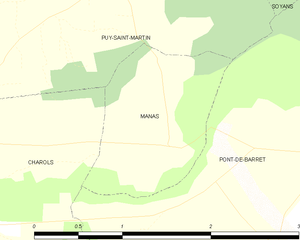
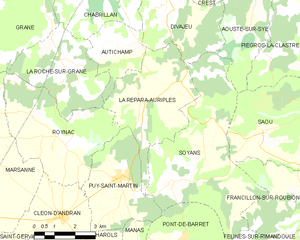
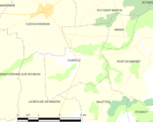
Puy-Saint-Martin is a picturesque village located in the Drôme department in southeastern France. It sits in a beautiful region characterized by rolling hills, vineyards, and charming countryside. While it may not be as widely known as some other hiking destinations in France, it offers several opportunities for outdoor activities, including hiking.
Hiking Trails
The area around Puy-Saint-Martin features a variety of trails suitable for different experience levels. You can expect to find:
- Scenic Views: Many trails offer stunning views of the surrounding landscapes, including vineyards and the distant mountains of the Vercors and the Alps.
- Diverse Terrain: Hikes can range from easy walks through lush fields to more challenging ascents in the nearby hills.
- Flora and Fauna: Hikers can enjoy the region's diverse plant life and may spot local wildlife, making it a rewarding experience for nature lovers.
Notable Routes
- Local Circuits: There are several circular hiking routes which allow the exploration of local woodlands and agricultural areas, providing a chance to experience the rural charm of the region.
- Access to Regional Parks: Puy-Saint-Martin is a great base for accessing nearby natural parks, like the Parc Naturel Régional du Vercors, where there are numerous well-marked trails ranging from easy to expert.
Recommendations
- Best Time to Hike: Spring and fall are ideal for hiking in this region as the weather is generally mild, with blooming flowers in spring and vibrant autumn colors. Summer can be hot, while winter may see snowfall in higher elevations.
- Local Amenities: Check out local accommodations if you plan to stay overnight. There may be small inns or guesthouses that provide a cozy atmosphere after a day of hiking.
- Equipment: Make sure to wear good hiking shoes and bring plenty of water and snacks, as some trails may not be near facilities.
Safety Tips
- Always inform someone about your hiking plans and expected return time.
- Carry a detailed map or a GPS device, as some trails might not be well-marked.
- Dress in layers to accommodate changes in weather.
Conclusion
Hiking in Puy-Saint-Martin allows you to enjoy the serene atmosphere of the French countryside while also participating in a variety of outdoor activities. Whether you are looking for a leisurely stroll or a more challenging trek, you'll find something suitable in this lovely region.
- Страна:

- Почтовый код: 26450
- Координаты: 44° 37' 42" N, 4° 58' 24" E


- GPS треки (wikiloc): [Ссылка]
- Площадь: 11.65 кв.км
- Население: 872
- Википедия английская: wiki(en)
- Википедия национальная: wiki(fr)
- Хранилище Wikidata: Wikidata: Q1075960
- Катеория в википедии: [Ссылка]
- код Freebase: [/m/03mgkc9]
- код GeoNames: Альт: [6430183]
- номер SIREN: [212602585]
- код BNF: [152531189]
- код муниципалитета INSEE: 26258
Граничит с регионами:


Roynac
- коммуна во Франции
Roynac is a charming commune in the Drôme department of southeastern France, located in the Auvergne-Rhône-Alpes region. It offers various hiking opportunities, set against the backdrop of picturesque landscapes, rolling hills, and lush forests. Here are some highlights about hiking in and around Roynac:...
- Страна:

- Почтовый код: 26450
- Координаты: 44° 38' 34" N, 4° 56' 23" E


- GPS треки (wikiloc): [Ссылка]
- Площадь: 17.06 кв.км
- Население: 482


Manas
- коммуна во Франции
Manas, located in the Drôme department of the Auvergne-Rhône-Alpes region of southeastern France, offers a charming backdrop for hiking enthusiasts. The area is characterized by its beautiful landscapes, rolling hills, vineyards, and proximity to the picturesque landscapes of the Vercors Regional Natural Park and the Drôme Provençale....
- Страна:

- Почтовый код: 26160
- Координаты: 44° 35' 58" N, 4° 59' 3" E


- GPS треки (wikiloc): [Ссылка]
- Площадь: 1.91 кв.км
- Население: 192


Soyans
- коммуна во Франции
Soyans, located in the Drôme department of southeastern France, is less known among hiking enthusiasts compared to major regions but offers beautiful landscapes and a variety of trails. The area is characterized by its stunning natural features, including forests, hills, and valleys, making it suitable for different types of hiking experiences....
- Страна:

- Почтовый код: 26400
- Координаты: 44° 38' 13" N, 5° 1' 33" E


- GPS треки (wikiloc): [Ссылка]
- Площадь: 25.64 кв.км
- Население: 375


Pont-de-Barret
- коммуна во Франции
Pont-de-Barret is a charming village located in the Drôme department of the Auvergne-Rhône-Alpes region in southeastern France. It is an excellent area for hiking, offering picturesque landscapes, varied terrain, and a blend of natural beauty and cultural heritage....
- Страна:

- Почтовый код: 26160
- Координаты: 44° 36' 7" N, 5° 0' 40" E


- GPS треки (wikiloc): [Ссылка]
- Площадь: 16.6 кв.км
- Население: 671


La Répara-Auriples
- коммуна во Франции
La Répara-Auriples, located in the Drôme department in southeastern France, is a beautiful area for hiking, characterized by its picturesque landscapes, rolling hills, and charming rural scenery. Here are some key aspects to consider when hiking in this region:...
- Страна:

- Почтовый код: 26400
- Координаты: 44° 39' 34" N, 4° 59' 11" E


- GPS треки (wikiloc): [Ссылка]
- Площадь: 15.03 кв.км
- Население: 230


Cléon-d'Andran
- коммуна во Франции
Cléon-d'Andran is a charming commune located in the Drôme department of southeastern France. The surrounding area is characterized by its beautiful landscapes, which are perfect for hiking enthusiasts. Here are some highlights and tips for hiking in and around Cléon-d'Andran:...
- Страна:

- Почтовый код: 26450
- Координаты: 44° 36' 40" N, 4° 56' 9" E


- GPS треки (wikiloc): [Ссылка]
- Площадь: 10.25 кв.км
- Население: 856


Charols
- коммуна во Франции
Charols is a charming village located in the Drôme department of the Auvergne-Rhône-Alpes region in southeastern France. It's a great base for hiking enthusiasts due to its picturesque landscapes, diverse terrain, and several trails that cater to various skill levels....
- Страна:

- Почтовый код: 26450
- Координаты: 44° 35' 34" N, 4° 57' 5" E


- GPS треки (wikiloc): [Ссылка]
- Площадь: 7.31 кв.км
- Население: 887

