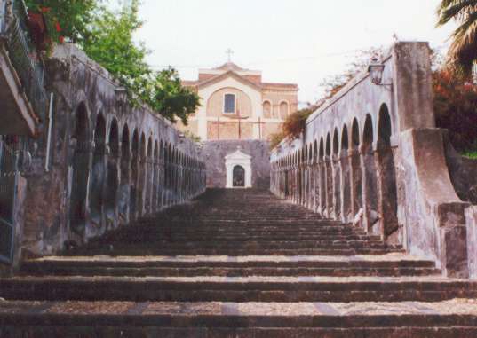
Рагальна (Ragalna, Ragalna)
- коммуна в Италии
Ragalna, situated on the slopes of Mount Etna in Sicily, Italy, offers an incredible backdrop for hiking enthusiasts. Nestled amidst lush landscapes and volcanic terrain, it features various trails that cater to different skill levels. Here are some key points to consider for hiking in Ragalna:
Trails and Routes
- Sentiero del Vulcano: This path takes you through the unique volcanic landscapes, providing a close-up view of Mount Etna’s geological features.
- Natural Park Trails: The surrounding Parco dell'Etna offers multiple trails that range in difficulty, with some offering stunning panoramic views of the volcanic landscape and distant coastlines.
- Local Paths: Explore the lesser-known paths around Ragalna that lead you through rural areas, vineyards, and orchards, showcasing the beauty of the local flora and fauna.
Difficulty Levels
- Easy Trails: Suitable for beginners and families, these trails usually have gentle slopes and well-marked paths.
- Moderate to Difficult Trails: For experienced hikers, trails that lead closer to the summit of Mount Etna or through rugged terrain offer more challenging experiences.
Best Time to Hike
- Spring and Fall: The weather during these seasons tends to be mild, making hiking more comfortable.
- Summer: It can get quite hot, so early morning or late afternoon hikes are preferable.
- Winter: Be cautious, as snow can impact trails and hiking conditions.
Safety Tips
- Weather Considerations: Always check the weather forecast before heading out, especially since conditions can change rapidly on Mount Etna.
- Proper Gear: Wear sturdy hiking boots, bring plenty of water, and consider poles for steadiness on rocky terrain.
- Guided Tours: Consider joining guided tours if you're unfamiliar with the area or if you want to learn more about the geology and ecology of the region.
What to Bring
- Sufficient water and snacks for energy
- Sunscreen and a hat for sun protection
- A map or GPS device to navigate the trails
- A camera to capture the stunning views
Wildlife and Flora
Hiking in Ragalna provides opportunities to see unique plant species and wildlife, including endemic species that thrive in the volcanic soil.
Summary
Hiking in Ragalna offers a mix of adventure, stunning scenery, and a chance to explore the fascinating geology of Mount Etna. Whether you are a seasoned hiker or a beginner, there's something for everyone. Always prioritize safety and sustainability by respecting the natural environment.
- Страна:

- Почтовый код: 95030
- Телефонный код: 095
- Код автомобильного номера: CT
- Координаты: 37° 38' 0" N, 14° 56' 0" E


- GPS треки (wikiloc): [Ссылка]
- Высота над уровнем моря: 830 м m
- Площадь: 39.53 кв.км
- Население: 3960
- Веб сайт: http://www.comune.ragalna.ct.it
- Википедия русская: wiki(ru)
- Википедия английская: wiki(en)
- Википедия национальная: wiki(it)
- Хранилище Wikidata: Wikidata: Q478763
- Катеория в википедии: [Ссылка]
- код Freebase: [/m/0gqhyc]
- код GeoNames: Альт: [6543314]
- ID отношения в OpenStreetMap: [39306]
- код ISTAT: 087058
- кадастровый код Италии: M287
Граничит с регионами:
Бельпассо
- коммуна в Италии
Belpasso, located on the eastern slope of Mount Etna in Sicily, Italy, offers a variety of hiking opportunities that combine stunning natural landscapes, fascinating geological features, and rich local history. Here are some key aspects to consider for a hiking experience in Belpasso:...
- Страна:

- Почтовый код: 95032
- Телефонный код: 095
- Код автомобильного номера: CT
- Координаты: 37° 35' 0" N, 14° 59' 0" E


- GPS треки (wikiloc): [Ссылка]
- Высота над уровнем моря: 551 м m
- Площадь: 166.33 кв.км
- Население: 28126
- Веб сайт: [Ссылка]

Бьянкавилла
- коммуна в Италии
Biancavilla is a charming town located in the Sicilian region of Italy, nestled on the slopes of Mount Etna, Europe's highest and most active volcano. The surrounding area offers a diverse range of hiking opportunities suitable for various skill levels, with stunning landscapes, rich biodiversity, and unique geological features. Here’s an overview of what you can expect when hiking in Biancavilla:...
- Страна:

- Почтовый код: 95033
- Телефонный код: 095
- Код автомобильного номера: CT
- Координаты: 37° 38' 43" N, 14° 51' 49" E


- GPS треки (wikiloc): [Ссылка]
- Высота над уровнем моря: 513 м m
- Площадь: 70.28 кв.км
- Население: 23948
- Веб сайт: [Ссылка]


Патерно
- коммуна в Италии
Paternò, located in Sicily, Italy, offers a distinct hiking experience thanks to its beautiful landscapes and proximity to Mount Etna, one of the most active volcanoes in the world. Here are some highlights about hiking in and around Paternò:...
- Страна:

- Почтовый код: 95047
- Телефонный код: 095
- Код автомобильного номера: CT
- Координаты: 37° 34' 0" N, 14° 54' 0" E


- GPS треки (wikiloc): [Ссылка]
- Высота над уровнем моря: 225 м m
- Площадь: 144.68 кв.км
- Население: 47827
- Веб сайт: [Ссылка]


Санта-Мария-ди-Ликодия
- коммуна в Италии
 Hiking in Санта-Мария-ди-Ликодия
Santa Maria di Licodia is a charming town located on the eastern slopes of Mount Etna in Sicily, Italy. The area is rich in natural beauty and offers several excellent hiking opportunities, especially for those interested in volcanic landscapes and varied terrain....
- Страна:

- Почтовый код: 95038
- Телефонный код: 095
- Код автомобильного номера: CT
- Координаты: 37° 37' 0" N, 14° 54' 0" E


- GPS треки (wikiloc): [Ссылка]
- Высота над уровнем моря: 442 м m
- Площадь: 26.28 кв.км
- Население: 7691
- Веб сайт: [Ссылка]
