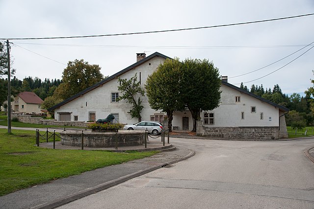
Rantechaux (Rantechaux)

- коммуна во Франции
 Hiking in Rantechaux
Rantechaux, located in the Doubs department of the Bourgogne-Franche-Comté region in France, offers beautiful landscapes and a variety of hiking opportunities. While specific trails can vary, here are some general aspects and suggestions for hiking in the area:
Trail Options
-
Le Sentier des Sources: This trail can lead you along scenic paths where you can explore local flora and fauna, taking in views of the surrounding countryside.
-
Mont d'Or Trails: A bit further afield, the Mont d'Or area offers a range of hiking routes with different levels of difficulty, suitable for both beginners and experienced hikers.
-
Nearby Nature Reserves: The region is rich in natural reserves, such as the Réserve Naturelle de la Haute Chaîne du Jura, providing opportunities for more challenging hikes with stunning views and wildlife sightings.
Preparation
- Maps and Information: Make sure to obtain detailed trail maps and check local hiking guides for any updates on trail conditions.
- Weather: The weather can change rapidly, so be prepared with appropriate clothing and equipment.
- Safety: Carry a first aid kit, enough water, and snacks. Inform someone of your hiking plans, especially if venturing onto less populated trails.
Best Time to Hike
Spring and early autumn are usually the best times to visit for pleasant weather and fewer crowds. Be aware of local wildlife, especially in spring.
Local Tips
- Consider visiting local tourism offices for current information on trail conditions and any guided tours available.
- Follow Leave No Trace principles to preserve the natural beauty of the area.
Rantechaux offers a peaceful retreat with the opportunity to experience the beauty of the French countryside, making it a wonderful hiking destination. Enjoy your adventure!
- Страна:

- Почтовый код: 25580
- Координаты: 47° 6' 44" N, 6° 22' 30" E


- GPS треки (wikiloc): [Ссылка]
- Площадь: 5.71 кв.км
- Население: 179
- Википедия английская: wiki(en)
- Википедия национальная: wiki(fr)
- Хранилище Wikidata: Wikidata: Q530856
- Катеория в википедии: [Ссылка]
- код Freebase: [/m/03mhc8d]
- код Freebase: [/m/03mhc8d]
- код GeoNames: Альт: [2984421]
- код GeoNames: Альт: [2984421]
- код BNF: [15252706q]
- код BNF: [15252706q]
- код муниципалитета INSEE: 25480
- код муниципалитета INSEE: 25480
Граничит с регионами:


Épenoy
- коммуна во Франции
Hiking in Épenoy
Épenoy is a picturesque village located in the Bourgogne-Franche-Comté region of eastern France, nestled in the Jura Mountains. This area is known for its stunning landscapes, diverse flora and fauna, and a range of hiking opportunities suitable for various experience levels....
- Страна:
- Почтовый код: 25800
- Координаты: 47° 7' 52" N, 6° 22' 14" E
- GPS треки (wikiloc): [Ссылка]
- Площадь: 13.25 кв.км
- Население: 631


Étray
- коммуна во Франции
Hiking in Étray
Étray is a picturesque commune located in the Auvergne-Rhône-Alpes region of France, surrounded by stunning natural landscapes. While it may not be as widely known as some other hiking destinations, it offers a variety of trails and beautiful scenery that can make for an enjoyable hiking experience....
- Страна:
- Почтовый код: 25800
- Координаты: 47° 7' 23" N, 6° 20' 34" E
- GPS треки (wikiloc): [Ссылка]
- Площадь: 6 кв.км
- Население: 264


Vanclans
- коммуна во Франции
Hiking in Vanclans
It seems like you might be referring to Vancouver and its surrounding areas, particularly in British Columbia, Canada. If that’s the case, Vancouver is known for its stunning natural landscapes and numerous hiking opportunities. Here are some popular hiking spots around Vancouver that you might consider exploring:...
- Страна:
- Почтовый код: 25580
- Координаты: 47° 6' 1" N, 6° 21' 41" E
- GPS треки (wikiloc): [Ссылка]
- Площадь: 9.6 кв.км
- Население: 216

Passonfontaine
- коммуна во Франции
Hiking in Passonfontaine
Passonfontaine is a picturesque area located in France, known for its stunning natural landscapes and hiking opportunities. While it may not be as widely recognized as some of the larger national parks, it offers a variety of trails that cater to different skill levels, making it a great destination for both novice and experienced hikers....
- Страна:
- Почтовый код: 25690
- Координаты: 47° 6' 28" N, 6° 25' 8" E
- GPS треки (wikiloc): [Ссылка]
- Площадь: 19.49 кв.км
- Население: 316