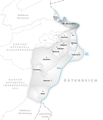
Райнек (Rheineck, Rheineck SG)


 Hiking in Райнек
Rheineck, located in the canton of St. Gallen in Switzerland, offers a variety of hiking opportunities that cater to different skill levels and preferences. The area is known for its beautiful landscapes, including rolling hills, lush forests, and stunning views of Lake Constance and the surrounding mountains. Here are some highlights and tips for hiking in Rheineck:
Hiking Trails
-
Lake Constance Trails: Trails along the shores of Lake Constance offer scenic views and leisurely walks. The paths are typically well-marked and provide opportunities to enjoy the waterfront.
-
Regional Trails: Explore the various marked regional hiking trails that connect Rheineck to nearby towns such as St. Margrethen and Rorschach. These routes often lead through picturesque countryside and vineyards.
-
Hiking in the Appenzell Region: Just a short drive from Rheineck, the Appenzell region features more challenging hikes with breathtaking mountain scenery. Trails such as the Ebenalp or the hike to Wasserauen are popular among experienced hikers.
Key Considerations
- Trail Conditions: Always check the local trail conditions before heading out, as weather can impact trail accessibility.
- Pack Appropriately: Bring plenty of water, snacks, and a basic first-aid kit. Always wear appropriate hiking shoes and gear, depending on the season.
- Navigation: Use maps or a hiking app to stay on course. While many trails are well-marked, it's easy to lose your way in more remote areas.
Best Times to Hike
- Spring and Fall: These seasons offer mild temperatures and vibrant landscapes, making them ideal for hiking.
- Summer: Be cautious of heat and remember to carry enough water. Early morning hikes can be a great way to avoid the midday sun.
- Winter: Some trails may be suitable for snowshoeing or winter hiking. Check local conditions and be prepared for icy paths.
Additional Activities
In addition to hiking, Rheineck offers opportunities for cycling and other outdoor activities, as well as cultural experiences in the town itself. Consider visiting local vineyards or taking a ferry ride on Lake Constance to enjoy the area from a different perspective.
Safety Tips
- Always let someone know your hiking plans and estimated return time.
- If hiking alone, consider choosing busier trails.
- Be aware of wildlife; while encounters are rare, it’s always best to be cautious.
Enjoy your hiking experience in Rheineck! The natural beauty and tranquil atmosphere provide a perfect backdrop for any nature enthusiast.
- Страна:

- Почтовый код: 9424
- Телефонный код: 071
- Код автомобильного номера: SG
- Координаты: 47° 28' 12" N, 9° 35' 0" E


- GPS треки (wikiloc): [Ссылка]
- Высота над уровнем моря: 399 м m
- Площадь: 2.18 кв.км
- Население: 3485
- Веб сайт: http://www.rheineck.ch
- Википедия русская: wiki(ru)
- Википедия английская: wiki(en)
- Википедия национальная: wiki(de)
- Хранилище Wikidata: Wikidata: Q69595
- Катеория в википедии: [Ссылка]
- код Freebase: [/m/0gmg52]
- код GeoNames: Альт: [7286891]
- код VIAF: Альт: [170712137]
- ID отношения в OpenStreetMap: [1683925]
- код GND: Альт: [4116982-7]
- идентификатор местоположения ArchINFORM: [9793]
- идентификатор HDS: [1336]
- код швейцарского муниципалитета: [3235]
Граничит с регионами:


Вальценхаузен
Hiking in Вальценхаузен
Walzenhausen, located in Switzerland, is an excellent destination for hiking enthusiasts. Situated in the canton of Appenzell, it offers stunning views of the surrounding landscapes, including the Rhine Valley and the Swiss Alps....
- Страна:
- Почтовый код: 9428
- Телефонный код: 071
- Код автомобильного номера: AR
- Координаты: 47° 26' 37" N, 9° 35' 51" E
- GPS треки (wikiloc): [Ссылка]
- Высота над уровнем моря: 824 м m
- Площадь: 6.98 кв.км
- Население: 1994
- Веб сайт: [Ссылка]


Таль
Hiking in Таль
Thal, located in the canton of St. Gallen, Switzerland, offers some beautiful hiking opportunities that cater to different skill levels. The region is characterized by picturesque landscapes, rolling hills, and stunning views of the surrounding mountains. Here are some highlights and tips for hiking in Thal:...
- Страна:
- Почтовый код: 9425
- Телефонный код: 071
- Код автомобильного номера: SG
- Координаты: 47° 28' 42" N, 9° 33' 24" E
- GPS треки (wikiloc): [Ссылка]
- Высота над уровнем моря: 397 м m
- Площадь: 9.58 кв.км
- Население: 6480
- Веб сайт: [Ссылка]

Санкт-Маргретен
Hiking in Санкт-Маргретен
St. Margrethen is a picturesque town located in the canton of St. Gallen in Switzerland, near the shores of Lake Constance. The area offers several opportunities for hiking enthusiasts, with trails that vary in difficulty and length, catering to different skill levels....
- Страна:
- Почтовый код: 9430
- Телефонный код: 071
- Код автомобильного номера: SG
- Координаты: 47° 27' 12" N, 9° 37' 34" E
- GPS треки (wikiloc): [Ссылка]
- Высота над уровнем моря: 408 м m
- Площадь: 6.85 кв.км
- Население: 5889
- Веб сайт: [Ссылка]


Лутценберг
Hiking in Лутценберг
Lutzenberg is a charming community located in the Appenzell District of Switzerland, known for its picturesque landscapes and proximity to the beautiful Appenzell region. Hiking in Lutzenberg offers stunning vistas of rolling hills, lush forests, and scenic views of the Swiss Alps....
- Страна:
- Почтовый код: 9426
- Телефонный код: 071
- Код автомобильного номера: AR
- Координаты: 47° 27' 29" N, 9° 35' 1" E
- GPS треки (wikiloc): [Ссылка]
- Высота над уровнем моря: 523 м m
- Площадь: 2.26 кв.км
- Население: 1253
- Веб сайт: [Ссылка]