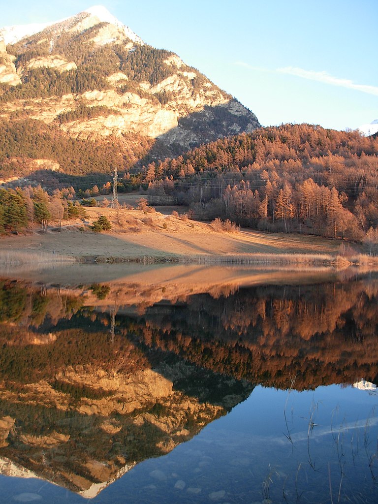
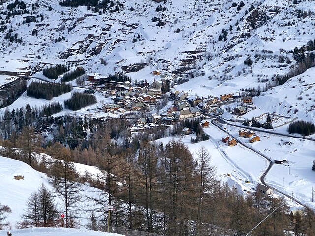
Ризуль (Risoul, Risoul)
- коммуна во Франции
 Hiking in Ризуль
Risoul is a charming alpine village located in the French Alps, known primarily for its ski resort, but it also offers fantastic hiking opportunities during the warmer months. Here are some key points to consider if you're looking to hike in Risoul:
Trail Options
-
Le Col de Ségriès: This trail provides stunning views and leads you to the picturesque Col de Ségriès. It's a moderate hike and is suitable for most hikers with some experience.
-
Lac de l'Eyssina: This trail takes you to a beautiful mountain lake, offering a serene setting and is perfect for a picnic. It’s a bit of a climb but rewards you with breathtaking scenery.
-
Les Sentiers de Découverte: These discovery trails are designed for families and beginners, featuring shorter distances and educational signs about the flora and fauna.
-
GR5 Trail: For more seasoned hikers, parts of the GR5 long-distance trail pass through the area, offering more challenging hikes and the chance to experience the stunning diverse landscapes of the Alps.
Map and Navigation
It’s advisable to carry a detailed map or use a GPS app designed for hiking. Signposting is generally good, but having your own navigation aids can help ensure you stay on the right track.
Best Time to Hike
The best time for hiking in Risoul is generally from late spring to early autumn (May to September), when the weather is milder and the trails are clear of snow.
Preparation
- Gear: Make sure to wear proper hiking boots and pack layers, as weather can change quickly in the mountains.
- Water and Snacks: Always carry enough water and snacks to keep your energy levels up.
- Sun Protection: Don’t forget sunscreen, sunglasses, and a hat, as UV exposure can be higher at altitude.
Local Regulations
Be mindful of local wildlife and vegetation, and follow Leave No Trace principles to keep the trails and environment pristine.
Hiking in Risoul offers a fantastic way to explore the natural beauty of the French Alps, whether you’re a novice or an experienced hiker. Enjoy your adventure!
- Страна:

- Почтовый код: 05600
- Координаты: 44° 38' 55" N, 6° 38' 24" E


- GPS треки (wikiloc): [Ссылка]
- Площадь: 30.34 кв.км
- Население: 638
- Википедия русская: wiki(ru)
- Википедия английская: wiki(en)
- Википедия национальная: wiki(fr)
- Хранилище Wikidata: Wikidata: Q877518
- Катеория в википедии: [Ссылка]
- код Freebase: [/m/03m6zvj]
- код Freebase: [/m/03m6zvj]
- код GeoNames: Альт: [2983439]
- код GeoNames: Альт: [2983439]
- номер SIREN: [210501193]
- номер SIREN: [210501193]
- код тезауруса PACTOLS: [pcrtFnueiOqAgZ]
- код тезауруса PACTOLS: [pcrtFnueiOqAgZ]
- код муниципалитета INSEE: 05119
- код муниципалитета INSEE: 05119
Граничит с регионами:
Сент-Андре-д’Эмбрён
- коммуна во Франции
Hiking in Сент-Андре-д’Эмбрён
Saint-André-d'Embrun is a charming village located in the southeastern part of France, nestled in the Hautes-Alpes region. It offers a variety of hiking opportunities that cater to different experience levels, making it a great destination for outdoor enthusiasts....
- Страна:
- Почтовый код: 05200
- Координаты: 44° 35' 10" N, 6° 32' 2" E
- GPS треки (wikiloc): [Ссылка]
- Площадь: 38.63 кв.км
- Население: 644
Вар
Hiking in Вар
Vars, located in the Hautes-Alpes region of southeastern France, is a fantastic destination for hiking enthusiasts. Known primarily for its winter sports, Vars also offers stunning landscapes and a variety of hiking trails during the warmer months. Here's an overview of what to expect when hiking in this area:...
- Страна:
- Почтовый код: 05560
- Координаты: 44° 35' 42" N, 6° 41' 23" E
- GPS треки (wikiloc): [Ссылка]
- Площадь: 92.2 кв.км
- Население: 573
- Веб сайт: [Ссылка]

Гийестр
- коммуна во Франции
Hiking in Гийестр
Guillestre is a charming village located in the southern Alps of France, within the Hautes-Alpes department. It serves as an excellent base for various hiking adventures, offering a range of trails catering to different skill levels and providing stunning alpine scenery....
- Страна:
- Почтовый код: 05600
- Координаты: 44° 39' 37" N, 6° 38' 57" E
- GPS треки (wikiloc): [Ссылка]
- Площадь: 51.29 кв.км
- Население: 2301
- Веб сайт: [Ссылка]

Сен-Клеман-сюр-Дюранс
- коммуна во Франции
Hiking in Сен-Клеман-сюр-Дюранс
Saint-Clément-sur-Durance, located in the Hautes-Alpes region of France, offers a variety of hiking opportunities amidst stunning natural scenery. The area is characterized by its picturesque landscapes, including mountains, rivers, and quaint villages. Here are some key points to consider for hiking in this area:...
- Страна:
- Почтовый код: 05600
- Координаты: 44° 38' 56" N, 6° 34' 42" E
- GPS треки (wikiloc): [Ссылка]
- Высота над уровнем моря: 872 м m
- Площадь: 25.06 кв.км
- Население: 291