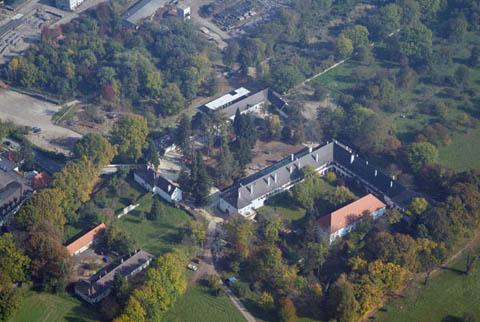
Рорбах-бай-Маттерсбург (Rohrbach bei Mattersburg, Rohrbach bei Mattersburg)
- политическая община в Австрии
 Hiking in Рорбах-бай-Маттерсбург
Rohrbach bei Mattersburg, located in the Burgenland region of Austria, is an appealing destination for hiking enthusiasts. The region is characterized by its picturesque landscapes, rolling hills, vineyards, and forests, making it a great spot for a variety of hiking activities.
Hiking Trails
There are several marked hiking trails in and around Rohrbach, suitable for different fitness levels. Some popular options include:
-
Local Nature Trails: These trails often meander through forests and agricultural land, providing opportunities to experience local flora and fauna.
-
Vineyard Paths: Given the proximity of vineyards, there are trails that offer pleasant walks through wine-growing areas, allowing hikers to enjoy scenic views of the vineyards and surrounding countryside.
-
Historic Routes: Some trails may lead to historical sites or viewpoints, where hikers can learn more about the local culture and history.
Best Practices for Hiking in Rohrbach
- Preparation: Always check the weather before heading out and dress appropriately. Sturdy hiking shoes and layered clothing are recommended.
- Hydration: Bring enough water, especially on warmer days.
- Trail Etiquette: Stay on marked paths, respect wildlife, and follow any local guidelines.
- Navigation: While many trails are well-marked, consider carrying a map or using a hiking app to ensure you stay on track.
Additional Activities
Apart from hiking, the area also offers cycling routes, bird watching, and opportunities to explore local culture through community events and local wineries.
Overall, Rohrbach bei Mattersburg is a charming place for outdoor activities, with a focus on nature and tranquility, perfect for a day hike or longer excursions.
- Страна:

- Почтовый код: 7222
- Телефонный код: 02626
- Код автомобильного номера: MA
- Координаты: 47° 42' 35" N, 16° 25' 38" E


- GPS треки (wikiloc): [Ссылка]
- Высота над уровнем моря: 266 м m
- Площадь: 15.23 кв.км
- Население: 2707
- Веб сайт: http://www.rohrbach-bm.at/
- Википедия русская: wiki(ru)
- Википедия английская: wiki(en)
- Википедия национальная: wiki(de)
- Хранилище Wikidata: Wikidata: Q670828
- Катеория в википедии: [Ссылка]
- код Freebase: [/m/02qnf5s]
- код GeoNames: Альт: [2767283]
- код VIAF: Альт: [248262914]
- код австрийского муниципалитета: [10610]
Граничит с регионами:

Цемендорф-Штёттера
Hiking in Цемендорф-Штёттера
Zemendorf-Stöttera is a small village located in Austria, near the border with Hungary. While it may not be as well-known as some of the larger hiking destinations in the country, it offers opportunities for those looking to explore the scenic landscapes of the region....
- Страна:
- Почтовый код: 7023
- Телефонный код: 02626
- Код автомобильного номера: MA
- Координаты: 47° 45' 56" N, 16° 27' 17" E
- GPS треки (wikiloc): [Ссылка]
- Высота над уровнем моря: 198 м m
- Площадь: 12.83 кв.км
- Население: 1268
- Веб сайт: [Ссылка]

Драсбург
Hiking in Драсбург
Draßburg, located in Austria, is known for its scenic landscapes, making it a great destination for hiking enthusiasts. Nestled near the foothills of the Alps, this area offers various trails that cater to different skill levels, from beginner to advanced hikers....
- Страна:
- Почтовый код: 7021
- Телефонный код: 02686
- Код автомобильного номера: MA
- Координаты: 47° 44' 46" N, 16° 29' 17" E
- GPS треки (wikiloc): [Ссылка]
- Высота над уровнем моря: 223 м m
- Площадь: 9.67 кв.км
- Население: 1199
- Веб сайт: [Ссылка]


Лойперсбах-им-Бургенланд
- община в Австрии
Hiking in Лойперсбах-им-Бургенланд
Loipersbach im Burgenland is a charming area located in Austria, known for its beautiful landscapes and outdoor activities, making it a great destination for hiking enthusiasts. Hiking in this region offers a unique combination of scenic views, diverse terrain, and the opportunity to experience the rich cultural and natural heritage of Burgenland....
- Страна:
- Почтовый код: 7020
- Телефонный код: 02686
- Код автомобильного номера: MA
- Координаты: 47° 41' 45" N, 16° 28' 20" E
- GPS треки (wikiloc): [Ссылка]
- Высота над уровнем моря: 292 м m
- Площадь: 8.54 кв.км
- Население: 1229
- Веб сайт: [Ссылка]

Зигграбен
- политическая община в Австрии
Hiking in Зигграбен
Sieggraben, located in Austria, offers beautiful landscapes and a variety of hiking opportunities. This area is known for its lush greenery, gentle hills, and scenic views typical of the Lower Austria region....
- Страна:
- Почтовый код: 7223
- Телефонный код: 02621
- Код автомобильного номера: MA
- Координаты: 47° 38' 59" N, 16° 22' 50" E
- GPS треки (wikiloc): [Ссылка]
- Высота над уровнем моря: 450 м m
- Площадь: 17.7 кв.км
- Население: 1248
- Веб сайт: [Ссылка]
Лаккенбах
Hiking in Лаккенбах
Lackenbach, located in Austria's Burgenland region, offers a unique mix of natural beauty and outdoor recreational opportunities. The area is characterized by its picturesque landscapes, including forests, rolling hills, and nearby lakes. Here are some key points to consider when hiking in Lackenbach:...
- Страна:
- Почтовый код: 7322
- Телефонный код: 02619
- Код автомобильного номера: OP
- Координаты: 47° 35' 22" N, 16° 27' 46" E
- GPS треки (wikiloc): [Ссылка]
- Высота над уровнем моря: 313 м m
- Площадь: 18.1 кв.км
- Население: 1167
- Веб сайт: [Ссылка]

Шаттендорф
Hiking in Шаттендорф
Schattendorf is a small municipality in Austria, located in the state of Burgenland. While it isn’t a well-known hiking destination, it has the charm of the Austrian countryside and offers opportunities for hiking in nearby areas....
- Страна:
- Почтовый код: 7022
- Телефонный код: 0664
- Код автомобильного номера: MA
- Координаты: 47° 42' 39" N, 16° 30' 38" E
- GPS треки (wikiloc): [Ссылка]
- Высота над уровнем моря: 256 м m
- Площадь: 12.1 кв.км
- Население: 2379
- Веб сайт: [Ссылка]
Марц
Hiking in Марц
Hiking in Marz, Austria, offers a delightful experience especially for those who enjoy picturesque landscapes, rich nature, and the charm of small Austrian towns. Marz is located in the Burgenland region, known for its scenic vineyards, rolling hills, and proximity to the Örség National Park....
- Страна:
- Почтовый код: 7221
- Телефонный код: 0 2626
- Код автомобильного номера: MA
- Координаты: 47° 43' 0" N, 16° 24' 58" E
- GPS треки (wikiloc): [Ссылка]
- Высота над уровнем моря: 252 м m
- Площадь: 17.4 кв.км
- Население: 2073
- Веб сайт: [Ссылка]