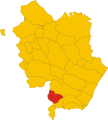
Ротонделла (Rotondella, Rotondella)
.svg)
- коммуна Италии
 Hiking in Ротонделла
Rotondella is a charming town located in the Basilicata region of Italy, known for its beautiful landscapes and rich history. When it comes to hiking in and around Rotondella, there are several aspects to consider:
Scenic Trails
-
Natural Beauty: The area surrounding Rotondella features stunning vistas, rolling hills, and the iconic Mediterranean flora. You can expect a mix of rocky terrains, forests, and panoramic viewpoints.
-
Historical Paths: Some trails may lead you near ancient ruins or historical sites, allowing you to explore the cultural heritage of the region while enjoying a hike.
Popular Hiking Areas
-
Pollino National Park: Located not too far from Rotondella, this national park offers extensive hiking trails through diverse ecosystems, including rugged mountains, rivers, and rare plant species. The park is ideal for various hiking levels, from easy walks to challenging treks.
-
Appennino Lucano: This mountain range offers numerous trails with breathtaking scenery. You can enjoy hiking, along with activities such as birdwatching and photography.
Tips for Hiking in Rotondella
-
Best Time to Hike: The ideal months for hiking are usually from late spring to early fall (May to October), when the weather is pleasant and trails are accessible.
-
Preparation: Always carry enough water, comfortable hiking shoes, a map of the area, and a basic first-aid kit. Cell service may be limited in remote areas, so consider having a physical map.
-
Guided Tours: If you're unfamiliar with the area, consider joining a guided hiking tour. Local guides can provide insights into the natural and cultural significance of the landscapes.
-
Respect Nature: As in any natural area, follow Leave No Trace principles. Stick to marked trails and avoid disturbing wildlife.
Local Culture
After a day of hiking, take the time to explore the town of Rotondella. Experience local cuisine, enjoy regional wines, and connect with the locals to learn more about the culture and history of the area.
With its combination of natural beauty and cultural richness, Rotondella offers an excellent destination for hikers looking to explore Italy's less-traveled paths. Happy hiking!
- Страна:

- Почтовый код: 75026
- Телефонный код: 0835
- Код автомобильного номера: MT
- Координаты: 40° 10' 0" N, 16° 31' 0" E


- GPS треки (wikiloc): [Ссылка]
- Высота над уровнем моря: 576 м m
- Площадь: 76.72 кв.км
- Население: 2592
- Веб сайт: http://www.comune.rotondella.mt.it/
- Википедия русская: wiki(ru)
- Википедия английская: wiki(en)
- Википедия национальная: wiki(it)
- Хранилище Wikidata: Wikidata: Q52329
- Катеория в википедии: [Ссылка]
- код Freebase: [/m/0fgv77]
- код Freebase: [/m/0fgv77]
- код GeoNames: Альт: [6540035]
- код GeoNames: Альт: [6540035]
- ID отношения в OpenStreetMap: [40315]
- ID отношения в OpenStreetMap: [40315]
- код ISTAT: 077023
- код ISTAT: 077023
- кадастровый код Италии: H591
- кадастровый код Италии: H591
Граничит с регионами:

Колобраро
- коммуна Италии
Hiking in Колобраро
Colobraro is a small hilltop village located in the Basilicata region of southern Italy, known for its stunning landscapes, historical charm, and various hiking opportunities. While it may not be as widely recognized as some other hiking destinations in Italy, it offers a unique experience for those looking to explore serene trails and enjoy nature....
- Страна:
- Почтовый код: 75021
- Телефонный код: 0835
- Код автомобильного номера: MT
- Координаты: 40° 11' 0" N, 16° 26' 0" E
- GPS треки (wikiloc): [Ссылка]
- Высота над уровнем моря: 630 м m
- Площадь: 66.61 кв.км
- Население: 1203
- Веб сайт: [Ссылка]


Нова-Сири
- коммуна Италии
Hiking in Нова-Сири
Nova Siri, located in the Basilicata region of Italy, is not only a beautiful coastal town but also offers some fantastic hiking opportunities. The area is rich in natural beauty, featuring mountainous terrain, coastal views, and lush greenery. Here are some aspects of hiking in and around Nova Siri:...
- Страна:
- Почтовый код: 75020
- Телефонный код: 0835
- Код автомобильного номера: MT
- Координаты: 40° 9' 0" N, 16° 32' 0" E
- GPS треки (wikiloc): [Ссылка]
- Высота над уровнем моря: 355 м m
- Площадь: 52.75 кв.км
- Население: 6810
- Веб сайт: [Ссылка]


Поликоро
- коммуна Италии
Hiking in Поликоро
Policoro, located in the Basilicata region of southern Italy, offers a unique mix of natural beauty, history, and Mediterranean landscapes, making it a great spot for hiking enthusiasts. Here are some key points to consider when hiking in and around Policoro:...
- Страна:
- Почтовый код: 75025
- Телефонный код: 0835
- Код автомобильного номера: MT
- Координаты: 40° 12' 0" N, 16° 40' 0" E
- GPS треки (wikiloc): [Ссылка]
- Высота над уровнем моря: 25 м m
- Площадь: 67.66 кв.км
- Население: 17694
- Веб сайт: [Ссылка]


Турси
- коммуна Италии
Hiking in Турси
Tursi is a charming town located in the Basilicata region of Southern Italy, known for its rich history and beautiful landscapes. While it may not be as well-known as some other hiking destinations in Italy, Tursi and its surrounding areas offer some lovely opportunities for outdoor enthusiasts....
- Страна:
- Почтовый код: 75028
- Телефонный код: 0835
- Код автомобильного номера: MT
- Координаты: 40° 15' 0" N, 16° 28' 0" E
- GPS треки (wikiloc): [Ссылка]
- Высота над уровнем моря: 243 м m
- Площадь: 159.93 кв.км
- Население: 4981
- Веб сайт: [Ссылка]
Вальсинни
- коммуна Италии
Hiking in Вальсинни
Valsinni, a charming village in the Basilicata region of southern Italy, offers a unique blend of history and nature, making it an inviting destination for hiking enthusiasts. Here are some key points to consider if you're planning to hike in and around Valsinni:...
- Страна:
- Почтовый код: 75029
- Телефонный код: 0835
- Код автомобильного номера: MT
- Координаты: 40° 10' 0" N, 16° 27' 0" E
- GPS треки (wikiloc): [Ссылка]
- Высота над уровнем моря: 250 м m
- Площадь: 32.22 кв.км
- Население: 1486
- Веб сайт: [Ссылка]