
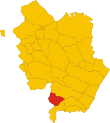
Вальсинни (Valsinni, Valsinni)
.svg)
- коммуна Италии
 Hiking in Вальсинни
Valsinni, a charming village in the Basilicata region of southern Italy, offers a unique blend of history and nature, making it an inviting destination for hiking enthusiasts. Here are some key points to consider if you're planning to hike in and around Valsinni:
Hiking Trails
-
Rural Paths: The hills and countryside surrounding Valsinni feature several rural trails that take you through vineyards, olive groves, and scenic landscapes. Many paths are less traveled, providing a peaceful experience.
-
Historic Routes: Explore paths that lead to historical sites, such as old watchtowers and ruins that provide insight into the area's rich history. The ruins of the castle on the hill provide a rewarding view after a short climb.
-
Cilento National Park: While Valsinni is not directly in the national park, it's relatively close to the Cilento and Vallo di Diano National Park. A day trip can offer more extensive hiking opportunities with diverse ecosystems and stunning vistas.
Features and Attractions
-
Local Flora and Fauna: The area is home to various plant species and wildlife, making it a great spot for nature lovers. Birdwatching can also be rewarding here.
-
Scenic Views: Hikers can enjoy breathtaking views of the Ionian Sea and the surrounding hills. Sunset hikes are particularly popular for panoramic vistas.
-
Cultural Experience: Incorporating local sites into your hike, including churches and traditional architecture, can enhance your experience and give you a deeper understanding of the local culture.
Practical Tips
-
Weather: Check the weather before you go, especially if you're hiking in the summer months, as temperatures can be quite high.
-
Gear: Wear sturdy hiking boots and bring plenty of water, snacks, sunscreen, and a hat, especially for longer hikes.
-
Map and Trail Information: It's wise to have a local map or app, as some trails may not be well-marked. Familiarize yourself with the area beforehand.
-
Local Guidance: Consider joining a guided hiking tour or connecting with local hiking groups to enhance your experience and ensure you explore the best trails.
Valsinni's scenic beauty and historical significance make it a wonderful spot for hiking and experiencing the natural and cultural richness of southern Italy. Enjoy your adventure!
- Страна:

- Почтовый код: 75029
- Телефонный код: 0835
- Код автомобильного номера: MT
- Координаты: 40° 10' 0" N, 16° 27' 0" E


- GPS треки (wikiloc): [Ссылка]
- Высота над уровнем моря: 250 м m
- Площадь: 32.22 кв.км
- Население: 1486
- Веб сайт: http://www.comune.valsinni.mt.it/
- Википедия русская: wiki(ru)
- Википедия английская: wiki(en)
- Википедия национальная: wiki(it)
- Хранилище Wikidata: Wikidata: Q52339
- Катеория в википедии: [Ссылка]
- код Freebase: [/m/0fgv6v]
- код Freebase: [/m/0fgv6v]
- код GeoNames: Альт: [6537654]
- код GeoNames: Альт: [6537654]
- код VIAF: Альт: [168019026]
- код VIAF: Альт: [168019026]
- ID отношения в OpenStreetMap: [40306]
- ID отношения в OpenStreetMap: [40306]
- место в MusicBrainz: [b16701c3-f080-4e7e-842f-a59717f6267d]
- место в MusicBrainz: [b16701c3-f080-4e7e-842f-a59717f6267d]
- код Цифрового атласа Римской империи: [30466]
- код Цифрового атласа Римской империи: [30466]
- код ISTAT: 077030
- код ISTAT: 077030
- кадастровый код Италии: D513
- кадастровый код Италии: D513
Граничит с регионами:

Колобраро
- коммуна Италии
Hiking in Колобраро
Colobraro is a small hilltop village located in the Basilicata region of southern Italy, known for its stunning landscapes, historical charm, and various hiking opportunities. While it may not be as widely recognized as some other hiking destinations in Italy, it offers a unique experience for those looking to explore serene trails and enjoy nature....
- Страна:
- Почтовый код: 75021
- Телефонный код: 0835
- Код автомобильного номера: MT
- Координаты: 40° 11' 0" N, 16° 26' 0" E
- GPS треки (wikiloc): [Ссылка]
- Высота над уровнем моря: 630 м m
- Площадь: 66.61 кв.км
- Население: 1203
- Веб сайт: [Ссылка]


Нова-Сири
- коммуна Италии
Hiking in Нова-Сири
Nova Siri, located in the Basilicata region of Italy, is not only a beautiful coastal town but also offers some fantastic hiking opportunities. The area is rich in natural beauty, featuring mountainous terrain, coastal views, and lush greenery. Here are some aspects of hiking in and around Nova Siri:...
- Страна:
- Почтовый код: 75020
- Телефонный код: 0835
- Код автомобильного номера: MT
- Координаты: 40° 9' 0" N, 16° 32' 0" E
- GPS треки (wikiloc): [Ссылка]
- Высота над уровнем моря: 355 м m
- Площадь: 52.75 кв.км
- Население: 6810
- Веб сайт: [Ссылка]
Ротонделла
- коммуна Италии
Hiking in Ротонделла
Rotondella is a charming town located in the Basilicata region of Italy, known for its beautiful landscapes and rich history. When it comes to hiking in and around Rotondella, there are several aspects to consider:...
- Страна:
- Почтовый код: 75026
- Телефонный код: 0835
- Код автомобильного номера: MT
- Координаты: 40° 10' 0" N, 16° 31' 0" E
- GPS треки (wikiloc): [Ссылка]
- Высота над уровнем моря: 576 м m
- Площадь: 76.72 кв.км
- Население: 2592
- Веб сайт: [Ссылка]
Сан-Джорджо-Лукано
- коммуна Италии
Hiking in Сан-Джорджо-Лукано
San Giorgio Lucano, a charming town in the Basilicata region of Italy, is not only known for its historical architecture and picturesque landscapes but also offers some excellent hiking opportunities. Nestled in the Pollino National Park area, the region is characterized by its rugged terrain, rolling hills, and stunning natural beauty, making it an appealing destination for outdoor enthusiasts....
- Страна:
- Почтовый код: 75027
- Телефонный код: 0835
- Код автомобильного номера: MT
- Координаты: 40° 7' 0" N, 16° 23' 0" E
- GPS треки (wikiloc): [Ссылка]
- Высота над уровнем моря: 416 м m
- Площадь: 39.26 кв.км
- Население: 1157
- Веб сайт: [Ссылка]
Ноеполи
- коммуна Италии
Hiking in Ноеполи
Noepoli is a small town located in the southern part of Italy, specifically in the Basilicata region. While it may not be as widely known for hiking as some other areas in Italy, it does offer opportunities for outdoor enthusiasts looking to explore the natural beauty of the region....
- Страна:
- Почтовый код: 85035
- Телефонный код: 0973
- Код автомобильного номера: PZ
- Координаты: 40° 5' 0" N, 16° 20' 0" E
- GPS треки (wikiloc): [Ссылка]
- Высота над уровнем моря: 676 м m
- Площадь: 46.71 кв.км
- Население: 841
- Веб сайт: [Ссылка]


Нокара
- коммуна Италии
Hiking in Нокара
I'm sorry, but there seems to be some confusion about "Nocara." It may not be a well-known hiking destination, or it could be a misspelling, as I'm not familiar with it based on the available data up to October 2023....
- Страна:
- Почтовый код: 87070
- Телефонный код: 0981
- Код автомобильного номера: CS
- Координаты: 40° 6' 0" N, 16° 29' 0" E
- GPS треки (wikiloc): [Ссылка]
- Высота над уровнем моря: 859 м m
- Площадь: 34.05 кв.км
- Население: 369
- Веб сайт: [Ссылка]