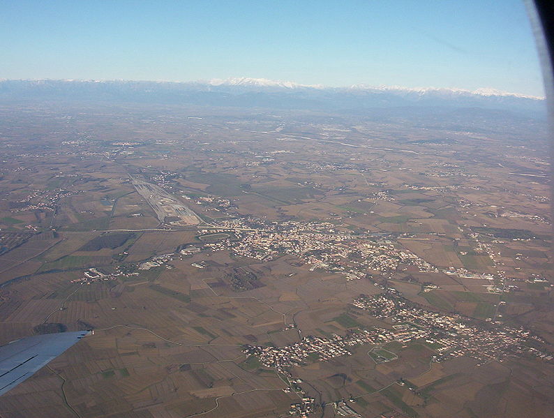
Руда (Ruda, Ruda)
.svg)
- коммуна в Италии
 Hiking in Руда
Ruda, located in the Friuli Venezia Giulia region of Italy, is surrounded by beautiful landscapes and rich natural heritage, making it an excellent area for hiking. Here's an overview of what you can expect when hiking in and around Ruda:
Scenic Trails
-
Varied Terrain: The area features a mix of flat plains, rolling hills, and nearby mountainous terrain. You can find trails that cater to all levels of experience, from easy walks suitable for families to more challenging hikes for seasoned hikers.
-
Natural Beauty: The Friuli region is known for its stunning scenery, including lush forests, vineyards, and views of the Julian Alps. Many trails will give you panoramic views of the surrounding countryside.
-
Wildlife and Flora: While hiking, you might spot various local wildlife, such as deer, birds, and many unique plant species that thrive in the diverse ecosystems of the region.
Popular Hiking Areas
-
Cavin di Ruda: Explore the nearby caves and walk along the trails leading to these fascinating geological formations.
-
Collio Region: This renowned wine-producing area offers beautiful trails that lead through vineyards and charming villages.
-
Julian Alps: A short drive away, you can access more challenging hikes in the Julian Alps, including trails to stunning summits and glacial lakes.
Tips for Hiking in Ruda
- Best Time to Hike: Spring (April to June) and early autumn (September to October) are ideal times for hiking due to mild weather and less crowded trails.
- Local Resources: Check local visitor centers for maps, trail information, and guided tours that you may want to consider.
- Safety: Always carry sufficient water, wear appropriate footwear, and let someone know your hiking plan. If you're venturing into remote areas, consider bringing a map or a GPS device.
Conclusion
Hiking in Ruda offers a mix of natural beauty and cultural experiences. Whether you're looking for a leisurely walk or an adventurous trek, the diverse landscape of Friuli provides something for everyone. Enjoy your hike!
- Страна:

- Почтовый код: 33050
- Телефонный код: 0431
- Код автомобильного номера: UD
- Координаты: 45° 50' 0" N, 13° 24' 0" E


- GPS треки (wikiloc): [Ссылка]
- Высота над уровнем моря: 12 м m
- Площадь: 19.47 кв.км
- Население: 2900
- Веб сайт: http://www.comune.ruda.ud.it
- Википедия русская: wiki(ru)
- Википедия английская: wiki(en)
- Википедия национальная: wiki(it)
- Хранилище Wikidata: Wikidata: Q53348
- Катеория в википедии: [Ссылка]
Граничит с регионами:


Сан-Пьер-д’Изонцо
- коммуна Италии
Hiking in Сан-Пьер-д’Изонцо
San Pier d'Isonzo is a small town in the Friuli Venezia Giulia region of Italy, near the Isonzo River and not far from the border with Slovenia. While it may not be known as a major hiking destination, the surrounding areas offer opportunities for outdoor enthusiasts to explore the lush landscapes, historical sites, and scenic views....
- Страна:
- Почтовый код: 34070
- Телефонный код: 0481
- Код автомобильного номера: GO
- Координаты: 45° 51' 0" N, 13° 28' 0" E
- GPS треки (wikiloc): [Ссылка]
- Высота над уровнем моря: 18 м m
- Площадь: 9.03 кв.км
- Население: 2023
- Веб сайт: [Ссылка]


Турриако
- коммуна Италии
Hiking in Турриако
Turriaco, a small town in the Friuli Venezia Giulia region of Italy, is surrounded by beautiful landscapes that offer various hiking opportunities. While Turriaco itself may not have extensive hiking trails, there are several options nearby that provide a chance to explore the scenic beauty of the region....
- Страна:
- Почтовый код: 34070
- Телефонный код: 0481
- Код автомобильного номера: GO
- Координаты: 45° 49' 0" N, 13° 27' 0" E
- GPS треки (wikiloc): [Ссылка]
- Высота над уровнем моря: 12 м m
- Площадь: 5.18 кв.км
- Население: 2832
- Веб сайт: [Ссылка]
Виллессе
- коммуна Италии
Hiking in Виллессе
Villesse is a small town located in the Friuli Venezia Giulia region of Italy, close to the border with Slovenia. While it may not be as well-known as other hiking destinations, the area around Villesse offers a variety of outdoor activities and potential hiking opportunities....
- Страна:
- Почтовый код: 34070
- Телефонный код: 0481
- Код автомобильного номера: GO
- Координаты: 45° 52' 0" N, 13° 26' 0" E
- GPS треки (wikiloc): [Ссылка]
- Высота над уровнем моря: 18 м m
- Площадь: 12.05 кв.км
- Население: 1698
- Веб сайт: [Ссылка]


Айело дель Фриули-Венеция-Джули
- коммуна Италии
Hiking in Айело дель Фриули-Венеция-Джули
Aiello del Friuli, located in the Friuli Venezia Giulia region of northeastern Italy, offers a unique combination of natural beauty and cultural heritage. While it may not be as widely known for hiking as some other areas in the region, there are still opportunities for outdoor enthusiasts to enjoy the scenic landscapes and charm of the surrounding countryside....
- Страна:
- Почтовый код: 33041
- Телефонный код: 0431
- Код автомобильного номера: UD
- Координаты: 45° 52' 0" N, 13° 22' 0" E
- GPS треки (wikiloc): [Ссылка]
- Высота над уровнем моря: 18 м m
- Площадь: 13.35 кв.км
- Население: 2243
- Веб сайт: [Ссылка]


Камполонго-Тапольяно
- коммуна Италии
Hiking in Камполонго-Тапольяно
Campolongo Tapogliano, located in the Friuli Venezia Giulia region of northeastern Italy, offers a variety of hiking opportunities set against a picturesque backdrop of rolling hills and verdant landscapes. Here are some key points to consider for hiking in this area:...
- Страна:
- Почтовый код: 33040
- Телефонный код: 0431
- Код автомобильного номера: UD
- Координаты: 45° 52' 0" N, 13° 23' 0" E
- GPS треки (wikiloc): [Ссылка]
- Высота над уровнем моря: 16 м m
- Площадь: 11.02 кв.км
- Население: 1155
- Веб сайт: [Ссылка]

Червиньяно-дель-Фриули
- коммуна Италии
Hiking in Червиньяно-дель-Фриули
Cervignano del Friuli, located in the Friuli Venezia Giulia region of northeastern Italy, offers a range of hiking opportunities characterized by its picturesque landscapes, rich history, and proximity to both natural and cultural attractions....
- Страна:
- Почтовый код: 33050; 33052
- Телефонный код: 0431
- Код автомобильного номера: UD
- Координаты: 45° 49' 23" N, 13° 20' 6" E
- GPS треки (wikiloc): [Ссылка]
- Высота над уровнем моря: 2 м m
- Площадь: 29.17 кв.км
- Население: 13881
- Веб сайт: [Ссылка]