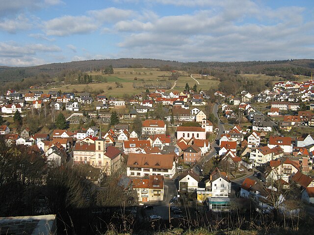
Ruppertshüttener Forst (Ruppertshüttener Forst)

 Hiking in Ruppertshüttener Forst
Ruppertshüttener Forst, located in Germany, is a beautiful area for hiking enthusiasts. The forest is part of a larger network of natural landscapes, providing a range of trails suited for different skill levels, from leisurely walks to more challenging hikes.
Hiking Features:
-
Scenic Trails: The area is known for its well-marked trails that wind through dense forests, along streams, and up gentle hills. The scenery in Ruppertshüttener Forst showcases the natural beauty of the region, with opportunities to see local wildlife and a variety of flora.
-
Trail Difficulty: Most trails are moderate, making them suitable for both beginners and experienced hikers. Be sure to check local maps or park signage for trail ratings and detailed descriptions.
-
Length of Hikes: You can find trails of varying lengths. Some may just be a few kilometers, perfect for a short day hike, while others can take several hours to complete. Plan according to your stamina and time available.
-
Accessibility: The forest is generally accessible, with trailheads located near parking areas. However, it's always advisable to check current conditions and accessibility prior to your visit, especially in winter or after heavy rain.
-
Additional Activities: Besides hiking, the area may offer opportunities for birdwatching, photography, or picnicking. If you're visiting in the autumn, the foliage can be breathtaking.
Safety Tips:
- Stay on Marked Trails: To preserve the natural habitat and ensure your safety, stick to marked paths.
- Weather Preparedness: Check the weather before your hike and dress in layers, as forest trails can be cooler and wetter than expected.
- Hydration and Snacks: Bring enough water and snacks to keep your energy levels up during your hike.
- Map and Navigation: Consider carrying a map or a GPS device, especially if you plan to hike longer or more remote trails.
Conclusion:
Ruppertshüttener Forst offers a peaceful escape into nature, making it an excellent destination for both casual walkers and dedicated hikers. With the right preparation, you can enjoy a rewarding experience among the trees!
- Страна:

- Координаты: 50° 5' 15" N, 9° 33' 49" E


- GPS треки (wikiloc): [Ссылка]
- Хранилище Wikidata: Wikidata: Q2176667
- Катеория в википедии: [Ссылка]
- ID отношения в OpenStreetMap: [2604371]
Граничит с регионами:
Партенштайн
Hiking in Партенштайн
Partenstein is a charming village located in Bavaria, Germany, and it offers some beautiful hiking opportunities for outdoor enthusiasts. Nestled in a picturesque landscape with rolling hills, forests, and streams, the area is perfect for both leisurely walks and more challenging hikes....
- Страна:
- Почтовый код: 97846
- Телефонный код: 09355
- Код автомобильного номера: MSP
- Координаты: 50° 3' 0" N, 9° 31' 0" E
- GPS треки (wikiloc): [Ссылка]
- Высота над уровнем моря: 194 м m
- Площадь: 10.47 кв.км
- Население: 2883
- Веб сайт: [Ссылка]

Лор-на-Майне
Hiking in Лор-на-Майне
Lohr am Main, located in Bavaria, Germany, is a picturesque town that offers beautiful hiking opportunities amid stunning landscapes. The area surrounding Lohr is characterized by its scenic views of the Main River, lush forests, and rolling hills. Here are some highlights for hiking in and around Lohr am Main:...
- Страна:
- Почтовый код: 97816
- Телефонный код: 09352
- Код автомобильного номера: MSP
- Координаты: 49° 59' 37" N, 9° 34' 42" E
- GPS треки (wikiloc): [Ссылка]
- Высота над уровнем моря: 167 м m
- Площадь: 90.44 кв.км
- Население: 15719
- Веб сайт: [Ссылка]

Гемюнден-на-Майне
Hiking in Гемюнден-на-Майне
Gemünden am Main, located in Bavaria, Germany, is surrounded by scenic landscapes, making it a great destination for hiking enthusiasts. Here are some highlights and tips about hiking in this area:...
- Страна:
- Почтовый код: 97737
- Телефонный код: 09351
- Координаты: 50° 2' 59" N, 9° 42' 20" E
- GPS треки (wikiloc): [Ссылка]
- Высота над уровнем моря: 160 м m
- Площадь: 75.09 кв.км
- Население: 10050
- Веб сайт: [Ссылка]