
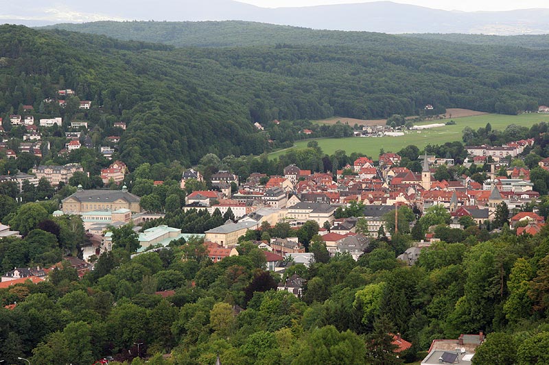
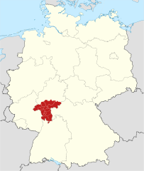
Нижняя Франкония (Lower Franconia, Unterfranken)


- административный округ Баварии
 Hiking in Нижняя Франкония
Lower Franconia, located in the northern part of Bavaria, Germany, is a great destination for hiking enthusiasts. This region is known for its diverse landscapes that range from rolling hills to picturesque vineyards and nature reserves, offering a variety of trails suitable for different skill levels.
Key Highlights for Hiking in Lower Franconia:
-
Scenic Trails:
- The Franconian Wine Trail offers routes through vineyards and charming villages, perfect for leisurely hikes and enjoying local wine.
- The Nature Park Franconian Switzerland is nearby, featuring limestone formations, towering cliffs, and impressive cave systems.
-
Historical Sites:
- Many trails pass by historical landmarks and castles, such as the Marienberg Fortress in Würzburg. These can provide interesting stopping points to learn about the region's history.
-
Diverse Ecosystems:
- Hikers can explore unique landscapes including the Spessart Forest, which is rich in flora and fauna, and offers trails for nature lovers and bird watchers.
-
Family-Friendly Options:
- There are numerous easy walking paths and circular trails that are suitable for families, ensuring that hikers of all ages can appreciate the beauty of the region.
-
Best Time to Hike:
- The best months for hiking are typically from late spring to early autumn (May to October) when the weather is mild and conducive to outdoor activities.
-
Trail Markings and Maps:
- Most trails are well-marked, but it is advisable to have a good map and possibly a guidebook. Local tourism offices often provide useful information and resources.
-
Local Cuisine:
- Don't miss the opportunity to enjoy local Franconian cuisine after a long hike. There are many wine taverns and restaurants in the area where you can savor regional specialties.
Safety Tips:
- Always check the weather before heading out.
- Wear suitable hiking footwear and carry enough water and snacks.
- Inform someone of your plans if you're going on longer hikes.
- Be respectful of nature and follow local guidelines to help preserve the environment.
Lower Franconia offers a wonderful blend of nature, culture, and recreation, making it an ideal hiking destination. Enjoy your adventure!
- Страна:

- Столица: Вюрцбург
- Координаты: 50° 1' 28" N, 9° 55' 55" E


- GPS треки (wikiloc): [Ссылка]
- Высота над уровнем моря: 289 м m
- Площадь: 8530.99 кв.км
- Население: 1298849
- Веб сайт: http://www.unterfranken.de
- Википедия русская: wiki(ru)
- Википедия английская: wiki(en)
- Википедия национальная: wiki(de)
- Хранилище Wikidata: Wikidata: Q10547
- Катеория в википедии: [Ссылка]
- Карты в википедии: [Ссылка]
- код GeoNames: Альт: [2819564]
- код BNF: [11931486c]
- код VIAF: Альт: [137143360]
- ID отношения в OpenStreetMap: [17585]
- код GND: Альт: [4061905-9]
- код LCNAF: Альт: [n81074047]
- Bavarikon ID: [ODB_A00000224]
- код ISNI: Альт: [0000 0004 0410 9310]
- код NUTS: [DE26]
- идентификатор Ringgold: [124853]
- код региона Германии: 096
Включает регионы:

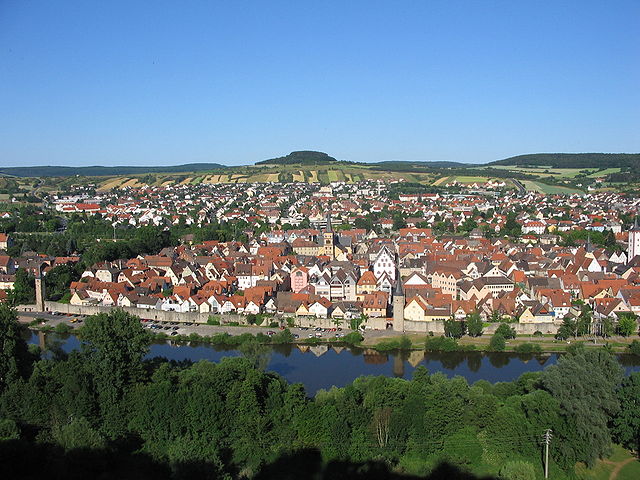
Вюрцбург
Hiking in Вюрцбург
Würzburg, located in the Lower Franconia region of Bavaria, Germany, is surrounded by beautiful landscapes, making it a great starting point for hiking adventures. Here are some highlights and considerations for hiking in and around the Würzburg district:...
- Страна:
- Столица: Вюрцбург
- Код автомобильного номера: OCH; WÜ
- Координаты: 49° 39' 36" N, 10° 0' 0" E
- GPS треки (wikiloc): [Ссылка]
- Высота над уровнем моря: 346 м m
- Площадь: 967.56 кв.км
- Население: 161340
- Веб сайт: [Ссылка]

Китцинген
Hiking in Китцинген
Kitzingen district, located in Bavaria, Germany, offers a variety of scenic landscapes suitable for hiking. The region is characterized by vineyards, rolling hills, and charming riverside paths along the Main River. Here are some highlights for hiking in Kitzingen district:...
- Страна:
- Столица: Китцинген
- Код автомобильного номера: KT
- Координаты: 49° 45' 0" N, 10° 15' 36" E
- GPS треки (wikiloc): [Ссылка]
- Высота над уровнем моря: 231 м m
- Площадь: 684.00 кв.км
- Население: 79304
- Веб сайт: [Ссылка]

Швайнфурт
Hiking in Швайнфурт
Schweinfurt, located in the northern part of Bavaria, Germany, offers a variety of hiking opportunities that showcase the beautiful landscapes of the region. The area is characterized by rolling hills, forests, and scenic valleys, making it ideal for both leisurely strolls and more challenging hikes....
- Страна:
- Столица: Швайнфурт
- Код автомобильного номера: GEO; SW
- Координаты: 50° 1' 12" N, 10° 15' 36" E
- GPS треки (wikiloc): [Ссылка]
- Высота над уровнем моря: 222 м m
- Площадь: 842.00 кв.км
- Население: 103697
- Веб сайт: [Ссылка]

Хасберге
- Район в Германии. Центр района — город Хасфурт.
Hiking in Хасберге
The Haßberge district, located in the northern part of Bavaria, Germany, is known for its beautiful landscapes, rolling hills, dense forests, and quaint villages, making it an excellent destination for hiking enthusiasts. Here are some key points about hiking in the Haßberge district:...
- Страна:
- Столица: Хасфурт
- Код автомобильного номера: HAS
- Координаты: 50° 4' 48" N, 10° 40' 12" E
- GPS треки (wikiloc): [Ссылка]
- Высота над уровнем моря: 368 м m
- Площадь: 956.00 кв.км
- Население: 80257
- Веб сайт: [Ссылка]

Рён-Грабфельд
Hiking in Рён-Грабфельд
Rhön-Grabfeld is a picturesque region located in Bavaria, Germany, renowned for its scenic landscapes, rolling hills, and rich natural beauty. It comprises part of the UNESCO Biosphere Reserve Rhön, which is characterized by its unique geology, biodiversity, and well-maintained hiking trails....
- Страна:
- Столица: Бад-Нойштадт-ан-дер-Зале
- Код автомобильного номера: MET; KÖN; NES
- Координаты: 50° 19' 48" N, 10° 15' 0" E
- GPS треки (wikiloc): [Ссылка]
- Высота над уровнем моря: 320 м m
- Площадь: 1022.00 кв.км
- Население: 77197
- Веб сайт: [Ссылка]
Бад-Киссинген
Hiking in Бад-Киссинген
Bad Kissingen, located in Bavaria, Germany, is a beautiful spa town known for its healing mineral waters and lovely natural surroundings. The area's scenic landscapes make it an excellent destination for hiking enthusiasts. Here are some key points about hiking in Bad Kissingen:...
- Страна:
- Столица: Бад-Киссинген
- Код автомобильного номера: HAB; BRK; KG
- Координаты: 50° 15' 0" N, 10° 0' 0" E
- GPS треки (wikiloc): [Ссылка]
- Высота над уровнем моря: 330 м m
- Площадь: 1137.00 кв.км
- Население: 99022
- Веб сайт: [Ссылка]
Майн-Шпессарт
Hiking in Майн-Шпессарт
Main-Spessart is a beautiful region located in Bavaria, Germany, known for its scenic landscapes, charming villages, and rich cultural heritage. It's a fantastic destination for hiking enthusiasts, offering a variety of trails that cater to different skill levels. Here’s what you can expect when hiking in Main-Spessart:...
- Страна:
- Столица: Карлштадт
- Код автомобильного номера: MSP
- Координаты: 49° 55' 12" N, 9° 45' 0" E
- GPS треки (wikiloc): [Ссылка]
- Высота над уровнем моря: 313 м m
- Площадь: 1321.4186 кв.км
- Население: 125915
- Веб сайт: [Ссылка]


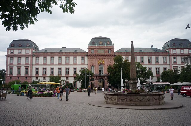
Ашаффенбург
Hiking in Ашаффенбург
Aschaffenburg, located in Bavaria, Germany, is known for its beautiful landscapes and proximity to the Spessart mountain range, making it a great destination for hiking enthusiasts. The region offers a mix of nature, historic sites, and charming villages, providing a variety of hiking experiences....
- Страна:
- Столица: Ашаффенбург
- Код автомобильного номера: ALZ; AB
- Координаты: 50° 4' 48" N, 9° 10' 12" E
- GPS треки (wikiloc): [Ссылка]
- Высота над уровнем моря: 246 м m
- Площадь: 699.00 кв.км
- Население: 152367


Мильтенберг
Hiking in Мильтенберг
Miltenberg, located in the Bavaria region of Germany, is a charming town nestled along the Main River and surrounded by picturesque landscapes, making it an excellent destination for hiking enthusiasts. Here are some highlights about hiking in the Miltenberg district:...
- Страна:
- Столица: Мильтенберг
- Код автомобильного номера: MIL
- Координаты: 49° 45' 0" N, 9° 15' 0" E
- GPS треки (wikiloc): [Ссылка]
- Высота над уровнем моря: 224 м m
- Площадь: 716.00 кв.км
- Население: 114255
- Веб сайт: [Ссылка]
Вюрцбург
- город в Германии
Hiking in Вюрцбург
Würzburg, located in Bavaria, Germany, offers a blend of urban exploration and access to beautiful hiking trails in the surrounding regions. Here are some highlights for hikers interested in this area:...
- Страна:
- Почтовый код: 97084; 97082; 97080; 97078; 97076; 97074; 97072; 97070
- Телефонный код: 0931
- Код автомобильного номера: WÜ
- Координаты: 49° 47' 40" N, 9° 55' 46" E
- GPS треки (wikiloc): [Ссылка]
- Высота над уровнем моря: 177 м m
- Площадь: 87.6 кв.км
- Население: 126010
- Веб сайт: [Ссылка]
Ашаффенбург
- город в Германии
Hiking in Ашаффенбург
Aschaffenburg is a charming town located in Bavaria, Germany, and is surrounded by beautiful landscapes that offer great opportunities for hiking. The region is characterized by its mix of cultural heritage and natural beauty, making it an ideal destination for outdoor enthusiasts....
- Страна:
- Почтовый код: 63739–63743
- Телефонный код: 06021
- Код автомобильного номера: AB
- Координаты: 49° 58' 0" N, 9° 9' 0" E
- GPS треки (wikiloc): [Ссылка]
- Высота над уровнем моря: 138 м m
- Площадь: 62.57 кв.км
- Население: 68986
- Веб сайт: [Ссылка]
Швайнфурт
- город в Германии
Hiking in Швайнфурт
Schweinfurt, located in southern Germany, is not only known for its historical significance but also for its beautiful natural landscapes, making it a great destination for hiking enthusiasts. Here are some aspects to consider when hiking in this region:...
- Страна:
- Почтовый код: 97422; 97423; 97424; 97421
- Телефонный код: 09721
- Код автомобильного номера: SW
- Координаты: 50° 3' 0" N, 10° 14' 0" E
- GPS треки (wikiloc): [Ссылка]
- Высота над уровнем моря: 226 м m
- Площадь: 35.71 кв.км
- Население: 51969
- Веб сайт: [Ссылка]
Граничит с регионами:


Средняя Франкония
- административный округ Баварии
Hiking in Средняя Франкония
Middle Franconia, located in Bavaria, Germany, is a picturesque region known for its diverse landscapes, charming villages, and rich cultural heritage. It offers a variety of hiking opportunities suitable for all levels of experience. Here are some highlights regarding hiking in this area:...
- Страна:
- Столица: Ансбах
- Координаты: 49° 18' 0" N, 10° 35' 0" E
- GPS треки (wikiloc): [Ссылка]
- Высота над уровнем моря: 401 м m
- Площадь: 7245.70 кв.км
- Население: 1750059
- Веб сайт: [Ссылка]


Верхняя Франкония
- административный округ Баварии
Hiking in Верхняя Франкония
Upper Franconia, located in northern Bavaria, Germany, is a lesser-known but stunning hiking destination characterized by its diverse landscapes, charming villages, and rich cultural heritage. Here are some highlights and tips for hiking in the region:...
- Страна:
- Столица: Байройт
- Координаты: 49° 57' 0" N, 11° 35' 0" E
- GPS треки (wikiloc): [Ссылка]
- Высота над уровнем моря: 368 м m
- Площадь: 7230.19 кв.км
- Население: 1062398
- Веб сайт: [Ссылка]


Тюрингия
- федеральная земля Германии
Hiking in Тюрингия
Thuringia, located in central Germany, is an excellent destination for hiking enthusiasts. Known for its diverse landscapes, lush forests, historical sites, and picturesque villages, Thuringia offers numerous trails that cater to different skill levels and interests. Here are some highlights and tips for hiking in the region:...
- Страна:
- Столица: Эрфурт
- Координаты: 50° 51' 40" N, 11° 3' 7" E
- GPS треки (wikiloc): [Ссылка]
- Высота над уровнем моря: 266 м m
- Площадь: 16171.0 кв.км
- Население: 2161000
- Веб сайт: [Ссылка]


Кассель
- административный округ в земле Гессен, Германия
Hiking in Кассель
Kassel is a beautiful region in Germany known for its picturesque landscapes, rich history, and ample opportunities for hiking. Located in the heart of Germany, Kassel offers access to various trails that range from easy walks to more challenging hikes, all set against the backdrop of the lush natural beauty of the surrounding hills and forests....
- Страна:
- Столица: Кассель
- Координаты: 51° 10' 12" N, 9° 25' 12" E
- GPS треки (wikiloc): [Ссылка]
- Высота над уровнем моря: 312 м m
- Площадь: 8288.7 кв.км
- Население: 1220000
- Веб сайт: [Ссылка]
Дармштадт
- административный округ земли Гессен в Германии
Hiking in Дармштадт
Darmstadt, located in the southern part of Hesse, Germany, offers various hiking opportunities that cater to different skill levels and preferences. The surrounding region is characterized by beautiful landscapes, including forests, hills, and scenic views, making it an excellent destination for outdoor enthusiasts....
- Страна:
- Столица: Дармштадт
- Координаты: 50° 4' 48" N, 8° 45' 0" E
- GPS треки (wikiloc): [Ссылка]
- Высота над уровнем моря: 179 м m
- Площадь: 7444.88 кв.км
- Веб сайт: [Ссылка]


Административный округ Карлсруэ
- административная единица в Баден-Вюртемберге, Германия
Hiking in Административный округ Карлсруэ
Karlsruhe, located in the southwest of Germany, is a great base for hiking enthusiasts. The region offers a mix of urban and natural landscapes, with easy access to nearby hills and forests. Here are some key highlights for hiking in the Karlsruhe area:...
- Страна:
- Столица: Карлсруэ
- Координаты: 49° 0' 0" N, 8° 30' 0" E
- GPS треки (wikiloc): [Ссылка]
- Высота над уровнем моря: 120 м m
- Площадь: 6919 кв.км
- Веб сайт: [Ссылка]

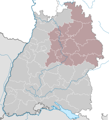
административный округ Штутгарт
- административный округ Баден-Вюртемберга (Германия)
Hiking in административный округ Штутгарт
Stuttgart, located in the southwestern region of Germany, is surrounded by beautiful natural landscapes that offer a variety of hiking opportunities. The region is characterized by its rolling hills, vineyards, and dense forests, making it an ideal spot for outdoor enthusiasts. Here are some highlights of hiking in the Stuttgart region:...
- Страна:
- Столица: Штутгарт
- Координаты: 49° 0' 0" N, 9° 40' 12" E
- GPS треки (wikiloc): [Ссылка]
- Высота над уровнем моря: 365 м m
- Площадь: 10558 кв.км
- Веб сайт: [Ссылка]