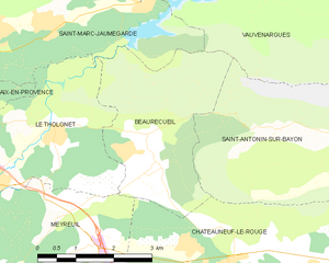
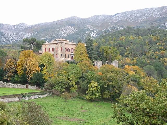
Сент-Антонен-сюр-Байон (Saint-Antonin-sur-Bayon, Saint-Antonin-sur-Bayon)

- коммуна во Франции
 Hiking in Сент-Антонен-сюр-Байон
Saint-Antonin-sur-Bayon, located in the Provence-Alpes-Côte d'Azur region of France, is surrounded by stunning natural landscapes, making it an ideal destination for hiking enthusiasts. Here are some highlights and tips for hiking in this beautiful area:
Scenic Trails
-
Local Trails: There are several well-marked trails in and around Saint-Antonin-sur-Bayon, offering different levels of difficulty. You can find paths that wind through picturesque villages, vineyards, and forests.
-
Cascades de Salles: A popular hike that can be accessed from near the village. The trail leads you to stunning waterfalls and provides opportunities to enjoy the local flora and fauna.
-
Montagne Sainte-Victoire: A bit further afield, the iconic Montagne Sainte-Victoire is a well-known hiking destination. It's a protected natural area with various trails that range from easy to challenging, providing stunning panoramic views of the landscape.
Hiking Tips
- Respect Nature: Stay on marked paths to minimize environmental impact and ensure your safety.
- Weather Preparedness: Check the weather forecast before you set out. The region can experience rapid weather changes.
- Hydration and Snacks: Carry enough water and snacks, especially if you're planning to hike for several hours.
- Local Guides: Consider hiring a local guide if you're unfamiliar with the area. They can enhance your experience with insights on the local history, flora, and fauna.
Best Time to Hike
- Spring (April to June): This is a wonderful time to hike in the Provence region, as the temperatures are mild, and the countryside is bursting with wildflowers.
- Autumn (September to November): Another great season for hiking, with cooler temperatures and beautiful autumn foliage.
Conclusion
Whether you're looking for a leisurely stroll or a challenging trek, hiking in and around Saint-Antonin-sur-Bayon offers something for every nature lover. Ensure to plan your hike according to your fitness level and always take the necessary precautions. Enjoy the breathtaking beauty of the natural surroundings!
- Страна:

- Почтовый код: 13100
- Координаты: 43° 31' 6" N, 5° 34' 58" E


- GPS треки (wikiloc): [Ссылка]
- Площадь: 17.57 кв.км
- Население: 124
- Веб сайт: http://st-antonin-sur-bayon.fr
- Википедия русская: wiki(ru)
- Википедия английская: wiki(en)
- Википедия национальная: wiki(fr)
- Хранилище Wikidata: Wikidata: Q640691
- Катеория в википедии: [Ссылка]
- код Freebase: [/m/02rpcg1]
- код GeoNames: Альт: [2981659]
- номер SIREN: [211300900]
- код BNF: [15247372d]
- код VIAF: Альт: [241217240]
- код GND: Альт: [4616966-0]
- код тезауруса PACTOLS: [pcrtGlIMapo745]
- код муниципалитета INSEE: 13090
Граничит с регионами:

Борекёй
- коммуна во Франции
Hiking in Борекёй
Beaurecueil is a charming village located near Aix-en-Provence in the Provence-Alpes-Côte d'Azur region of southern France. It offers several hiking opportunities, surrounded by beautiful natural landscapes that include rolling hills, forests, and panoramic views of the Sainte-Victoire Mountain, which is renowned for its striking beauty and significance in the works of painter Paul Cézanne....
- Страна:
- Почтовый код: 13100
- Координаты: 43° 30' 38" N, 5° 32' 40" E
- GPS треки (wikiloc): [Ссылка]
- Площадь: 9.86 кв.км
- Население: 578

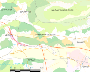
Шатонёф-ле-Руж
- коммуна во Франции
Hiking in Шатонёф-ле-Руж
Châteauneuf-le-Rouge, located in the Provence-Alpes-Côte d'Azur region of France, offers some beautiful hiking opportunities characterized by its picturesque landscapes, Mediterranean climate, and natural beauty. Here are some aspects to consider when hiking in and around Châteauneuf-le-Rouge:...
- Страна:
- Почтовый код: 13790
- Координаты: 43° 29' 23" N, 5° 34' 11" E
- GPS треки (wikiloc): [Ссылка]
- Высота над уровнем моря: 345.0 м m
- Площадь: 13.15 кв.км
- Население: 2172
- Веб сайт: [Ссылка]

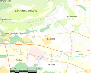
Руссе
- коммуна во Франции
Hiking in Руссе
Rousset, located in the Bouches-du-Rhône department of southern France, is a beautiful area that offers a variety of hiking opportunities, thanks to its stunning landscapes and proximity to the Sainte-Victoire Mountain. Here are some highlights for hiking in Rousset:...
- Страна:
- Почтовый код: 13790
- Координаты: 43° 28' 56" N, 5° 37' 20" E
- GPS треки (wikiloc): [Ссылка]
- Высота над уровнем моря: 224 м m
- Площадь: 19.5 кв.км
- Население: 4768
- Веб сайт: [Ссылка]

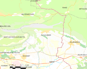
Пюилубье
- коммуна во Франции
Hiking in Пюилубье
Puyloubier is a charming commune located in the Provence-Alpes-Côte d'Azur region of southern France, nestled at the foot of the Sainte-Victoire Mountain. Known for its beautiful landscapes and diverse ecosystems, it offers a variety of hiking opportunities for both novice and experienced hikers....
- Страна:
- Почтовый код: 13114
- Координаты: 43° 31' 30" N, 5° 40' 37" E
- GPS треки (wikiloc): [Ссылка]
- Площадь: 40.85 кв.км
- Население: 1799
- Веб сайт: [Ссылка]

Вовнарг
- коммуна во Франции
Hiking in Вовнарг
Vauvenargues, located in the Bouches-du-Rhône department in Provence, France, is a picturesque destination for hiking enthusiasts. Nestled at the foot of the iconic Mont Sainte-Victoire, this area offers stunning landscapes, diverse flora and fauna, and a variety of hiking trails suitable for all levels....
- Страна:
- Почтовый код: 13126
- Координаты: 43° 33' 19" N, 5° 36' 10" E
- GPS треки (wikiloc): [Ссылка]
- Площадь: 54.31 кв.км
- Население: 1023