.jpg)
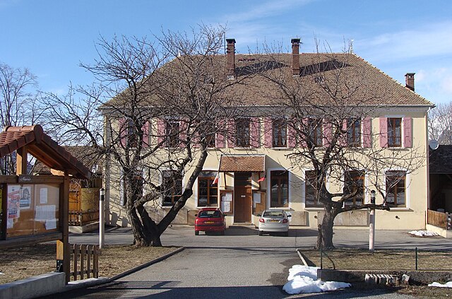
Сен-Бонне-ан-Шансор (Saint-Bonnet-en-Champsaur, Saint-Bonnet-en-Champsaur)
- коммуна во Франции
 Hiking in Сен-Бонне-ан-Шансор
Saint-Bonnet-en-Champsaur, located in the Hautes-Alpes region of southeastern France, is a picturesque area that offers a variety of hiking opportunities. The region is known for its stunning alpine scenery, including mountains, rivers, and lush forests, making it a fantastic destination for outdoor enthusiasts.
Key Features of Hiking in Saint-Bonnet-en-Champsaur:
-
Diverse Trails: The area has a range of hiking trails that cater to different skill levels, from easy walks suitable for families to more challenging hikes for seasoned trekkers.
-
Scenic Landscapes: Hikers can enjoy breathtaking views of the surrounding mountains, valleys, and possibly spot local wildlife. The Champsaur valley is particularly beautiful and provides a peaceful environment.
-
Access to the Ecrins National Park: Saint-Bonnet-en-Champsaur serves as a gateway to the Ecrins National Park, which is known for its rugged landscapes and extensive network of hiking trails. This allows hikers to explore higher altitudes and more diverse ecosystems.
-
Local Flora and Fauna: The area boasts rich biodiversity, including unique alpine flora and various animal species, making it an appealing spot for nature lovers.
-
Cultural Heritage: While hiking, you may encounter traditional Alpine villages and historical sites that reflect the cultural heritage of the region.
-
Seasonal Considerations: Depending on the season, the difficulty and accessibility of trails may change. Winter hiking and snowshoeing are options when snow covers the trails, while summer offers lush greenery and wildflowers.
-
Preparation and Safety: As with any hiking adventure, it's important to prepare adequately. Check weather conditions, carry sufficient water and food, wear appropriate footwear, and consider having a map or GPS device.
Popular Hiking Routes:
- Col de Pélvoux: A beautiful hike that offers panoramic views of the surrounding peaks; it's recommended for intermediate hikers.
- Sentier des Bans: This trail leads to striking glacial scenery and is a great option for those looking to explore the natural beauty of the area.
- Lac du Puy: An easier, family-friendly hike that leads to a serene mountain lake.
Tips for Hikers:
- Start Early: Begin your hikes early in the day to avoid crowds and make the most of daylight hours.
- Stay Hydrated: Always carry enough water and snacks to keep your energy up.
- Dress in Layers: Weather in the mountains can change rapidly, so dressing in layers is key for comfort.
- Follow the Trail Marks: Ensure that you stick to marked trails for safety.
In conclusion, hiking in Saint-Bonnet-en-Champsaur offers an enriching experience immersed in nature, ideal for those looking to explore the beauty of the French Alps. Enjoy your hikes and always prioritize safety!
- Страна:

- Почтовый код: 05500
- Координаты: 44° 40' 55" N, 6° 4' 35" E


- GPS треки (wikiloc): [Ссылка]
- Высота над уровнем моря: 1040 м m
- Площадь: 15.01 кв.км
- Население: 2047
- Веб сайт: http://www.mairie-saint-bonnet.net/
- Википедия русская: wiki(ru)
- Хранилище Wikidata: Wikidata: Q1020792
- Катеория в википедии: [Ссылка]
- код Freebase: [/m/03mfp8v]
- код Freebase: [/m/03mfp8v]
- код GeoNames: Альт: [2981355]
- код GeoNames: Альт: [2981355]
- код BNF: [15512434t]
- код BNF: [15512434t]
- код муниципалитета INSEE: 05132
- код муниципалитета INSEE: 05132
Граничит с регионами:

Беневан-э-Шарбийак
- коммуна во Франции
Hiking in Беневан-э-Шарбийак
Bénévent-et-Charbillac is a charming commune in the Drôme department of southeastern France, nestled in the beautiful landscape of the Vercors Massif. This region offers various opportunities for hiking enthusiasts, with trails that cater to different skill levels and preferences....
- Страна:
- Почтовый код: 05500
- Координаты: 44° 41' 54" N, 6° 5' 12" E
- GPS треки (wikiloc): [Ссылка]
- Высота над уровнем моря: 1120 м m
- Население: 274

Сен-Мишель-де-Шайоль
- коммуна во Франции
Hiking in Сен-Мишель-де-Шайоль
Saint-Michel-de-Chaillol is a charming village located in the French Alps, specifically in the Hautes-Alpes department of southeastern France. The area is known for its breathtaking landscapes, making it a wonderful destination for hiking enthusiasts....
- Страна:
- Почтовый код: 05260
- Координаты: 44° 40' 56" N, 6° 10' 3" E
- GPS треки (wikiloc): [Ссылка]
- Площадь: 16.78 кв.км
- Население: 315
Сент-Эзеб-ан-Шансор
- коммуна во Франции
Hiking in Сент-Эзеб-ан-Шансор
Saint-Eusèbe-en-Champsaur is a picturesque village located in the French Alps, in the Champsaur valley. It offers a variety of hiking opportunities for both novice and experienced hikers. Here are some highlights of hiking in this area:...
- Страна:
- Почтовый код: 05500
- Координаты: 44° 43' 33" N, 6° 1' 39" E
- GPS треки (wikiloc): [Ссылка]
- Площадь: 7.83 кв.км
- Население: 150

Сен-Лоран-дю-Кро
- коммуна во Франции
Hiking in Сен-Лоран-дю-Кро
Saint-Laurent-du-Cros is a charming village located in the Hautes-Alpes region of France. It’s an excellent base for outdoor enthusiasts, especially hikers, given its proximity to the Écrins National Park and the stunning landscapes of the Southern Alps....
- Страна:
- Почтовый код: 05500
- Координаты: 44° 38' 38" N, 6° 6' 39" E
- GPS треки (wikiloc): [Ссылка]
- Площадь: 12.69 кв.км
- Население: 520

Ла-Мот-ан-Шансор
- коммуна во Франции
Hiking in Ла-Мот-ан-Шансор
La Motte-en-Champsaur is a charming village located in the French Alps, known for its stunning natural scenery and a variety of hiking opportunities. The region offers a mix of landscapes, including alpine meadows, dense forests, and panoramic mountain views, making it an excellent destination for both novice and experienced hikers....
- Страна:
- Почтовый код: 05500
- Координаты: 44° 43' 57" N, 6° 4' 5" E
- GPS треки (wikiloc): [Ссылка]
- Площадь: 52.8 кв.км
- Население: 215
- Веб сайт: [Ссылка]

Сен-Жюльен-ан-Шансор
- коммуна во Франции
Hiking in Сен-Жюльен-ан-Шансор
Saint-Julien-en-Champsaur, located in the French Alps, is a beautiful destination for hiking enthusiasts. The area offers a variety of trails that cater to different skill levels, from easy walks to challenging hikes. The stunning landscapes, including mountains, valleys, and forests, provide a picturesque backdrop for outdoor activities....
- Страна:
- Почтовый код: 05500
- Координаты: 44° 39' 33" N, 6° 7' 42" E
- GPS треки (wikiloc): [Ссылка]
- Площадь: 10.04 кв.км
- Население: 357

Ла-Фар-ан-Шансор
- коммуна во Франции
Hiking in Ла-Фар-ан-Шансор
La Fare-en-Champsaur is a picturesque village located in the French Alps, within the Hautes-Alpes department of the Provence-Alpes-Côte d'Azur region. It is an excellent base for hiking enthusiasts, offering a variety of trails that cater to different skill levels and preferences....
- Страна:
- Почтовый код: 05500
- Координаты: 44° 40' 32" N, 6° 4' 19" E
- GPS треки (wikiloc): [Ссылка]
- Площадь: 10.27 кв.км
- Население: 453
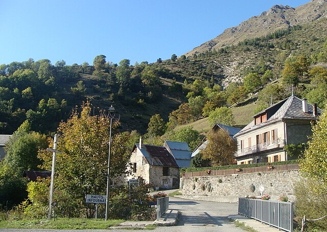
Лез-Энфурна
- коммуна во Франции
Hiking in Лез-Энфурна
Les Infournas is a lesser-known yet stunning hiking destination located in the southern region of France, particularly in the Provence-Alpes-Côte d'Azur area. It is renowned for its rugged landscapes, striking rock formations, and a variety of trails that cater to different skill levels. Here are some key points to keep in mind if you're planning a hike there:...
- Страна:
- Почтовый код: 05500
- Координаты: 44° 42' 57" N, 6° 5' 40" E
- GPS треки (wikiloc): [Ссылка]
- Площадь: 8.69 кв.км
- Население: 24
Полиньи
Hiking in Полиньи
Poligny, situated in the Hautes-Alpes region of southeastern France, is a fantastic destination for hikers, offering stunning landscapes, diverse trails, and a variety of outdoor activities....
- Страна:
- Почтовый код: 05500
- Координаты: 44° 41' 30" N, 6° 2' 50" E
- GPS треки (wikiloc): [Ссылка]
- Площадь: 13.81 кв.км
- Население: 302

Лей
- коммуна во Франции
Hiking in Лей
Laye, a charming commune in the Hautes-Alpes region of southeastern France, offers beautiful landscapes and a variety of hiking opportunities. Nestled in the French Alps, it boasts stunning mountain views, lush valleys, and diverse wildlife. Here are some key points to consider if you’re planning a hiking adventure in Laye:...
- Страна:
- Почтовый код: 05500
- Координаты: 44° 39' 40" N, 6° 5' 3" E
- GPS треки (wikiloc): [Ссылка]
- Площадь: 10.55 кв.км
- Население: 234