Сен-Жюльен-ан-Бошен (Saint-Julien-en-Beauchêne, Saint-Julien-en-Beauchêne)
- коммуна во Франции
 Hiking in Сен-Жюльен-ан-Бошен
Saint-Julien-en-Beauchêne is a charming commune located in the Hautes-Alpes region of southeastern France. The area is known for its stunning natural landscapes, including mountains, forests, and picturesque valleys, making it an excellent destination for hikers of all levels.
Hiking Opportunities
-
Scenic Trails: The region around Saint-Julien-en-Beauchêne offers a variety of trails, ranging from easy walks to challenging hikes. You can explore paths that lead through lovely forests, meadows, and along rivers.
-
Access to the Écrins National Park: Located nearby, Écrins National Park provides more extensive hiking opportunities with breathtaking mountain scenery, diverse flora and fauna, and well-marked trails. Some famous routes include trails leading to high-altitude lakes and peaks.
-
Local Flora and Fauna: While hiking, you may encounter a wide variety of wildlife, including chamois and numerous bird species. The area is also home to unique alpine plants, making it an interesting place for nature enthusiasts.
-
Historical and Cultural Sites: Along the hiking trails, you might come across historical sites, such as ruins of old farms, churches, or traditional mountain villages, adding a cultural experience to your hiking adventure.
Preparation Tips
-
Weather: Always check the weather forecast before heading out, as mountain weather can change rapidly. Dress in layers and be prepared for cooler temperatures at higher elevations.
-
Equip Properly: Wear good hiking boots and carry a map or GPS device. It's also advisable to have a robust first-aid kit, plenty of water, and snacks for energy.
-
Respect Nature: When hiking, follow the Leave No Trace principles to minimize your impact on the environment. Stick to marked trails and avoid disturbing wildlife.
-
Local Regulations: Check for any local regulations regarding open fire, camping, or specific trail guidelines.
Best Times to Hike
The best times for hiking in this region are typically during the spring and autumn months, when the weather is more moderate and the trails are less crowded. Summer can also be a great time, but be prepared for warmer conditions.
Saint-Julien-en-Beauchêne is an excellent destination for hikers looking to explore the beauty of the French Alps. Whether you're seeking a leisurely stroll in nature or a more strenuous mountain adventure, this area has something to offer every hiking enthusiast.
- Страна:

- Почтовый код: 05140
- Координаты: 44° 36' 58" N, 5° 42' 35" E


- GPS треки (wikiloc): [Ссылка]
- Площадь: 59.43 кв.км
- Население: 124
- Веб сайт: http://www.saintjulienenbeauchene.com
- Википедия русская: wiki(ru)
- Википедия английская: wiki(en)
- Википедия национальная: wiki(fr)
- Хранилище Wikidata: Wikidata: Q626908
- Катеория в википедии: [Ссылка]
- код Freebase: [/m/02865qb]
- код Freebase: [/m/02865qb]
- код GeoNames: Альт: [6425635]
- код GeoNames: Альт: [6425635]
- номер SIREN: [210501466]
- номер SIREN: [210501466]
- код тезауруса PACTOLS: [pcrtHWST78rOBa]
- код тезауруса PACTOLS: [pcrtHWST78rOBa]
- код муниципалитета INSEE: 05146
- код муниципалитета INSEE: 05146
Граничит с регионами:

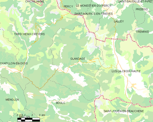
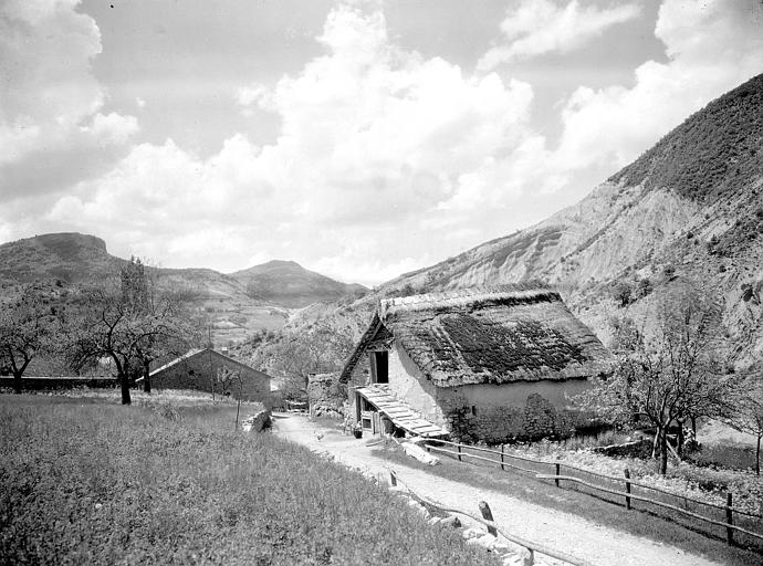
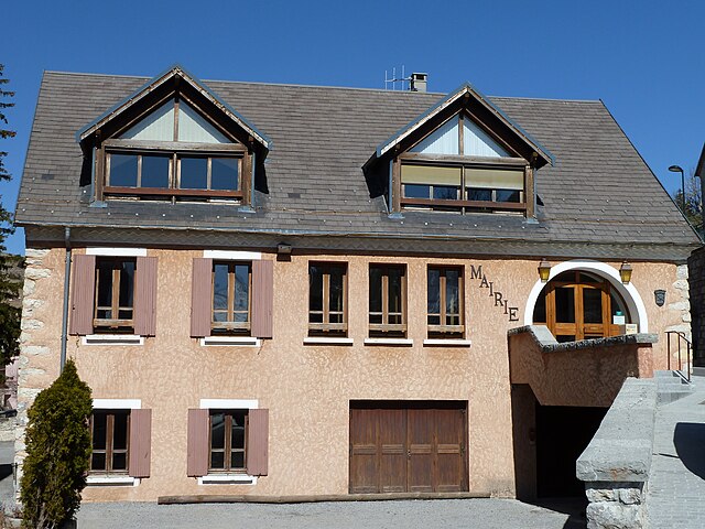
Glandage
- коммуна во Франции
Hiking in Glandage
It seems like there might be a typo in your request, as "Glandage" does not correspond to a well-known hiking location. If you meant "Glandage" in France, located in the Drôme department, I'd be happy to provide information about hiking in that area....
- Страна:
- Почтовый код: 26410
- Координаты: 44° 41' 17" N, 5° 35' 54" E
- GPS треки (wikiloc): [Ссылка]
- Площадь: 52.11 кв.км
- Население: 115

Ла-Клюз
- коммуна во Франции
Hiking in Ла-Клюз
La Cluse, often referred to as La Cluse and its surrounding areas, is a beautiful destination for hikers looking for scenic views, diverse landscapes, and unique geological features. Located in the Jura region of France, it is characterized by rugged terrain, forests, and panoramic views of both mountains and valleys....
- Страна:
- Почтовый код: 05250
- Координаты: 44° 38' 25" N, 5° 50' 56" E
- GPS треки (wikiloc): [Ссылка]
- Население: 43

Boulc
- коммуна во Франции
Hiking in Boulc
Boulc is a charming village located in the Drôme department of the Auvergne-Rhône-Alpes region in southeastern France. It is surrounded by beautiful natural landscapes, making it a great destination for hiking enthusiasts....
- Страна:
- Почтовый код: 26410
- Координаты: 44° 38' 52" N, 5° 34' 1" E
- GPS треки (wikiloc): [Ссылка]
- Площадь: 57.35 кв.км
- Население: 124
Деволюи
- коммуна во Франции
Hiking in Деволюи
Le Dévoluy is a stunning mountain range located in the French Alps, known for its diverse landscapes, breathtaking scenery, and extensive hiking opportunities. Whether you're an experienced hiker or a beginner, there's something for everyone in this area....
- Страна:
- Почтовый код: 05250
- Координаты: 44° 41' 33" N, 5° 56' 28" E
- GPS треки (wikiloc): [Ссылка]
- Площадь: 186.37 кв.км
- Население: 1011
- Веб сайт: [Ссылка]

Аспр-сюр-Бюэш
- коммуна во Франции
Hiking in Аспр-сюр-Бюэш
Aspres-sur-Buëch is a charming commune located in the Hautes-Alpes region of France, offering a range of hiking opportunities amidst stunning natural landscapes. The area is characterized by its picturesque valleys, rugged terrain, and beautiful views of the surrounding mountains. Here are some highlights for hiking around Aspres-sur-Buëch:...
- Страна:
- Почтовый код: 05140
- Координаты: 44° 31' 25" N, 5° 44' 59" E
- GPS треки (wikiloc): [Ссылка]
- Площадь: 42.65 кв.км
- Население: 832


Lus-la-Croix-Haute
- коммуна во Франции
Hiking in Lus-la-Croix-Haute
Lus-la-Croix-Haute is a beautiful destination for hiking enthusiasts, located in the picturesque Alps of France. This charming village offers a variety of trails that cater to different levels of hikers, from beginners to experienced adventurers....
- Страна:
- Почтовый код: 26620
- Координаты: 44° 39' 55" N, 5° 42' 20" E
- GPS треки (wikiloc): [Ссылка]
- Площадь: 87.2 кв.км
- Население: 549
Монбран
- коммуна во Франции
Hiking in Монбран
Montbrand is a charming area in the French Alps, known for its serene natural landscapes and opportunities for outdoor enthusiasts, particularly hikers. While specific trails and conditions may vary, here are some general insights into hiking in Montbrand:...
- Страна:
- Почтовый код: 05140
- Координаты: 44° 35' 23" N, 5° 40' 57" E
- GPS треки (wikiloc): [Ссылка]
- Площадь: 25.03 кв.км
- Население: 65


Ла-Фори
- коммуна во Франции
Hiking in Ла-Фори
La Faurie is a picturesque village located in the Département of Hautes-Alpes in southeastern France, within the Provence-Alpes-Côte d'Azur region. The surrounding landscape offers stunning views and a variety of hiking opportunities suitable for different skill levels....
- Страна:
- Почтовый код: 05140
- Координаты: 44° 34' 2" N, 5° 44' 24" E
- GPS треки (wikiloc): [Ссылка]
- Площадь: 31.44 кв.км
- Население: 315