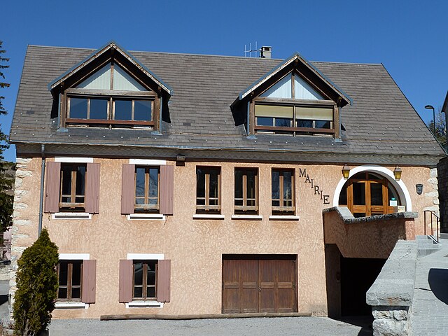
Lus-la-Croix-Haute (Lus-la-Croix-Haute)

- коммуна во Франции
 Hiking in Lus-la-Croix-Haute
Lus-la-Croix-Haute is a beautiful destination for hiking enthusiasts, located in the picturesque Alps of France. This charming village offers a variety of trails that cater to different levels of hikers, from beginners to experienced adventurers.
Key Features of Hiking in Lus-la-Croix-Haute:
-
Diverse Trails: The area boasts a wide range of trails, including gentle walks through scenic forests, challenging mountain hikes, and breathtaking viewpoints. Some popular hikes include routes to the Grand Veymont and the nearby Taillefer mountain.
-
Stunning Scenery: Hikers can expect to be surrounded by stunning landscapes, including rolling hills, dramatic cliffs, and lush greenery. The panoramic views of the Alps and valleys are particularly rewarding.
-
Wildlife and Flora: The region is home to diverse wildlife and a rich variety of flora, with opportunities for birdwatching and observing local plant species. Nature lovers will enjoy the peaceful atmosphere and vibrant ecosystems.
-
Accessible Year-Round: While summer and early fall are popular for hiking, its mountainous terrain is also breathtaking in winter. Depending on conditions, some trails might allow for snowshoeing or winter hiking.
-
Local Culture: As you hike, you'll have the chance to experience the charming local culture, including traditional mountain cuisine in local restaurants and cozy accommodations in the village.
-
Guided Tours: For those new to the area or looking for a more informative experience, guided hikes are available. Local guides can provide insights into the geography, history, and ecology of the region.
-
Skiing Opportunities: In addition to hiking, Lus-la-Croix-Haute is also a winter sports destination, meaning that trails can often be adapted for skiing or snowshoeing in the colder months.
Tips for Hiking in Lus-la-Croix-Haute:
- Plan Ahead: Always check local trail maps and conditions before setting out, as some trails may be affected by seasonal weather changes.
- Dress Appropriately: Wear layered clothing to adapt to changes in temperature, especially in higher elevations.
- Stay Hydrated & Nourished: Carry plenty of water and some snacks to keep your energy up during your hikes.
- Respect Nature: Follow the principle of Leave No Trace to preserve the natural beauty for future hikers.
Whether you are looking for a leisurely stroll or a challenging trek, Lus-la-Croix-Haute offers an array of hiking experiences that are sure to make your adventure memorable.
- Страна:

- Почтовый код: 26620
- Координаты: 44° 39' 55" N, 5° 42' 20" E


- GPS треки (wikiloc): [Ссылка]
- Площадь: 87.2 кв.км
- Население: 549
- Википедия английская: wiki(en)
- Википедия национальная: wiki(fr)
- Хранилище Wikidata: Wikidata: Q468568
- Катеория в википедии: [Ссылка]
- код Freebase: [/m/03mhhvy]
- код GeoNames: Альт: [6430114]
- номер SIREN: [212601686]
- код BNF: [15253029p]
- WOEID: [609027]
- код муниципалитета INSEE: 26168
Граничит с регионами:

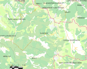
Glandage
- коммуна во Франции
Hiking in Glandage
It seems like there might be a typo in your request, as "Glandage" does not correspond to a well-known hiking location. If you meant "Glandage" in France, located in the Drôme department, I'd be happy to provide information about hiking in that area....
- Страна:
- Почтовый код: 26410
- Координаты: 44° 41' 17" N, 5° 35' 54" E
- GPS треки (wikiloc): [Ссылка]
- Площадь: 52.11 кв.км
- Население: 115

Аньер-ан-Деволюи
- коммуна во Франции
Hiking in Аньер-ан-Деволюи
Agnières-en-Dévoluy is a beautiful village located in the Dévoluy mountain range in the French Alps. This region is known for its stunning landscapes, diverse flora and fauna, and a variety of hiking trails that cater to different skill levels. Here are some key points about hiking in Agnières-en-Dévoluy:...
- Страна:
- Почтовый код: 05250
- Координаты: 44° 41' 42" N, 5° 52' 56" E
- GPS треки (wikiloc): [Ссылка]
- Население: 287
- Веб сайт: [Ссылка]

Ла-Клюз
- коммуна во Франции
Hiking in Ла-Клюз
La Cluse, often referred to as La Cluse and its surrounding areas, is a beautiful destination for hikers looking for scenic views, diverse landscapes, and unique geological features. Located in the Jura region of France, it is characterized by rugged terrain, forests, and panoramic views of both mountains and valleys....
- Страна:
- Почтовый код: 05250
- Координаты: 44° 38' 25" N, 5° 50' 56" E
- GPS треки (wikiloc): [Ссылка]
- Население: 43

Сен-Дидье
- коммуна во Франции
Hiking in Сен-Дидье
Saint-Disdier, located in the Hautes-Alpes region of France, offers a wonderful environment for hiking enthusiasts. Surrounded by the stunning landscapes of the Southern French Alps, the area is known for its picturesque trails, diverse ecosystems, and breathtaking views....
- Страна:
- Почтовый код: 05250
- Координаты: 44° 44' 0" N, 5° 54' 0" E
- GPS треки (wikiloc): [Ссылка]
- Высота над уровнем моря: 1040 м m
- Население: 139


Лалле
- коммуна во Франции
Hiking in Лалле
Lalley, located in the northern part of the United States, specifically in New Hampshire's White Mountains, offers a variety of hiking opportunities for all skill levels. The area is known for its stunning natural beauty, including dense forests, mountain streams, and panoramic views. Here are some highlights of hiking in Lalley:...
- Страна:
- Почтовый код: 38930
- Координаты: 44° 45' 28" N, 5° 40' 34" E
- GPS треки (wikiloc): [Ссылка]
- Площадь: 23.65 кв.км
- Население: 201
- Веб сайт: [Ссылка]
Деволюи
- коммуна во Франции
Hiking in Деволюи
Le Dévoluy is a stunning mountain range located in the French Alps, known for its diverse landscapes, breathtaking scenery, and extensive hiking opportunities. Whether you're an experienced hiker or a beginner, there's something for everyone in this area....
- Страна:
- Почтовый код: 05250
- Координаты: 44° 41' 33" N, 5° 56' 28" E
- GPS треки (wikiloc): [Ссылка]
- Площадь: 186.37 кв.км
- Население: 1011
- Веб сайт: [Ссылка]

Сен-Жюльен-ан-Бошен
- коммуна во Франции
Hiking in Сен-Жюльен-ан-Бошен
Saint-Julien-en-Beauchêne is a charming commune located in the Hautes-Alpes region of southeastern France. The area is known for its stunning natural landscapes, including mountains, forests, and picturesque valleys, making it an excellent destination for hikers of all levels....
- Страна:
- Почтовый код: 05140
- Координаты: 44° 36' 58" N, 5° 42' 35" E
- GPS треки (wikiloc): [Ссылка]
- Площадь: 59.43 кв.км
- Население: 124
- Веб сайт: [Ссылка]


Треминис
- коммуна во Франции
Hiking in Треминис
Tréminis is a charming village located in the Isère department of the Auvergne-Rhône-Alpes region in southeastern France. It’s known for its beautiful landscapes and outdoor activities, making it a great spot for hiking enthusiasts....
- Страна:
- Почтовый код: 38710
- Координаты: 44° 44' 51" N, 5° 46' 8" E
- GPS треки (wikiloc): [Ссылка]
- Площадь: 49.4 кв.км
- Население: 180