Saint-Maurice District (Bezirk Saint-Maurice)

 Hiking in Saint-Maurice District
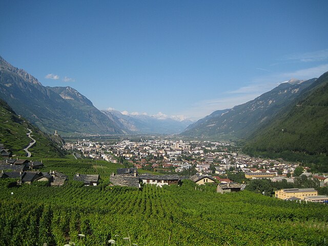
The Saint-Maurice District, located in the Valais region of Switzerland, is a stunning area known for its picturesque landscapes, towering mountains, and vibrant hiking trails. Whether you're a seasoned hiker or a beginner, there's something for everyone in this region. Here are some highlights and details to consider when hiking in the Saint-Maurice District:
Scenic Trails
-
Val d'Illiez: This beautiful valley offers various trails that range from leisurely walks to challenging hikes. The paths often lead through charming villages, refreshing streams, and lush forests.
-
Bac de la Roche: A mountain trail that offers breathtaking views of the surrounding peaks and valleys. It's a bit challenging, but the panoramic vistas make it worthwhile.
-
Sentier des Planètes: A fascinating educational trail that explores the solar system through scale models of the planets, making it a fun and engaging hike for families.
Elevation and Terrain
The Saint-Maurice District features a mix of elevations, with some valleys sitting at lower altitudes and other trails leading up to higher peaks. Be prepared for diverse terrain, including rocky paths, forest trails, and meadows.
Wildlife and Nature
Hiking in this region provides the opportunity to spot various local wildlife, such as ibex, chamois, and a variety of bird species. The flora is equally rich, with many alpine flowers blossoming in the spring and summer months.
Local Culture
As you hike through this district, you’ll encounter traditional Swiss villages where you can experience local culture, cuisine, and hospitality. Stop by a local restaurant or chalet to try some regional dishes.
Seasonal Considerations
- Summer: Ideal for hiking, with warm weather and accessible trails. Be mindful of the occasional afternoon thunderstorm.
- Autumn: Beautiful fall colors and fewer tourists. Some higher-altitude trails may become snow-covered, so check conditions in advance.
- Winter: While hiking is limited in snow-covered areas, many trails become popular for snowshoeing and winter hikes.
- Spring: Dramatic landscapes come alive with blooming wildflowers, but be cautious of lingering snow on higher trails.
Safety Tips
- Always check the weather forecast before heading out.
- Bring proper hiking gear, including sturdy boots, layered clothing, and enough water and snacks.
- Familiarize yourself with the trails and consider using a map or hiking app.
- Inform someone of your hiking plans, and if hiking alone, take extra precautions.
Access and Transport
The Saint-Maurice District is accessible via public transportation, with trains and buses connecting to key starting points for hiking trails. Many trails can also be reached by car, with parking often available near trailheads.
Enjoy your hiking experience in the Saint-Maurice District, and take in the breathtaking beauty that this Swiss region has to offer!
- Страна:

- Код автомобильного номера: VS
- Координаты: 46° 9' 14" N, 6° 59' 54" E


- GPS треки (wikiloc): [Ссылка]
- Высота над уровнем моря: 2099 м m
- Площадь: 185.6 кв.км
- Википедия английская: wiki(en)
- Википедия национальная: wiki(de)
- Хранилище Wikidata: Wikidata: Q176556
- Катеория в википедии: [Ссылка]
- код Freebase: [/m/0286qfb]
- код GeoNames: Альт: [6458832]
- идентификатор местоположения ArchINFORM: [45100]
- идентификатор HDS: [8412]
Включает регионы:
Dorénaz
Hiking in Dorénaz
Dorénaz is a charming village located in the Valais region of Switzerland, nestled between the Rhône River and the foot of the majestic mountains. Hiking in this area offers stunning views, diverse landscapes, and a range of trails suitable for different skill levels. Here are some key points to consider when hiking in Dorénaz:...
- Страна:
- Почтовый код: 1905
- Телефонный код: 027
- Код автомобильного номера: VS
- Координаты: 46° 9' 6" N, 7° 3' 42" E
- GPS треки (wikiloc): [Ссылка]
- Высота над уровнем моря: 1289 м m
- Площадь: 12.6 кв.км
- Население: 930
- Веб сайт: [Ссылка]

Vernayaz
Hiking in Vernayaz
Vernayaz, a charming village located in the Valais region of Switzerland, offers stunning hiking opportunities that showcase the breathtaking landscapes of the Swiss Alps. Here are some aspects to consider when hiking in and around Vernayaz:...
- Страна:
- Почтовый код: 1904
- Телефонный код: 027
- Код автомобильного номера: VS
- Координаты: 46° 8' 0" N, 7° 2' 0" E
- GPS треки (wikiloc): [Ссылка]
- Высота над уровнем моря: 455 м m
- Площадь: 5.7 кв.км
- Население: 1886
- Веб сайт: [Ссылка]

Collonges
Hiking in Collonges
Collonges, a charming village located in the Rhône-Alpes region of Switzerland, offers a variety of hiking opportunities set against a picturesque backdrop of the Alps. Here are some highlights and tips for hiking in this beautiful area:...
- Страна:
- Телефонный код: 027
- Код автомобильного номера: VS
- Координаты: 46° 10' 49" N, 7° 3' 21" E
- GPS треки (wikiloc): [Ссылка]
- Высота над уровнем моря: 1310 м m
- Площадь: 12.3 кв.км
- Население: 780
- Веб сайт: [Ссылка]

Finhaut
Hiking in Finhaut
Finhaut is a charming village situated in the Rhône-Alpes region of France, nestled in the beautiful Alps. It is part of the Haute-Savoie department, and is known for its breathtaking landscapes, rich natural heritage, and proximity to multiple hiking trails that cater to various skill levels. Here are some highlights about hiking in Finhaut:...
- Страна:
- Почтовый код: 1925
- Телефонный код: 027
- Код автомобильного номера: VS
- Координаты: 46° 4' 59" N, 6° 58' 36" E
- GPS треки (wikiloc): [Ссылка]
- Высота над уровнем моря: 1874 м m
- Площадь: 22.8 кв.км
- Население: 387
- Веб сайт: [Ссылка]

Salvan
Hiking in Salvan
Salvan, located in the scenic region of Valais, Switzerland, is a beautiful destination for hiking enthusiasts. Nestled in the mountains near the popular resort town of Champery, it offers a variety of trails that cater to different skill levels. Here are some highlights for hiking in and around Salvan:...
- Страна:
- Почтовый код: 1922
- Телефонный код: 027
- Код автомобильного номера: VS
- Координаты: 46° 7' 0" N, 7° 1' 0" E
- GPS треки (wikiloc): [Ссылка]
- Высота над уровнем моря: 959 м m
- Площадь: 53.4 кв.км
- Население: 1374
- Веб сайт: [Ссылка]

Vérossaz
Hiking in Vérossaz
Vérossaz is a picturesque village located in the Valais region of Switzerland, offering hiking enthusiasts a range of beautiful trails amid stunning alpine scenery. Here are some key points to consider when hiking in and around Vérossaz:...
- Страна:
- Почтовый код: 1891
- Телефонный код: 024
- Код автомобильного номера: VS
- Координаты: 46° 13' 0" N, 6° 59' 0" E
- GPS треки (wikiloc): [Ссылка]
- Высота над уровнем моря: 811 м m
- Площадь: 14.28 кв.км
- Население: 748
- Веб сайт: [Ссылка]

Сен-Морис
Hiking in Сен-Морис
Saint-Maurice, located in the Valais region of Switzerland, is a charming town known for its rich history and stunning natural surroundings. It provides a great base for hiking enthusiasts looking to explore the beautiful landscapes of the Swiss Alps....
- Страна:
- Почтовый код: 1890
- Телефонный код: 024
- Код автомобильного номера: VS
- Координаты: 46° 13' 8" N, 7° 0' 17" E
- GPS треки (wikiloc): [Ссылка]
- Высота над уровнем моря: 414 м m
- Площадь: 7.18 кв.км
- Население: 4595
- Веб сайт: [Ссылка]

Эвионаз
- муниципалитет в кантоне Вале
Hiking in Эвионаз
Evionnaz is a charming village in the Valais region of Switzerland, located near the Rhône River and surrounded by stunning alpine landscapes. It serves as an excellent base for hiking enthusiasts, offering a variety of trails that cater to different skill levels, from leisurely walks to more challenging hikes....
- Страна:
- Почтовый код: 1902
- Телефонный код: 027
- Код автомобильного номера: VS
- Координаты: 46° 10' 45" N, 7° 1' 21" E
- GPS треки (wikiloc): [Ссылка]
- Высота над уровнем моря: 1981 м m
- Площадь: 48.0 кв.км
- Население: 1260
- Веб сайт: [Ссылка]

Massongex
Hiking in Massongex
Massongex, located in the picturesque region of the Valais in Switzerland, offers a range of hiking opportunities that highlight its stunning natural landscapes. Here are some key points about hiking in this area:...
- Страна:
- Почтовый код: 1869
- Телефонный код: 024
- Код автомобильного номера: VS
- Координаты: 46° 15' 0" N, 6° 59' 0" E
- GPS треки (wikiloc): [Ссылка]
- Высота над уровнем моря: 408 м m
- Площадь: 6.6 кв.км
- Население: 1802
- Веб сайт: [Ссылка]
Граничит с регионами:

Martigny District
Hiking in Martigny District
Hiking in the Martigny District can be a breathtaking experience, as it is located in the Valais region of Switzerland, known for its stunning landscapes, varied terrain, and rich cultural history. Here are some highlights and tips for hiking in this area:...
- Страна:
- Столица: Мартиньи
- Код автомобильного номера: VS
- Координаты: 46° 7' 26" N, 7° 6' 13" E
- GPS треки (wikiloc): [Ссылка]
- Высота над уровнем моря: 458 м m
- Площадь: 263.5 кв.км


Monthey District
Hiking in Monthey District
The Monthey District, located in the Valais region of Switzerland, is a fantastic destination for hiking enthusiasts. This area, nestled between stunning Alpine landscapes, offers a variety of trails suitable for all skill levels, from beginners to experienced hikers....
- Страна:
- Столица: Монте
- Код автомобильного номера: VS
- Координаты: 46° 16' 14" N, 6° 54' 10" E
- GPS треки (wikiloc): [Ссылка]
- Высота над уровнем моря: 1214 м m
- Площадь: 255.1 кв.км