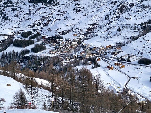
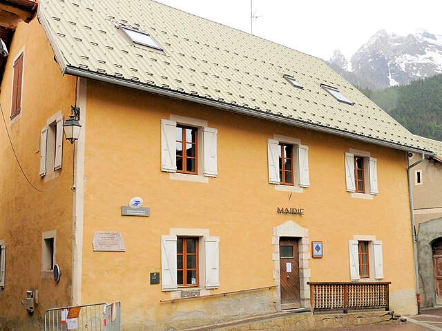
Сен-Поль-сюр-Юбей (Saint-Paul-sur-Ubaye, Saint-Paul-sur-Ubaye)
- коммуна во Франции
 Hiking in Сен-Поль-сюр-Юбей
Saint-Paul-sur-Ubaye is a charming commune in the Alpes-de-Haute-Provence region of France, nestled in the Ubaye Valley. It's an excellent destination for hiking enthusiasts due to its stunning natural landscapes, alpine scenery, and rich biodiversity. Here’s what you can expect when hiking in this area:
Trails and Routes
- Variety of Trails: Saint-Paul-sur-Ubaye offers various hiking trails suitable for different skill levels, from easy walks to challenging hikes.
- Scenic Views: Many of the trails provide breathtaking views of the surrounding mountains, valleys, and the Ubaye River. The trails often lead you through lush forests, across meadows, and up to panoramic viewpoints.
- Connection to the Écrins National Park: Some trails may link up with routes leading into the nearby Écrins National Park, providing an opportunity to explore even more expansive wild areas.
- Historical Trails: The region is rich in history, and some trails may take you past historical sites such as old villages, chapels, and abandoned farms.
Flora and Fauna
- Biodiversity: The region has a rich variety of flora and fauna. Keep an eye out for local wildlife, including chamois, marmots, and a variety of bird species.
- Alpine Plants: You may encounter unique alpine plants and wildflowers, especially during the spring and summer months.
Best Times to Hike
- Spring to Fall: The best time for hiking in Saint-Paul-sur-Ubaye is from late spring through early autumn, when the weather is generally mild and the trails are accessible.
- Snow Hiking in Winter: If you’re experienced and prepared, some trails can be explored in winter, offering a different perspective and beauty, often accompanied by snow cover.
Preparation Tips
- Gear: Ensure you have appropriate hiking gear, including sturdy boots, weather-appropriate clothing, and a day pack with water, snacks, and a first aid kit.
- Navigation: While many trails are well marked, a hiking map or GPS device can be helpful to avoid getting lost, especially in more remote areas.
- Local Regulations: Check local regulations for hiking in protected areas, including rules about staying on marked trails and respecting wildlife.
Conclusion
Hiking in Saint-Paul-sur-Ubaye offers a rewarding experience for nature lovers and outdoor adventurers. With its stunning landscapes, rich biodiversity, and a variety of trails, it’s a fantastic destination to immerse yourself in the beauty of the French Alps. Always remember to hike responsibly and enjoy your time in this picturesque region!
- Страна:

- Почтовый код: 04530
- Координаты: 44° 31' 0" N, 6° 45' 0" E


- GPS треки (wikiloc): [Ссылка]
- Площадь: 205.55 кв.км
- Население: 200
- Веб сайт: http://www.mairie-saint-paul-ubaye.com
- Википедия русская: wiki(ru)
- Википедия английская: wiki(en)
- Википедия национальная: wiki(fr)
- Хранилище Wikidata: Wikidata: Q876989
- Катеория в википедии: [Ссылка]
- код Freebase: [/m/03m7xkn]
- код Freebase: [/m/03m7xkn]
- код GeoNames: Альт: [6615714]
- код GeoNames: Альт: [6615714]
- номер SIREN: [210401931]
- номер SIREN: [210401931]
- код муниципалитета INSEE: 04193
- код муниципалитета INSEE: 04193
Граничит с регионами:

Мейрон
- коммуна во Франции
Hiking in Мейрон
Meyronnes is a picturesque village located in the Alpes-de-Haute-Provence region of southeastern France. Nestled in the Mercantour National Park, it offers a range of hiking opportunities that cater to different skill levels, making it an excellent destination for nature lovers and outdoor enthusiasts....
- Страна:
- Почтовый код: 04530
- Координаты: 44° 28' 35" N, 6° 47' 57" E
- GPS треки (wikiloc): [Ссылка]
- Площадь: 40.59 кв.км
- Население: 60
Вар
Hiking in Вар
Vars, located in the Hautes-Alpes region of southeastern France, is a fantastic destination for hiking enthusiasts. Known primarily for its winter sports, Vars also offers stunning landscapes and a variety of hiking trails during the warmer months. Here's an overview of what to expect when hiking in this area:...
- Страна:
- Почтовый код: 05560
- Координаты: 44° 35' 42" N, 6° 41' 23" E
- GPS треки (wikiloc): [Ссылка]
- Площадь: 92.2 кв.км
- Население: 573
- Веб сайт: [Ссылка]

Беллино
- коммуна Италии
Hiking in Беллино
Bellino is a picturesque village located in the Susa Valley of the Piedmont region in northern Italy. It’s known for its stunning landscapes, rich culture, and outdoor activities, making it a fantastic destination for hiking enthusiasts....
- Страна:

- Почтовый код: 12020
- Телефонный код: 0175
- Код автомобильного номера: CN
- Координаты: 44° 35' 0" N, 7° 2' 0" E
- GPS треки (wikiloc): [Ссылка]
- Высота над уровнем моря: 1576 м m
- Площадь: 62.07 кв.км
- Население: 103
- Веб сайт: [Ссылка]

Понтекьянале
- коммуна Италии
Hiking in Понтекьянале
Pontechianale, located in the Susa Valley in the Piedmont region of Italy, is a stunning area for hiking enthusiasts. Nestled at the base of the impressive Alps, it offers breathtaking views, diverse trails, and a variety of landscapes ranging from lush valleys to rocky peaks. Here are some highlights of hiking in Pontechianale:...
- Страна:
- Почтовый код: 12020
- Телефонный код: 0175
- Код автомобильного номера: CN
- Координаты: 44° 37' 0" N, 7° 2' 0" E
- GPS треки (wikiloc): [Ссылка]
- Высота над уровнем моря: 1614 м m
- Площадь: 94.92 кв.км
- Население: 163
- Веб сайт: [Ссылка]

Аччельо
- коммуна Италии
Hiking in Аччельо
Acceglio is a beautiful village located in the Piedmont region of Italy, nestled in the stunning Susa Valley of the Cottian Alps. Known for its picturesque landscape, rich flora and fauna, and traditional alpine architecture, it serves as an excellent base for hiking enthusiasts....
- Страна:
- Почтовый код: 12021
- Телефонный код: 0171
- Код автомобильного номера: CN
- Координаты: 44° 29' 0" N, 6° 59' 0" E
- GPS треки (wikiloc): [Ссылка]
- Высота над уровнем моря: 1200 м m
- Площадь: 151.53 кв.км
- Население: 155
- Веб сайт: [Ссылка]

Сен-Веран
- коммуна в департаменте Верхние Альпы, Франция
Hiking in Сен-Веран
Saint-Véran is one of the highest inhabited villages in Europe, located in the Queyras region of the French Southern Alps. It's known for its stunning landscapes, traditional architecture, and a variety of hiking trails that cater to all levels of hikers....
- Страна:
- Почтовый код: 05350
- Координаты: 44° 42' 0" N, 6° 52' 6" E
- GPS треки (wikiloc): [Ссылка]
- Высота над уровнем моря: 2042 м m
- Площадь: 44.75 кв.км
- Население: 236
Сейак
- коммуна во Франции
Hiking in Сейак
Ceillac is a charming village located in the Queyras Regional Natural Park in the French Alps, known for its stunning landscapes and excellent hiking opportunities. The area is characterized by its beautiful valleys, high peaks, and a variety of ecosystems, making it a perfect destination for both novice and experienced hikers....
- Страна:
- Почтовый код: 05600
- Координаты: 44° 40' 1" N, 6° 46' 36" E
- GPS треки (wikiloc): [Ссылка]
- Площадь: 96.05 кв.км
- Население: 294
- Веб сайт: [Ссылка]
Ла-Кондамин-Шатлар
- коммуна во Франции
Hiking in Ла-Кондамин-Шатлар
La Condamine-Châtelard is a picturesque village located in the Alpes-Maritimes region of France, near the Italian border. It's a part of the larger area of the French Alps, known for its stunning natural landscapes and outdoor recreational opportunities, including hiking....
- Страна:
- Почтовый код: 04530
- Координаты: 44° 27' 29" N, 6° 44' 45" E
- GPS треки (wikiloc): [Ссылка]
- Высота над уровнем моря: 1305 м m
- Площадь: 56.08 кв.км
- Население: 172

Креву
- коммуна во Франции
Hiking in Креву
Crévoux is a picturesque village located in the French Alps, part of the Hautes-Alpes department, and is often celebrated for its stunning natural beauty and outdoor recreational opportunities, including fantastic hiking trails. Here are some highlights to help you prepare for a hiking adventure in Crévoux:...
- Страна:
- Почтовый код: 05200
- Координаты: 44° 32' 53" N, 6° 36' 26" E
- GPS треки (wikiloc): [Ссылка]
- Площадь: 56.26 кв.км
- Население: 140