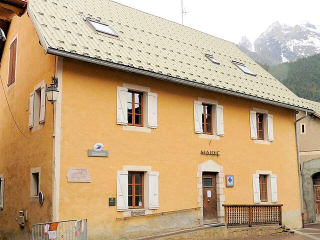
Сен-Веран (Saint-Véran, Saint-Véran)
- коммуна в департаменте Верхние Альпы, Франция
 Hiking in Сен-Веран
Saint-Véran is one of the highest inhabited villages in Europe, located in the Queyras region of the French Southern Alps. It's known for its stunning landscapes, traditional architecture, and a variety of hiking trails that cater to all levels of hikers.
Hiking Opportunities:
-
Scenic Trails: The area offers beautiful trails that take you through alpine meadows, forests, and offer panoramic views of snow-capped peaks. Important routes include:
- The GR58 Trail: This long-distance trail circles the Queyras regional park and includes several sections that pass through or near Saint-Véran.
- The Col de la Font Sancte: A more challenging hike that leads to one of the highest passes, offering breathtaking views.
-
Cultural Trails: Some trails allow you to explore the village’s unique architecture and history, including traditional wooden houses and chapels.
-
Wildlife Watching: The area is rich in biodiversity, so keep an eye out for chamois, marmots, and various bird species along the hiking paths.
-
Seasonal Variations: Hiking in the summer offers wildflowers and lush greenery, while autumn can show stunning fall foliage. In winter, the region is popular for snowshoeing and cross-country skiing.
Tips for Hiking in Saint-Véran:
- Gear Up: Wear sturdy hiking boots and dress in layers, as the weather can change quickly.
- Stay Hydrated: Carry enough water and snacks, especially on longer hikes.
- Maps and Guides: Familiarize yourself with trail maps and consider hiring a local guide if you are unfamiliar with the terrain.
- Respect Nature: Follow Leave No Trace principles to preserve the natural beauty of the area.
Accessibility:
The village is accessible by road, and there are parking facilities for hikers. In the summer months, public transport options may be available from nearby towns.
Conclusion:
Saint-Véran is a hidden gem for hikers, offering a combination of natural beauty, cultural heritage, and a variety of trails to explore. Whether you're looking for a leisurely stroll or a challenging hike, you'll find something that suits your preferences in this remarkable locale.
- Страна:

- Почтовый код: 05350
- Координаты: 44° 42' 0" N, 6° 52' 6" E


- GPS треки (wikiloc): [Ссылка]
- Высота над уровнем моря: 2042 м m
- Площадь: 44.75 кв.км
- Население: 236
- Википедия русская: wiki(ru)
- Википедия английская: wiki(en)
- Википедия национальная: wiki(fr)
- Хранилище Wikidata: Wikidata: Q476465
- Катеория в википедии: [Ссылка]
- код Freebase: [/m/06fq3l]
- код Freebase: [/m/06fq3l]
- код GeoNames: Альт: [2976686]
- код GeoNames: Альт: [2976686]
- номер SIREN: [210501573]
- номер SIREN: [210501573]
- код BNF: [11946531s]
- код BNF: [11946531s]
- код VIAF: Альт: [144274742]
- код VIAF: Альт: [144274742]
- код LCNAF: Альт: [n82164089]
- код LCNAF: Альт: [n82164089]
- код тезауруса PACTOLS: [pcrts9zhz4uUMB]
- код тезауруса PACTOLS: [pcrts9zhz4uUMB]
- код муниципалитета INSEE: 05157
- код муниципалитета INSEE: 05157
Граничит с регионами:

Молин-ан-Кейра
- коммуна во Франции
Hiking in Молин-ан-Кейра
Molines-en-Queyras is a picturesque village located in the Queyras Regional Natural Park in the French Alps. It's an ideal destination for hiking enthusiasts, offering a variety of trails that cater to different skill levels. Here’s what you can expect when hiking in this beautiful region:...
- Страна:
- Почтовый код: 05350
- Координаты: 44° 43' 51" N, 6° 50' 36" E
- GPS треки (wikiloc): [Ссылка]
- Площадь: 53.62 кв.км
- Население: 305

Понтекьянале
- коммуна Италии
Hiking in Понтекьянале
Pontechianale, located in the Susa Valley in the Piedmont region of Italy, is a stunning area for hiking enthusiasts. Nestled at the base of the impressive Alps, it offers breathtaking views, diverse trails, and a variety of landscapes ranging from lush valleys to rocky peaks. Here are some highlights of hiking in Pontechianale:...
- Страна:

- Почтовый код: 12020
- Телефонный код: 0175
- Код автомобильного номера: CN
- Координаты: 44° 37' 0" N, 7° 2' 0" E
- GPS треки (wikiloc): [Ссылка]
- Высота над уровнем моря: 1614 м m
- Площадь: 94.92 кв.км
- Население: 163
- Веб сайт: [Ссылка]
Сейак
- коммуна во Франции
Hiking in Сейак
Ceillac is a charming village located in the Queyras Regional Natural Park in the French Alps, known for its stunning landscapes and excellent hiking opportunities. The area is characterized by its beautiful valleys, high peaks, and a variety of ecosystems, making it a perfect destination for both novice and experienced hikers....
- Страна:
- Почтовый код: 05600
- Координаты: 44° 40' 1" N, 6° 46' 36" E
- GPS треки (wikiloc): [Ссылка]
- Площадь: 96.05 кв.км
- Население: 294
- Веб сайт: [Ссылка]

Сен-Поль-сюр-Юбей
- коммуна во Франции
Hiking in Сен-Поль-сюр-Юбей
Saint-Paul-sur-Ubaye is a charming commune in the Alpes-de-Haute-Provence region of France, nestled in the Ubaye Valley. It's an excellent destination for hiking enthusiasts due to its stunning natural landscapes, alpine scenery, and rich biodiversity. Here’s what you can expect when hiking in this area:...
- Страна:
- Почтовый код: 04530
- Координаты: 44° 31' 0" N, 6° 45' 0" E
- GPS треки (wikiloc): [Ссылка]
- Площадь: 205.55 кв.км
- Население: 200
- Веб сайт: [Ссылка]