%20(cropped).JPG)
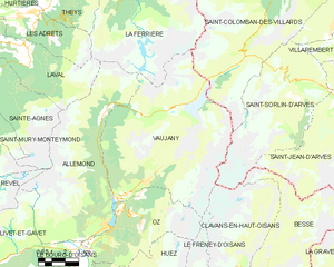
Saint-Sorlin-d'Arves (Saint-Sorlin-d'Arves)

- коммуна во Франции
 Hiking in Saint-Sorlin-d'Arves
Saint-Sorlin-d'Arves is a beautiful alpine village located in the Savoie region of the French Alps. It is particularly known for its stunning landscapes, diverse wildlife, and a range of hiking trails that cater to various skill levels. Here’s a general overview of what you can expect when hiking in the area:
Trail Options
-
Beginner Trails: There are several easy trails suitable for families and beginners. These paths often lead through lush valleys, past meadows filled with wildflowers, and offer breathtaking views of the surrounding mountains.
-
Intermediate Trails: For those with a bit more experience, there are moderate trails that provide more challenging terrain. These hikes often include ascents that offer spectacular panoramas of the Arvan-Villards massif.
-
Advanced and Technical Trails: Experienced hikers can tackle advanced routes that involve steeper climbs and may require some scrambling. These trails often lead to higher altitudes, where you can observe unique alpine flora and fauna.
Notable Routes
-
Col de la Croix de Fer: A popular hike that leads to a mountain pass offering panoramic views. This route is accessible from Saint-Sorlin-d'Arves and is perfect for hikers looking to challenge themselves.
-
Lac de la Pêche: This picturesque lake can be reached through a moderately difficult trail, making it a great destination for a day hike. The lake's striking blue waters set against the backdrop of towering peaks are a highlight.
-
Sentier des Aiguilles d'Arves: This path provides stunning views of the Aiguilles d'Arves and is suitable for those looking to experience the dramatic landscapes of the region.
Tips for Hiking in Saint-Sorlin-d'Arves
-
Safety First: Always check the weather before heading out, as conditions can change rapidly in the mountains. It's also wise to carry a map or GPS device since some trails may not be well-marked.
-
Appropriate Gear: Wear sturdy hiking boots and bring along plenty of water, snacks, sunscreen, and a first-aid kit. Depending on the elevation and season, be prepared for varying temperatures.
-
Local Wildlife: Be aware of the wildlife in the area, including ibex and chamois. Maintain a respectful distance and do not feed them.
-
Guided Tours: If you're unfamiliar with the area, consider hiring a local guide who can provide insights into the geography and ecology while ensuring you stay safe on your hike.
-
Seasonality: The best time for hiking in Saint-Sorlin-d'Arves is typically from late spring to early autumn, when trails are clear of snow, and the weather is more reliable.
Whether you are an experienced hiker or a beginner, the trails around Saint-Sorlin-d'Arves offer something for everyone—stunning views, a chance to connect with nature, and the joy of exploring the Alpine landscape.
- Страна:

- Почтовый код: 73530
- Координаты: 45° 13' 16" N, 6° 14' 5" E


- GPS треки (wikiloc): [Ссылка]
- Площадь: 39 кв.км
- Население: 339
- Веб сайт: http://www.saintsorlindarves.com
- Википедия английская: wiki(en)
- Википедия национальная: wiki(fr)
- Хранилище Wikidata: Wikidata: Q1231290
- Катеория в википедии: [Ссылка]
- код Freebase: [/m/03npft7]
- номер SIREN: [217302801]
- код BNF: [15274210g]
- код VIAF: Альт: [246670959]
- ID отношения в OpenStreetMap: [113635]
- код муниципалитета INSEE: 73280
Граничит с регионами:


Клаванз-ан-От-Уазан
- коммуна во Франции
Hiking in Клаванз-ан-От-Уазан
Clavans-en-Haut-Oisans is a picturesque village located in the French Alps, specifically in the Isère department. It's a fantastic base for hiking enthusiasts due to its stunning natural surroundings and proximity to the Écrins National Park, one of France's largest and most beautiful national parks....
- Страна:
- Почтовый код: 38142
- Координаты: 45° 5' 1" N, 6° 9' 46" E
- GPS треки (wikiloc): [Ссылка]
- Площадь: 15.58 кв.км
- Население: 108
- Веб сайт: [Ссылка]


Бесс
- коммуна во Франции
Hiking in Бесс
Besse, located in the Isère department of the Auvergne-Rhône-Alpes region in southeastern France, is a fantastic destination for hiking enthusiasts. Nestled in the spectacular landscapes of the French Alps, Besse offers a range of hiking trails that cater to various levels of experience, from beginner to expert....
- Страна:
- Почтовый код: 38142
- Координаты: 45° 4' 18" N, 6° 10' 12" E
- GPS треки (wikiloc): [Ссылка]
- Площадь: 25.46 кв.км
- Население: 133
- Веб сайт: [Ссылка]


Saint-Jean-d'Arves
- коммуна во Франции
Hiking in Saint-Jean-d'Arves
Saint-Jean-d'Arves is a picturesque village located in the French Alps, specifically in the Savoie region. This area is renowned for its stunning mountain landscapes, diverse wildlife, and a wide array of hiking opportunities. Here’s what you can expect when hiking in Saint-Jean-d'Arves:...
- Страна:
- Почтовый код: 73530
- Координаты: 45° 12' 26" N, 6° 16' 23" E
- GPS треки (wikiloc): [Ссылка]
- Площадь: 75.6 кв.км
- Население: 265
- Веб сайт: [Ссылка]

Вожани
- коммуна во Франции
Hiking in Вожани
Vaujany is a charming alpine village located in the French Alps, within the Oisans region, and is part of the larger Alpe d'Huez Grand Domaine Ski area. It's not only a great skiing destination but also an excellent location for hiking, especially during the warmer months when the snow melts and the trails become accessible....
- Страна:
- Почтовый код: 38114
- Координаты: 45° 9' 27" N, 6° 4' 36" E
- GPS треки (wikiloc): [Ссылка]
- Площадь: 64.54 кв.км
- Население: 307
- Веб сайт: [Ссылка]


Фонкуверт-ля-Туссюир
- коммуна во Франции
Hiking in Фонкуверт-ля-Туссюир
Fontcouverte-la-Toussuire is a picturesque village located in the Savoie region of the French Alps, offering a variety of hiking opportunities for outdoor enthusiasts. Whether you’re a beginner or an advanced hiker, the area provides trails that cater to different skill levels, along with stunning mountain scenery, alpine flora, and the chance to spot local wildlife....
- Страна:
- Почтовый код: 73300
- Координаты: 45° 14' 47" N, 6° 18' 9" E
- GPS треки (wikiloc): [Ссылка]
- Площадь: 21.52 кв.км
- Население: 534
- Веб сайт: [Ссылка]


Villarembert
- коммуна во Франции
Hiking in Villarembert
Villarembert is a charming village located in the Savoie region of the French Alps, known for its beautiful landscapes and access to numerous hiking trails. It's particularly popular among outdoor enthusiasts due to its proximity to the Maurienne Valley and the Trois Vallées ski area, which transforms into a hiker's paradise in the summer months....
- Страна:
- Почтовый код: 73300
- Координаты: 45° 14' 45" N, 6° 16' 46" E
- GPS треки (wikiloc): [Ссылка]
- Площадь: 9.58 кв.км
- Население: 249
- Веб сайт: [Ссылка]


Saint-Colomban-des-Villards
- коммуна во Франции
Hiking in Saint-Colomban-des-Villards
Saint-Colomban-des-Villards is a charming commune in the Savoie region of the French Alps, known for its stunning landscapes and diverse hiking opportunities. The area offers a mix of trails that cater to different skill levels, from leisurely walks to challenging hikes....
- Страна:
- Почтовый код: 73130
- Координаты: 45° 17' 39" N, 6° 13' 36" E
- GPS треки (wikiloc): [Ссылка]
- Высота над уровнем моря: 1204 м m
- Площадь: 81.12 кв.км
- Население: 173