Sainte-Marie (Sainte-Marie)

- коммуна во Франции
 Hiking in Sainte-Marie
Sainte-Marie, located in the Doubs department of the Bourgogne-Franche-Comté region in eastern France, offers a range of beautiful hiking opportunities that are perfect for nature enthusiasts and outdoor adventurers. The region is characterized by its lush landscapes, rolling hills, and picturesque views typical of the Jura Mountains.
Hiking Opportunities
-
Scenic Trails: The area boasts several well-marked trails that cater to various skill levels. You can find leisurely walks suitable for families as well as more challenging treks for experienced hikers.
-
Natural Beauty: The landscape is dotted with forests, meadows, and rivers. As you hike, you can enjoy views of the surrounding mountains and valleys, especially stunning during spring and autumn when the foliage changes.
-
Lakes and Waterfalls: Nearby natural attractions like Lac de Saint-Point and various waterfalls provide perfect spots for a rest and picnicking.
-
Wildlife Watching: The region is home to diverse flora and fauna. Keep an eye out for local wildlife, such as deer, various bird species, and unique plants lining the trails.
-
Cultural Sites: Incorporate some cultural exploration by including stops at local villages or historical sites along the way. You might find traditional Jura architecture and small local museums.
Tips for Hiking in Sainte-Marie
- Gear Up: Wear sturdy hiking boots and dress in layers, as weather conditions can change rapidly in the mountains.
- Stay Hydrated: Bring plenty of water, especially during longer hikes.
- Trail Maps: Utilize local trail maps or smartphone apps for navigation, and be sure to adhere to marked paths.
- Timing: The best times to hike in this region are late spring through early autumn, but be prepared for cooler temperatures and rain even in these months.
Local Resources
Consider visiting the local tourist office for maps, guided hikes, and updated information on trail conditions. They can also provide insights on hidden gems or special events happening in the region.
Conclusion
Sainte-Marie offers a delightful hiking experience tailored to various preferences, with the added bonus of stunning natural scenery and tranquil surroundings. Make sure to take your time to soak in the beauty of the Doubs landscape while you hike!
- Страна:

- Почтовый код: 25113
- Координаты: 47° 30' 27" N, 6° 41' 43" E


- GPS треки (wikiloc): [Ссылка]
- Площадь: 7.17 кв.км
- Население: 709
- Википедия английская: wiki(en)
- Википедия национальная: wiki(fr)
- Хранилище Wikidata: Wikidata: Q905037
- Катеория в википедии: [Ссылка]
- код Freebase: [/m/03mhcw1]
- код Freebase: [/m/03mhcw1]
- код GeoNames: Альт: [6453868]
- код GeoNames: Альт: [6453868]
- номер SIREN: [212505234]
- номер SIREN: [212505234]
- код BNF: [152527490]
- код BNF: [152527490]
- код муниципалитета INSEE: 25523
- код муниципалитета INSEE: 25523
Граничит с регионами:


Bavans
- коммуна во Франции
Hiking in Bavans
Bavans is a picturesque village located in the Doubs department of the Bourgogne-Franche-Comté region in eastern France. While it may not be as widely known as some other hiking destinations in the country, its natural beauty offers plenty of opportunities for outdoor enthusiasts....
- Страна:
- Почтовый код: 25550
- Координаты: 47° 28' 54" N, 6° 43' 50" E
- GPS треки (wikiloc): [Ссылка]
- Площадь: 8.83 кв.км
- Население: 3683


Arcey
- коммуна во Франции
Hiking in Arcey
Arcey is a small commune located in the Doubs department in the Bourgogne-Franche-Comté region of eastern France. While it might not be as widely known as some other hiking destinations, it offers a picturesque setting for outdoor enthusiasts who appreciate natural beauty and quieter trails....
- Страна:
- Почтовый код: 25750
- Координаты: 47° 31' 20" N, 6° 39' 39" E
- GPS треки (wikiloc): [Ссылка]
- Площадь: 12.57 кв.км
- Население: 1434
- Веб сайт: [Ссылка]


Présentevillers
- коммуна во Франции
Hiking in Présentevillers
Présentevillers is a small village located in the Doubs department in the Bourgogne-Franche-Comté region of eastern France. While it may not be as well-known as some larger hiking destinations, it offers charming surroundings and opportunities for those looking to explore nature....
- Страна:
- Почтовый код: 25550
- Координаты: 47° 30' 4" N, 6° 43' 50" E
- GPS треки (wikiloc): [Ссылка]
- Площадь: 3.83 кв.км
- Население: 452

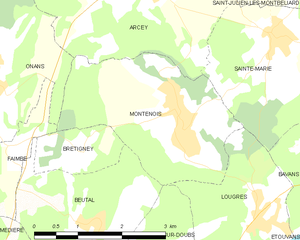
Montenois
- коммуна во Франции
Hiking in Montenois
Montenois, a commune in the Doubs department of the Bourgogne-Franche-Comté region in eastern France, is known for its natural beauty and scenic landscapes, making it a delightful hiking destination. While it may not be as famous as some other hiking locales in France, it offers a peaceful environment for outdoor enthusiasts....
- Страна:
- Почтовый код: 25260
- Координаты: 47° 29' 35" N, 6° 39' 58" E
- GPS треки (wikiloc): [Ссылка]
- Площадь: 8.03 кв.км
- Население: 1519


Saint-Julien-lès-Montbéliard
- коммуна во Франции
Hiking in Saint-Julien-lès-Montbéliard
Saint-Julien-lès-Montbéliard is a charming commune located in the Bourgogne-Franche-Comté region of France, near the town of Montbéliard. The area is characterized by its beautiful natural landscapes, hills, and forests, making it a great destination for hiking enthusiasts....
- Страна:
- Почтовый код: 25550
- Координаты: 47° 31' 20" N, 6° 42' 38" E
- GPS треки (wikiloc): [Ссылка]
- Площадь: 3.81 кв.км
- Население: 168

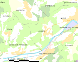
Lougres
- коммуна во Франции
Hiking in Lougres
It seems like there may be a small confusion with the name "Lougres." As of my last training data cut-off in October 2023, there isn't a widely known hiking destination by that name. However, if you're referring to the region of Lugares or perhaps a specific location in Europe or elsewhere that sounds similar, please clarify for more detailed advice....
- Страна:
- Почтовый код: 25260
- Координаты: 47° 28' 18" N, 6° 41' 12" E
- GPS треки (wikiloc): [Ссылка]
- Площадь: 5.97 кв.км
- Население: 774
- Веб сайт: [Ссылка]