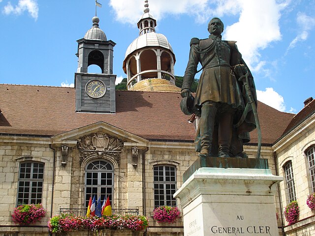
Saizenay (Saizenay)

- коммуна во Франции
 Hiking in Saizenay
Saizenay is a picturesque area that offers an array of hiking opportunities amid beautiful natural scenery. While specific trails may not be as well-documented as those in more popular hiking destinations, there are still plenty of routes and paths to explore. Here are a few general tips and ideas for hiking in Saizenay:
-
Scenic Landscapes: The region is known for its rolling hills, lush forests, and tranquil countryside. Be prepared to encounter diverse ecosystems, which can include woodlands, meadows, and riverbanks.
-
Local Trails: Research local trail maps or contact local hiking clubs or tourist offices for information on marked trails in the area. Some trails may wind through vineyards or along rivers, offering beautiful views and opportunities for wildlife spotting.
-
Difficulty Levels: Trails in Saizenay may vary in difficulty, so it is advisable to choose hikes that match your fitness level and experience. Beginners might enjoy shorter, flatter trails, while more experienced hikers might seek out challenging routes with elevation gain.
-
What to Bring: Ensure you pack essentials such as water, snacks, a first aid kit, a compass or GPS device, and appropriate clothing for the weather conditions. Good hiking footwear is crucial for comfort and safety.
-
Respect Nature: As with any hiking locale, follow Leave No Trace principles. Stay on marked trails, carry out what you bring in, and respect wildlife and other hikers.
-
Local Culture: Don’t forget to take some time to enjoy the local culture, traditions, and possibly even some local cuisine in Saizenay after your hike.
Before heading out, it's always wise to check the weather forecast and let someone know your planned route and expected return time. Enjoy your exploration of the stunning landscapes that Saizenay has to offer!
- Страна:

- Почтовый код: 39110
- Координаты: 46° 57' 43" N, 5° 54' 54" E


- GPS треки (wikiloc): [Ссылка]
- Площадь: 4.88 кв.км
- Население: 100
- Википедия английская: wiki(en)
- Википедия национальная: wiki(fr)
- Хранилище Wikidata: Wikidata: Q614587
- Катеория в википедии: [Ссылка]
- код Freebase: [/m/03nvv46]
- код Freebase: [/m/03nvv46]
- код GeoNames: Альт: [6433748]
- код GeoNames: Альт: [6433748]
- номер SIREN: [213904972]
- номер SIREN: [213904972]
- код BNF: [15258858p]
- код BNF: [15258858p]
- код муниципалитета INSEE: 39497
- код муниципалитета INSEE: 39497
Граничит с регионами:

Salins-les-Bains
- коммуна во Франции
Hiking in Salins-les-Bains
Salins-les-Bains, located in the Jura region of France, is known for its beautiful landscapes, rich historical heritage, and therapeutic salt springs. Hiking in this area offers a mix of natural beauty, cultural landmarks, and opportunities to enjoy the unique geology of the Jura Mountains....
- Страна:
- Почтовый код: 39110
- Координаты: 46° 56' 28" N, 5° 52' 42" E
- GPS треки (wikiloc): [Ссылка]
- Высота над уровнем моря: 350 м m
- Площадь: 24.68 кв.км
- Население: 2718
- Веб сайт: [Ссылка]


Saraz
- коммуна во Франции
Hiking in Saraz
Hiking in Saraz, a region that is often characterized by stunning landscapes, rich biodiversity, and varying terrains, can offer an array of experiences for both beginner and experienced hikers. While specific information about the trails and conditions in Saraz may depend on the particular area or country you are referring to (as "Saraz" can indicate different locations), here are some general tips and insights regarding hiking in a mountainous or scenic area like Saraz:...
- Страна:
- Почтовый код: 25330
- Координаты: 46° 59' 48" N, 5° 58' 58" E
- GPS треки (wikiloc): [Ссылка]
- Площадь: 6.02 кв.км
- Население: 11

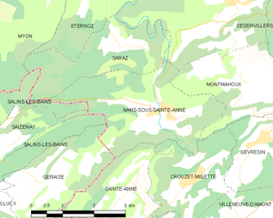
Nans-sous-Sainte-Anne
- коммуна во Франции
Hiking in Nans-sous-Sainte-Anne
Nans-sous-Sainte-Anne is a charming village located in the Jura region of France, known for its stunning natural landscapes, rich biodiversity, and various hiking opportunities. The village is nestled within the Jura Mountains, which offer a mix of lush forests, rolling hills, rivers, and captivating rock formations....
- Страна:
- Почтовый код: 25330
- Координаты: 46° 58' 36" N, 5° 59' 56" E
- GPS треки (wikiloc): [Ссылка]
- Площадь: 8.86 кв.км
- Население: 139