Замерберг (Samerberg, Samerberg)

 Hiking in Замерберг
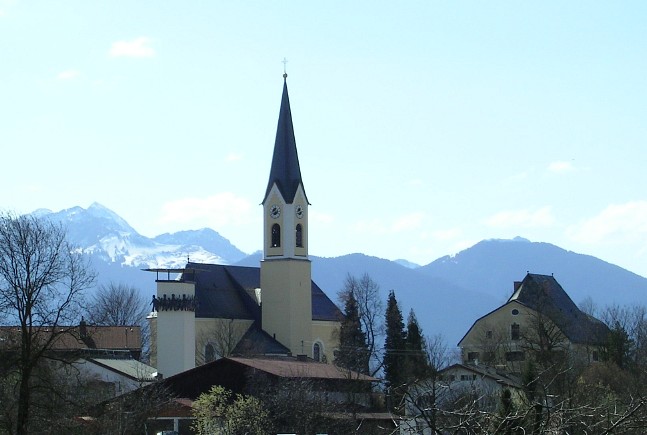
Samerberg is a beautiful region located in Bavaria, Germany, known for its stunning landscapes, diverse hiking trails, and outdoor recreational opportunities. Here’s what you can expect when hiking in Samerberg:
Scenic Trails:
-
Variety of Terrain: Samerberg offers a range of hiking trails, from gentle walks suitable for families to more challenging routes for experienced hikers. The region features rolling hills, lush meadows, dense forests, and panoramic mountain views.
-
Breathtaking Views: Many trails provide stunning vistas of the Alps and the surrounding valleys. Some popular viewpoints include the Wendelstein Mountain, which is accessible via various paths.
Popular Hiking Routes:
-
Samerberg Plateau: The plateau offers several well-marked trails that allow hikers to explore the area at a comfortable pace while enjoying the natural beauty.
-
Samerberger Höhenweg: This scenic trail runs along the ridge and connects several villages. It provides fantastic views and is ideal for those looking to take in the beauty of the region.
-
Wendelstein: The trail to Wendelstein is popular and provides both hiking paths and the option to take a cog railway for part of the way. It is a rewarding hike with breathtaking views from the summit.
Accessibility:
- Trail Markings: The trails are generally well-marked, making it easy for hikers to navigate. Always look out for the yellow signs indicating the paths.
- Difficulty Levels: Trails range from easy to moderate and challenging, so hikers of all levels can find suitable routes.
Tips for Hiking in Samerberg:
- Weather Conditions: Check the weather forecast before heading out, as conditions can change quickly in the mountains.
- Proper Gear: Wear appropriate hiking shoes and dress in layers. Bring enough water and snacks for your hike.
- Respect Nature: Follow the Leave No Trace principles to help preserve the natural beauty of the area.
- Local Information: Visit local tourist information centers for maps, advice on trails, and any updates on conditions.
Nearby Attractions:
Along with hiking, the Samerberg region is also home to other activities such as cycling, paragliding, and winter sports during the colder months.
Whether you're looking for a short day hike or a longer adventure, Samerberg offers a wonderful setting for outdoor enthusiasts to explore nature, enjoy fresh air, and experience the breathtaking Bavarian landscape.
- Страна:

- Почтовый код: 83122
- Телефонный код: 08032
- Код автомобильного номера: RO
- Координаты: 47° 47' 0" N, 12° 13' 0" E


- GPS треки (wikiloc): [Ссылка]
- Высота над уровнем моря: 700 м m
- Площадь: 33.39 кв.км
- Население: 1981
- Веб сайт: http://www.samerberg.de
- Википедия русская: wiki(ru)
- Википедия английская: wiki(en)
- Википедия национальная: wiki(de)
- Хранилище Wikidata: Wikidata: Q533300
- Катеория в википедии: [Ссылка]
- код Freebase: [/m/02q7f9q]
- код GeoNames: Альт: [2842084]
- код VIAF: Альт: [158349716]
- ID отношения в OpenStreetMap: [2186939]
- код GND: Альт: [4118309-5]
- идентификатор местоположения ArchINFORM: [11904]
- код LCNAF: Альт: [n85307947]
- WOEID: [690885]
- код Historical Gazetteer: [SAMERGJN67CS]
- Bavarikon ID: [ODB_A00001330]
- идентификатор муниципалитетов в Германии: 09187172
Граничит с регионами:

Рордорф
Hiking in Рордорф
Rohrdorf, located in Bavaria, Germany, is a picturesque area that offers a variety of hiking opportunities amidst beautiful landscapes. Here are some key points to consider when hiking in and around Rohrdorf:...
- Страна:
- Почтовый код: 83101
- Телефонный код: 08032; 08031
- Код автомобильного номера: RO
- Координаты: 47° 47' 56" N, 12° 10' 3" E
- GPS треки (wikiloc): [Ссылка]
- Высота над уровнем моря: 476 м m
- Площадь: 28.67 кв.км
- Население: 4266
- Веб сайт: [Ссылка]