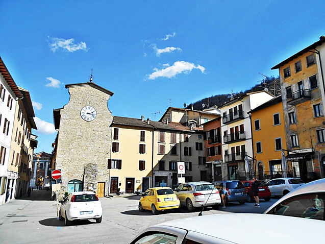
Сан-Бенедетто-Валь-ди-Самбро (San Benedetto Val di Sambro, San Benedetto Val di Sambro)
.svg)
- коммуна Италии
 Hiking in Сан-Бенедетто-Валь-ди-Самбро
San Benedetto Val di Sambro, located in the Apennine Mountains of Italy, offers a picturesque setting for hiking enthusiasts. The area is characterized by its lush landscapes, rolling hills, and a diverse range of flora and fauna. Here are some highlights and tips for hiking in this region:
Hiking Trails
-
Sentiero CAI: The Italian Alpine Club (CAI) has established various marked trails in the area, which vary in difficulty. Look for trails that fit your hiking experience and fitness level.
-
Punta di Ragnatela: This trail offers a moderately challenging hike with stunning views of the surrounding mountains and valleys.
-
Parco Regionale dei Laghi di Suviana e Brasimone: This regional park features several trails around beautiful lakes, providing opportunities for both hiking and enjoying nature. The park is rich in biodiversity.
Scenic Highlights
- Nature and Wildlife: Keep an eye out for local wildlife, including deer, wild boars, and a variety of bird species.
- Historical Sites: The area is rich in history, with ancient villages and churches that can add a cultural dimension to your hiking experience.
Tips for Hikers
- Preparation: Always bring sufficient water, snacks, and a map or GPS device. Familiarize yourself with the trail before setting out.
- Weather Considerations: The weather can change rapidly in the mountains. Dress in layers and be prepared for varying conditions.
- Respect Nature: Stay on marked trails, pack out what you pack in, and adhere to local guidelines to help preserve the natural beauty.
Best Time to Hike
The best time for hiking in San Benedetto Val di Sambro is typically spring (April to June) and fall (September to October) when the weather is mild and the scenery is particularly beautiful with blooming flowers or autumn foliage.
Whether you're a seasoned hiker or a beginner, San Benedetto Val di Sambro offers a range of options that showcase the natural beauty and cultural heritage of the Apennine region. Enjoy your hiking adventure!
- Страна:

- Почтовый код: 40048
- Телефонный код: 0534
- Код автомобильного номера: BO
- Координаты: 44° 13' 0" N, 11° 14' 0" E


- GPS треки (wikiloc): [Ссылка]
- Высота над уровнем моря: 602 м m
- Площадь: 66.47 кв.км
- Население: 4198
- Веб сайт: http://www.comunesbt.it
- Википедия русская: wiki(ru)
- Википедия английская: wiki(en)
- Википедия национальная: wiki(it)
- Хранилище Wikidata: Wikidata: Q94987
- Галерея изображений в википедии: [Ссылка]
- Катеория в википедии: [Ссылка]
- код Freebase: [/m/0gkhv7]
- код GeoNames: Альт: [6536744]
- код VIAF: Альт: [248729792]
- ID отношения в OpenStreetMap: [42923]
- UN/LOCODE: [ITSBS]
- код ISTAT: 037051
- кадастровый код Италии: G566
Граничит с регионами:

Фиренцуола
- коммуна Италии
Hiking in Фиренцуола
Firenzuola is a charming town located in the Tuscan-Emilian Apennines, just north of Florence, Italy. The area is known for its beautiful landscapes, scenic trails, and rich natural and historical heritage, making it a great destination for hikers....
- Страна:
- Почтовый код: 50033
- Телефонный код: 055
- Код автомобильного номера: FI
- Координаты: 44° 7' 11" N, 11° 22' 55" E
- GPS треки (wikiloc): [Ссылка]
- Высота над уровнем моря: 422 м m
- Площадь: 271.99 кв.км
- Население: 4599
- Веб сайт: [Ссылка]

Кастильоне-дей-Пеполи
- коммуна Италии
Hiking in Кастильоне-дей-Пеполи
Castiglione dei Pepoli is a charming village located in the Emilia-Romagna region of Italy, surrounded by the stunning landscapes of the Apennine Mountains. Known for its picturesque scenery, it offers numerous opportunities for hiking enthusiasts to explore the natural beauty of the area....
- Страна:
- Почтовый код: 40035
- Телефонный код: 0534
- Код автомобильного номера: BO
- Координаты: 44° 9' 0" N, 11° 9' 0" E
- GPS треки (wikiloc): [Ссылка]
- Высота над уровнем моря: 691 м m
- Площадь: 65.76 кв.км
- Население: 5514
- Веб сайт: [Ссылка]


Гриццана-Моранди
- коммуна Италии
Hiking in Гриццана-Моранди
Grizzana Morandi, located in the Apennine Mountains of northern Italy, offers a wonderful hiking experience surrounded by stunning landscapes, rich flora and fauna, and historical sites. Here are some highlights to consider when hiking in this beautiful area:...
- Страна:
- Почтовый код: 40030
- Телефонный код: 051
- Код автомобильного номера: BO
- Координаты: 44° 15' 0" N, 11° 9' 0" E
- GPS треки (wikiloc): [Ссылка]
- Высота над уровнем моря: 547 м m
- Площадь: 77 кв.км
- Население: 3694
- Веб сайт: [Ссылка]


Монгидоро
- коммуна Италии
Hiking in Монгидоро
Monghidoro, located in the region of Emilia-Romagna in Italy, offers a variety of hiking opportunities that allow you to explore its beautiful landscapes and rich biodiversity. Here’s what you need to know about hiking in this area:...
- Страна:
- Почтовый код: 40063
- Телефонный код: 051
- Код автомобильного номера: BO
- Координаты: 44° 13' 0" N, 11° 19' 0" E
- GPS треки (wikiloc): [Ссылка]
- Высота над уровнем моря: 841 м m
- Площадь: 48.29 кв.км
- Население: 3689
- Веб сайт: [Ссылка]


Монцуно
- коммуна Италии
Hiking in Монцуно
Monzuno is located in the Emilia-Romagna region of Italy, nestled within the beautiful hills of the Apennine Mountains. It’s a wonderful destination for hikers and nature enthusiasts, offering a variety of trails that cater to different skill levels. Here are some highlights to consider when hiking in Monzuno:...
- Страна:
- Почтовый код: 40036
- Телефонный код: 051
- Код автомобильного номера: BO
- Координаты: 44° 17' 0" N, 11° 16' 0" E
- GPS треки (wikiloc): [Ссылка]
- Высота над уровнем моря: 621 м m
- Площадь: 65.01 кв.км
- Население: 6375
- Веб сайт: [Ссылка]