Сан-Вито-аль-Тальяменто (San Vito al Tagliamento, San Vito al Tagliamento)
.svg)
- коммуна Италии
 Hiking in Сан-Вито-аль-Тальяменто
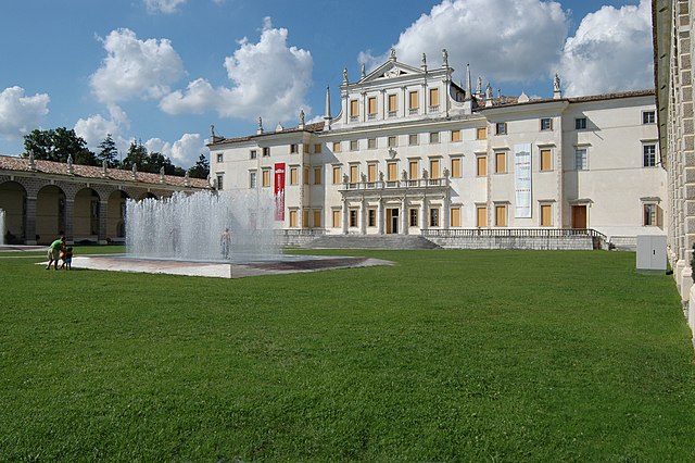
San Vito al Tagliamento, located in the Friuli Venezia Giulia region of northeastern Italy, is a charming town surrounded by picturesque landscapes, making it a great spot for hiking enthusiasts. The area features a mixture of rolling hills, woodlands, and agricultural fields, providing a variety of trails for different skill levels.
Popular Hiking Trails
-
Percorso Natura del Tagliamento: This trail follows the Tagliamento River, offering beautiful views and opportunities to observe local flora and fauna. It’s a relatively easy hike, ideal for families and beginners.
-
Colli Orientali del Friuli: This area offers numerous trails that lead through vineyards and scenic hills. You can enjoy wine tasting experiences along the way while taking in the stunning views of the surrounding countryside.
-
Parco delle Risorgive: Located nearby, this park features a network of trails that explore wetlands and streams. It’s a peaceful area perfect for birdwatching and enjoying nature.
###Tips for Hiking in San Vito al Tagliamento
- Best Time to Hike: Spring (April to June) and fall (September to October) are the best seasons due to mild weather and beautiful scenery.
- Gear: Wear sturdy hiking shoes and dress in layers, as the weather can change quickly. Bring water, snacks, and a first-aid kit.
- Navigation: Some trails may not be well marked, so consider using a GPS app or downloading maps before setting out.
Local Attractions
After a day of hiking, you can explore historic sites in San Vito al Tagliamento, such as the Church of San Vito and the town’s charming squares. Enjoying local cuisine and wines is also a great way to unwind after your outdoor adventures.
In summary, San Vito al Tagliamento offers beautiful hiking opportunities amid stunning landscapes and a rich cultural heritage, making it an excellent destination for outdoor enthusiasts.
- Страна:

- Почтовый код: 33078
- Телефонный код: 0434
- Код автомобильного номера: PN
- Координаты: 45° 54' 55" N, 12° 51' 20" E


- GPS треки (wikiloc): [Ссылка]
- Высота над уровнем моря: 30 м m
- Площадь: 60.88 кв.км
- Население: 15063
- Веб сайт: http://www.comune.san-vito-al-tagliamento.pn.it
- Википедия русская: wiki(ru)
- Википедия английская: wiki(en)
- Википедия национальная: wiki(it)
- Хранилище Wikidata: Wikidata: Q53194
- Катеория в википедии: [Ссылка]
- код Freebase: [/m/0gqzmn]
- код GeoNames: Альт: [6539332]
- код VIAF: Альт: [145412447]
- ID отношения в OpenStreetMap: [79173]
- место в MusicBrainz: [3b1bdf80-2d0f-443a-9330-550e7d241f07]
- код темы Quora: [San-Vito-Al-Tagliamento]
- UN/LOCODE: [ITSVT]
- код в Большой каталанской энциклопедии: [0267422]
- код ISTAT: 093041
- кадастровый код Италии: I403
Граничит с регионами:
Морсано-аль-Тальяменто
- коммуна Италии
Hiking in Морсано-аль-Тальяменто
Morsano al Tagliamento is a picturesque village located in the Friuli Venezia Giulia region of northeastern Italy. The area surrounding Morsano al Tagliamento is characterized by its gentle rolling hills, lush farmlands, and scenic landscapes, making it a delightful spot for hiking enthusiasts....
- Страна:
- Почтовый код: 33075
- Телефонный код: 0434
- Код автомобильного номера: PN
- Координаты: 45° 52' 23" N, 12° 57' 12" E
- GPS треки (wikiloc): [Ссылка]
- Высота над уровнем моря: 14 м m
- Площадь: 32.54 кв.км
- Население: 2788
- Веб сайт: [Ссылка]


Казарса-делла-Делиция
- коммуна Италии
Hiking in Казарса-делла-Делиция
Casarsa della Delizia, located in the Friuli Venezia Giulia region of northeastern Italy, is known for its beautiful landscapes and proximity to the striking natural features of the area. While this small town itself may not have extensive hiking trails directly within its limits, it serves as a great base for exploring the surrounding countryside and nearby natural parks....
- Страна:
- Почтовый код: 33072
- Телефонный код: 0434
- Код автомобильного номера: PN
- Координаты: 45° 57' 0" N, 12° 51' 0" E
- GPS треки (wikiloc): [Ссылка]
- Высота над уровнем моря: 44 м m
- Площадь: 20.47 кв.км
- Население: 8404
- Веб сайт: [Ссылка]
Кьонс
- коммуна Италии
Hiking in Кьонс
Chions, a small commune located in the province of Pordenone in the Friuli Venezia Giulia region of northeastern Italy, offers a peaceful environment for hiking enthusiasts. While it may not be as famous as larger national parks or mountains, the surrounding area features beautiful landscapes ideal for hiking....
- Страна:
- Почтовый код: 33083
- Телефонный код: 0434
- Код автомобильного номера: PN
- Координаты: 45° 51' 0" N, 12° 43' 0" E
- GPS треки (wikiloc): [Ссылка]
- Высота над уровнем моря: 15 м m
- Площадь: 33.45 кв.км
- Население: 5180
- Веб сайт: [Ссылка]
Фьюме-Венето
- коммуна Италии
Hiking in Фьюме-Венето
Fiume Veneto is a charming town located in the Friuli Venezia Giulia region of northeastern Italy. While it may not be as well-known as some of the larger national parks or hiking areas in Italy, it has its own unique appeal for those looking to explore the beautiful landscapes of the region. Here are some key aspects of hiking in and around Fiume Veneto:...
- Страна:
- Почтовый код: 33080
- Телефонный код: 0434
- Код автомобильного номера: PN
- Координаты: 45° 56' 0" N, 12° 44' 0" E
- GPS треки (wikiloc): [Ссылка]
- Высота над уровнем моря: 20 м m
- Площадь: 35.76 кв.км
- Население: 11729
- Веб сайт: [Ссылка]


Сесто-аль-Регена
- коммуна Италии
Hiking in Сесто-аль-Регена
Sesto al Reghena, a charming town in the Friuli Venezia Giulia region of Italy, is not only rich in history and culture but also offers some beautiful hiking opportunities. Nestled in the picturesque countryside, it serves as a great starting point for various hiking trails that allow you to explore the surrounding natural beauty....
- Страна:
- Почтовый код: 33079
- Телефонный код: 0434
- Код автомобильного номера: PN
- Координаты: 45° 51' 0" N, 12° 49' 0" E
- GPS треки (wikiloc): [Ссылка]
- Высота над уровнем моря: 13 м m
- Площадь: 40.68 кв.км
- Население: 6367
- Веб сайт: [Ссылка]
Камино-аль-Тальяменто
- коммуна Италии
Hiking in Камино-аль-Тальяменто
The Camino al Tagliamento, also known as the "Way of the Tagliamento," is a scenic hiking route in the Friuli Venezia Giulia region of northeastern Italy. This trail follows the Tagliamento River, one of the last wild rivers in Europe, and offers hikers a chance to experience stunning natural landscapes, diverse wildlife, and picturesque villages along the way....
- Страна:
- Почтовый код: 33030
- Телефонный код: 0432
- Код автомобильного номера: UD
- Координаты: 45° 55' 39" N, 12° 56' 41" E
- GPS треки (wikiloc): [Ссылка]
- Высота над уровнем моря: 34 м m
- Площадь: 22.32 кв.км
- Население: 1614
- Веб сайт: [Ссылка]

Кодройпо
- коммуна Италии
Hiking in Кодройпо
Codroipo, located in the Friuli Venezia Giulia region of northeastern Italy, offers a unique experience for hikers. The area is characterized by a mix of flat plains and gentle hills, making it suitable for hikers of all skill levels. While Codroipo itself may not be a well-known hiking destination, it's surrounded by beautiful landscapes and trails that can appeal to nature lovers....
- Страна:
- Почтовый код: 33033
- Телефонный код: 0432
- Код автомобильного номера: UD
- Координаты: 45° 57' 41" N, 12° 58' 39" E
- GPS треки (wikiloc): [Ссылка]
- Высота над уровнем моря: 43 м m
- Площадь: 75.22 кв.км
- Население: 16165
- Веб сайт: [Ссылка]