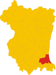
Кодройпо (Codroipo, Codroipo)
.svg)
- коммуна Италии
 Hiking in Кодройпо
Codroipo, located in the Friuli Venezia Giulia region of northeastern Italy, offers a unique experience for hikers. The area is characterized by a mix of flat plains and gentle hills, making it suitable for hikers of all skill levels. While Codroipo itself may not be a well-known hiking destination, it's surrounded by beautiful landscapes and trails that can appeal to nature lovers.
Trails and Surroundings
-
Natural Reserves: The nearby Natural Reserve of Foci dello Stella is a great spot for hiking, featuring diverse ecosystems with opportunities for observing wildlife, particularly birds.
-
Local Paths: Codroipo has various local paths that meander through the countryside, allowing hikers to enjoy the rural charm of the area. These paths often connect to other towns and offer scenic views of the surrounding agricultural lands.
-
Cultural Sites: As you hike around Codroipo, you may encounter historical landmarks, such as rustic villas and traditional farms, which contribute to the region’s cultural experience.
Tips for Hiking in Codroipo
- Best Time to Hike: Spring and fall are ideal times for hiking in this region, as the weather is mild and the landscapes are particularly beautiful.
- Gear: Wear appropriate hiking shoes and bring along essentials such as water, snacks, and a map or a GPS device. The trails can vary in difficulty, so it's essential to be prepared.
- Local Information: Visit local tourist information centers for maps of the area and recommendations for specific trails.
Nearby Attractions
If you're looking to enhance your hiking experience, consider visiting nearby areas such as:
- Val Cosa: Offers a variety of trails in a more mountainous landscape.
- The Giulia Hills: A bit further away but great for those seeking longer hikes with stunning panoramas.
Whether you’re a local or a visitor looking to explore the beautiful Friuli Venezia Giulia region, hiking in and around Codroipo can provide a tranquil and picturesque experience.
- Страна:

- Почтовый код: 33033
- Телефонный код: 0432
- Код автомобильного номера: UD
- Координаты: 45° 57' 41" N, 12° 58' 39" E


- GPS треки (wikiloc): [Ссылка]
- Высота над уровнем моря: 43 м m
- Площадь: 75.22 кв.км
- Население: 16165
- Веб сайт: http://www.comune.codroipo.ud.it
- Википедия русская: wiki(ru)
- Википедия английская: wiki(en)
- Википедия национальная: wiki(it)
- Хранилище Wikidata: Wikidata: Q53246
- Галерея изображений в википедии: [Ссылка]
- Катеория в википедии: [Ссылка]
- код Freebase: [/m/0gk8nr]
- код GeoNames: Альт: [6536308]
- код VIAF: Альт: [168638839]
- ID отношения в OpenStreetMap: [79099]
- идентификатор местоположения ArchINFORM: [893]
- место в MusicBrainz: [66030119-595d-4756-9ca2-6e8d7495f3f4]
- код темы Quora: [Codroipo]
- UN/LOCODE: [ITZGI]
- код в Большой каталанской энциклопедии: [0018493]
- код ISTAT: 030027
- кадастровый код Италии: C817
Граничит с регионами:

Сан-Вито-аль-Тальяменто
- коммуна Италии
Hiking in Сан-Вито-аль-Тальяменто
San Vito al Tagliamento, located in the Friuli Venezia Giulia region of northeastern Italy, is a charming town surrounded by picturesque landscapes, making it a great spot for hiking enthusiasts. The area features a mixture of rolling hills, woodlands, and agricultural fields, providing a variety of trails for different skill levels....
- Страна:
- Почтовый код: 33078
- Телефонный код: 0434
- Код автомобильного номера: PN
- Координаты: 45° 54' 55" N, 12° 51' 20" E
- GPS треки (wikiloc): [Ссылка]
- Высота над уровнем моря: 30 м m
- Площадь: 60.88 кв.км
- Население: 15063
- Веб сайт: [Ссылка]
Базилиано
- коммуна Италии
Hiking in Базилиано
Basiliano is a charming municipality located in the Friuli Venezia Giulia region of northern Italy. Although it may not be as well-known for hiking as some other areas in Italy, it offers a variety of beautiful landscapes, local trails, and access to the surrounding natural parks and hills. Here are some things to consider for hiking in and around Basiliano:...
- Страна:
- Почтовый код: 33031
- Телефонный код: 0432
- Код автомобильного номера: UD
- Координаты: 46° 1' 0" N, 13° 6' 0" E
- GPS треки (wikiloc): [Ссылка]
- Высота над уровнем моря: 77 м m
- Площадь: 43.05 кв.км
- Население: 5345
- Веб сайт: [Ссылка]


Бертиоло
- коммуна Италии
Hiking in Бертиоло
Bertiolo is a small town located in the Friuli Venezia Giulia region of northeastern Italy. While it might not be as famous as some of the larger towns or cities in Italy, it offers access to beautiful natural landscapes and hiking opportunities....
- Страна:
- Почтовый код: 33032
- Телефонный код: 0432
- Код автомобильного номера: UD
- Координаты: 45° 56' 42" N, 13° 3' 19" E
- GPS треки (wikiloc): [Ссылка]
- Высота над уровнем моря: 33 м m
- Площадь: 26.07 кв.км
- Население: 2423
- Веб сайт: [Ссылка]
Камино-аль-Тальяменто
- коммуна Италии
Hiking in Камино-аль-Тальяменто
The Camino al Tagliamento, also known as the "Way of the Tagliamento," is a scenic hiking route in the Friuli Venezia Giulia region of northeastern Italy. This trail follows the Tagliamento River, one of the last wild rivers in Europe, and offers hikers a chance to experience stunning natural landscapes, diverse wildlife, and picturesque villages along the way....
- Страна:
- Почтовый код: 33030
- Телефонный код: 0432
- Код автомобильного номера: UD
- Координаты: 45° 55' 39" N, 12° 56' 41" E
- GPS треки (wikiloc): [Ссылка]
- Высота над уровнем моря: 34 м m
- Площадь: 22.32 кв.км
- Население: 1614
- Веб сайт: [Ссылка]
Лестицца
- коммуна Италии
Hiking in Лестицца
Lestizza is a quaint town located in the Friuli Venezia Giulia region of northeastern Italy. While it might not be as famous as some of Italy's more well-known hiking destinations, it offers a serene environment with potential for lovely hikes in the surrounding countryside....
- Страна:
- Почтовый код: 33050
- Телефонный код: 0432
- Код автомобильного номера: UD
- Координаты: 45° 57' 0" N, 13° 8' 0" E
- GPS треки (wikiloc): [Ссылка]
- Высота над уровнем моря: 24 м m
- Площадь: 34.32 кв.км
- Население: 3771
- Веб сайт: [Ссылка]
Мерето-ди-Томба
- коммуна Италии
Hiking in Мерето-ди-Томба
Mereto di Tomba, located in the Friuli Venezia Giulia region of Italy, is a charming area that offers various hiking opportunities, especially for those looking to explore the natural beauty of northern Italy. The landscape is characterized by rolling hills, vineyards, and views of the surrounding mountains, making it a picturesque spot for outdoor activities....
- Страна:
- Почтовый код: 33036
- Телефонный код: 0432
- Код автомобильного номера: UD
- Координаты: 46° 3' 0" N, 13° 2' 0" E
- GPS треки (wikiloc): [Ссылка]
- Высота над уровнем моря: 98 м m
- Площадь: 27.30 кв.км
- Население: 2606
- Веб сайт: [Ссылка]


Седельяно
- коммуна Италии
Hiking in Седельяно
Sedegliano is a charming town located in the Friuli Venezia Giulia region of northeastern Italy. While it may not be widely known as a hiking destination, the surrounding areas offer some beautiful landscapes and opportunities for walking and hiking enthusiasts. Here’s what you need to know about hiking near Sedegliano:...
- Страна:
- Почтовый код: 33039
- Телефонный код: 0432
- Код автомобильного номера: UD
- Координаты: 46° 0' 50" N, 12° 58' 29" E
- GPS треки (wikiloc): [Ссылка]
- Высота над уровнем моря: 84 м m
- Площадь: 50.53 кв.км
- Население: 3766
- Веб сайт: [Ссылка]

Вармо
- коммуна Италии
Hiking in Вармо
Varmo, located in the Friuli Venezia Giulia region of northeastern Italy, is not widely known as a hiking destination compared to other areas in Italy, but it offers some beautiful landscapes and trails that can be enjoyed by hikers. The region is characterized by its stunning natural scenery, including rolling hills, rivers, and nearby mountains....
- Страна:
- Почтовый код: 33030
- Телефонный код: 0432
- Код автомобильного номера: UD
- Координаты: 45° 53' 0" N, 12° 59' 0" E
- GPS треки (wikiloc): [Ссылка]
- Высота над уровнем моря: 18 м m
- Площадь: 34.92 кв.км
- Население: 2725
- Веб сайт: [Ссылка]