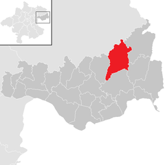
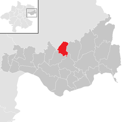
Санкт-Томас-на-Блазенштайне (Sankt Thomas am Blasenstein, St. Thomas am Blasenstein)
 Hiking in Санкт-Томас-на-Блазенштайне
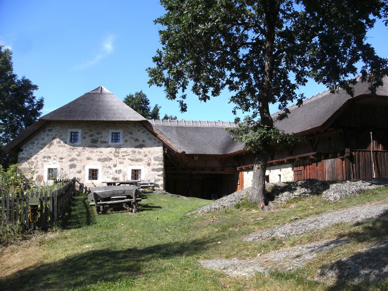
Sankt Thomas am Blasenstein is a charming village located in the Austrian region of Upper Austria, surrounded by beautiful landscapes that are ideal for hiking enthusiasts. The area offers a variety of trails catering to different skill levels, making it a great destination for both beginners and experienced hikers.
Hiking Trails
-
Blasensteiner Rundweg: This circular trail takes you around the Blasenstein area and offers stunning views of the surrounding hills and countryside. It's a moderate hike, suitable for families and those looking for a leisurely experience.
-
Grünburg Valley Trails: The valleys near Sankt Thomas provide several hiking routes that lead you through lush forests and along scenic streams. These trails can vary in difficulty, so you can choose one that matches your fitness level.
-
Peak of Blasenstein: For more experienced hikers, the route to the summit of Blasenstein is a rewarding challenge. The ascent provides panoramic views of the region's landscape, including the nearby foothills of the Alps.
Nature and Wildlife
Hiking in this region gives you the chance to experience diverse flora and fauna. Keep an eye out for local wildlife like deer, foxes, and various bird species. The area is also known for its lush greenery and occasional wildflowers, especially during spring and early summer.
Seasonal Considerations
- Spring and Summer: These seasons are ideal for hiking, with mild temperatures and well-maintained trails.
- Autumn: Fall foliage can create stunning landscapes, making it a great time for photography along the trails.
- Winter: Some trails may be accessible for winter hiking or snowshoeing, but always check local conditions beforehand.
Tips for Hikers
- Map and Information: Always carry a physical map or download a hiking app that works offline, as cell service may be limited in some areas.
- Gear: Wear comfortable and sturdy hiking footwear, and dress in layers to adapt to changing weather conditions.
- Stay Hydrated: Carry enough water, especially on warmer days, as some trails may not offer easily accessible water sources.
- Respect Nature: Follow Leave No Trace principles to preserve the natural beauty of the landscape.
Whether you're seeking a serene walk through nature or a challenging hike, Sankt Thomas am Blasenstein offers fantastic options for outdoor enthusiasts. Make sure to enjoy the beautiful scenery and the tranquility of the Austrian countryside!
- Страна:

- Почтовый код: 4364
- Телефонный код: 07265
- Код автомобильного номера: PE
- Координаты: 48° 18' 47" N, 14° 45' 49" E


- GPS треки (wikiloc): [Ссылка]
- Высота над уровнем моря: 723 м m
- Площадь: 29.04 кв.км
- Население: 927
- Веб сайт: http://www.st-thomas.at/
- Википедия русская: wiki(ru)
- Википедия английская: wiki(en)
- Википедия национальная: wiki(de)
- Хранилище Wikidata: Wikidata: Q678214
- Катеория в википедии: [Ссылка]
- код Freebase: [/m/03gv7qw]
- код GeoNames: Альт: [7873175]
- код VIAF: Альт: [246982831]
- код австрийского муниципалитета: [41122]
Граничит с регионами:

Пирбах
Hiking in Пирбах
Pierbach is a charming village located in Austria, surrounded by beautiful natural landscapes, making it an excellent destination for hiking enthusiasts. Here are some highlights about hiking in the region:...
- Страна:
- Почтовый код: 4282
- Телефонный код: 07267
- Код автомобильного номера: FR
- Координаты: 48° 20' 50" N, 14° 45' 20" E
- GPS треки (wikiloc): [Ссылка]
- Высота над уровнем моря: 494 м m
- Площадь: 22.7 кв.км
- Население: 1011
- Веб сайт: [Ссылка]

Пабнойкирхен
Hiking in Пабнойкирхен
Pabneukirchen is a charming village located in Upper Austria, surrounded by picturesque landscapes ideal for hiking enthusiasts. The area boasts rolling hills, forests, and serene trails that cater to a variety of skill levels, from casual walkers to more experienced hikers....
- Страна:
- Почтовый код: 4363
- Телефонный код: 07265
- Код автомобильного номера: PE
- Координаты: 48° 19' 1" N, 14° 49' 1" E
- GPS треки (wikiloc): [Ссылка]
- Высота над уровнем моря: 571 м m
- Площадь: 40.96 кв.км
- Население: 1706
- Веб сайт: [Ссылка]
Рехберг
Hiking in Рехберг
Rechberg is a beautiful hiking destination located in the Styria region of Austria. Known for its stunning landscapes, scenic views, and tranquil atmosphere, it offers various hiking trails suitable for different skill levels....
- Страна:
- Почтовый код: 4324
- Телефонный код: 07264
- Код автомобильного номера: PE
- Координаты: 48° 19' 19" N, 14° 42' 44" E
- GPS треки (wikiloc): [Ссылка]
- Высота над уровнем моря: 576 м m
- Площадь: 13.8 кв.км
- Население: 996
- Веб сайт: [Ссылка]

Бад-Кройцен
Hiking in Бад-Кройцен
Bad Kreuzen is a picturesque village in Austria, located in the region of Upper Austria, which offers a variety of hiking opportunities suitable for all levels of experience. The area is characterized by its lush landscapes, rolling hills, and beautiful natural settings. Here are some key points to consider if you're planning to hike in Bad Kreuzen:...
- Страна:
- Почтовый код: 4362
- Телефонный код: 07266
- Код автомобильного номера: PE
- Координаты: 48° 16' 0" N, 14° 48' 23" E
- GPS треки (wikiloc): [Ссылка]
- Высота над уровнем моря: 474 м m
- Площадь: 39.9 кв.км
- Население: 2266
- Веб сайт: [Ссылка]

Мюнцбах
Hiking in Мюнцбах
Münzbach, a picturesque village in Austria, offers a wonderful environment for hiking enthusiasts. Nestled in the foothills of the Alps, the region presents a range of trails that cater to various skill levels, from leisurely strolls to more challenging hikes....
- Страна:
- Почтовый код: 4323
- Телефонный код: 07264
- Код автомобильного номера: PE
- Координаты: 48° 16' 1" N, 14° 42' 56" E
- GPS треки (wikiloc): [Ссылка]
- Высота над уровнем моря: 421 м m
- Площадь: 24.89 кв.км
- Население: 1814
- Веб сайт: [Ссылка]

Кёнигсвизен
Hiking in Кёнигсвизен
Königswiesen, located in the beautiful region of Bavaria in Germany, offers a variety of hiking experiences that cater to different skill levels. The area is known for its stunning landscapes, lush forests, and picturesque trails. Here’s what you should know about hiking in Königswiesen:...
- Страна:
- Почтовый код: 4280
- Телефонный код: 07955
- Код автомобильного номера: FR
- Координаты: 48° 24' 28" N, 14° 50' 29" E
- GPS треки (wikiloc): [Ссылка]
- Высота над уровнем моря: 614 м m
- Площадь: 73.39 кв.км
- Население: 3113
- Веб сайт: [Ссылка]