Сант'Агата-суль-Сантерно (Sant'Agata sul Santerno, Sant'Agata sul Santerno)
.svg)
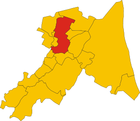
- коммуна Италии
 Hiking in Сант'Агата-суль-Сантерно
Sant'Agata sul Santerno is a quaint village located in the Emilia-Romagna region of Italy, surrounded by beautiful landscapes that are perfect for hiking enthusiasts. While the area itself may not be as famous as other hiking destinations in Italy, it offers a variety of scenic trails that cater to different skill levels.
Hiking Trails and Features:
-
Natural Landscape:
- The area around Sant'Agata sul Santerno is characterized by rolling hills, fertile plains, and picturesque countryside, making it ideal for leisurely hikes where you can enjoy the tranquil beauty of nature.
-
Proximity to Regional Parks:
- The village is close to various regional parks and nature reserves, such as the Delta del Po and the Casentino Forests. These parks provide a more extensive network of trails and opportunities for wildlife observation.
-
Historical Routes:
- You may find trails that lead to historical sites, including ancient churches and castles. Hiking in this region often combines outdoor activity with cultural experiences, as you can explore the rich history of the area.
-
Local Flora and Fauna:
- The area is home to diverse flora and fauna. As you hike, keep an eye out for local wildlife, bird species, and unique plant life that thrive in this region.
Hiking Tips:
- Preparation: Always check the weather forecast and trail conditions before heading out. Bring enough water, snacks, a map, and a first aid kit.
- Footwear: Invest in good hiking boots as some trails may be uneven or have loose gravel.
- Guided Tours: Consider joining local guided hiking tours to learn more about the natural and cultural history of the area.
- Respect Nature: Follow the Leave No Trace principles to help preserve the beauty of the landscape.
Conclusion:
Hiking in Sant'Agata sul Santerno offers a blend of natural beauty and cultural heritage, making it a delightful experience for those looking to explore the Emilia-Romagna countryside. Whether you’re a seasoned hiker or a casual walker, the scenic views and peaceful surroundings will surely enhance your outdoor adventure.
- Страна:

- Почтовый код: 48020
- Телефонный код: 0545
- Код автомобильного номера: RA
- Координаты: 44° 26' 0" N, 11° 52' 0" E


- GPS треки (wikiloc): [Ссылка]
- Высота над уровнем моря: 14 м m
- Площадь: 9.37 кв.км
- Население: 2918
- Веб сайт: http://www.comune.santagatasulsanterno.ra.it/
- Википедия русская: wiki(ru)
- Википедия английская: wiki(en)
- Википедия национальная: wiki(it)
- Хранилище Wikidata: Wikidata: Q52989
- Катеория в википедии: [Ссылка]
- код Freebase: [/m/0gkjrx]
- код GeoNames: Альт: [6540436]
- ID отношения в OpenStreetMap: [43195]
- UN/LOCODE: [ITZUP]
- код ISTAT: 039017
- кадастровый код Италии: I196
Граничит с регионами:

Луго
- коммуна в Италии
Hiking in Луго
Lugo, located in the Emilia-Romagna region of Italy, is known for its rich history and beautiful landscapes. While it's not a prominent hiking destination compared to some other areas in Emilia-Romagna, there are still some enjoyable hiking opportunities in and around Lugo....
- Страна:
- Почтовый код: 48022
- Телефонный код: 0545
- Код автомобильного номера: RA
- Координаты: 44° 25' 0" N, 11° 55' 0" E
- GPS треки (wikiloc): [Ссылка]
- Высота над уровнем моря: 15 м m
- Площадь: 117.06 кв.км
- Население: 32317
- Веб сайт: [Ссылка]
Масса-Ломбарда
- коммуна Италии
Hiking in Масса-Ломбарда
Massa Lombarda, located in the Emilia-Romagna region of Italy, is not predominantly known as a hiking destination compared to other areas in Italy. However, the surrounding countryside offers some scenic walks and opportunities for exploration....
- Страна:
- Почтовый код: 48024
- Телефонный код: 0545
- Код автомобильного номера: RA
- Координаты: 44° 27' 0" N, 11° 49' 0" E
- GPS треки (wikiloc): [Ссылка]
- Высота над уровнем моря: 13 м m
- Площадь: 37.25 кв.км
- Население: 10646
- Веб сайт: [Ссылка]