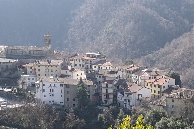
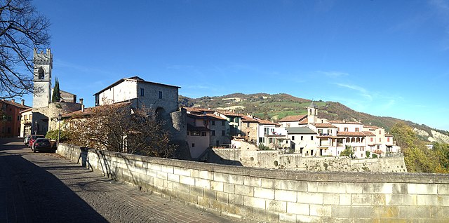
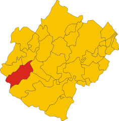
Санта-София (Santa Sofia, Santa Sofia)
.svg)
- коммуна в регионе Эмилия-Романья, Италия
 Hiking in Санта-София
Santa Sofia, located in the province of Forlì-Cesenatico in the Emilia-Romagna region of Italy, offers beautiful hiking opportunities set in a picturesque natural landscape. Nestled in the foothills of the Apennines, the area is characterized by lush forests, rolling hills, and stunning views, making it an attractive destination for outdoor enthusiasts.
Key Hiking Trails and Areas
-
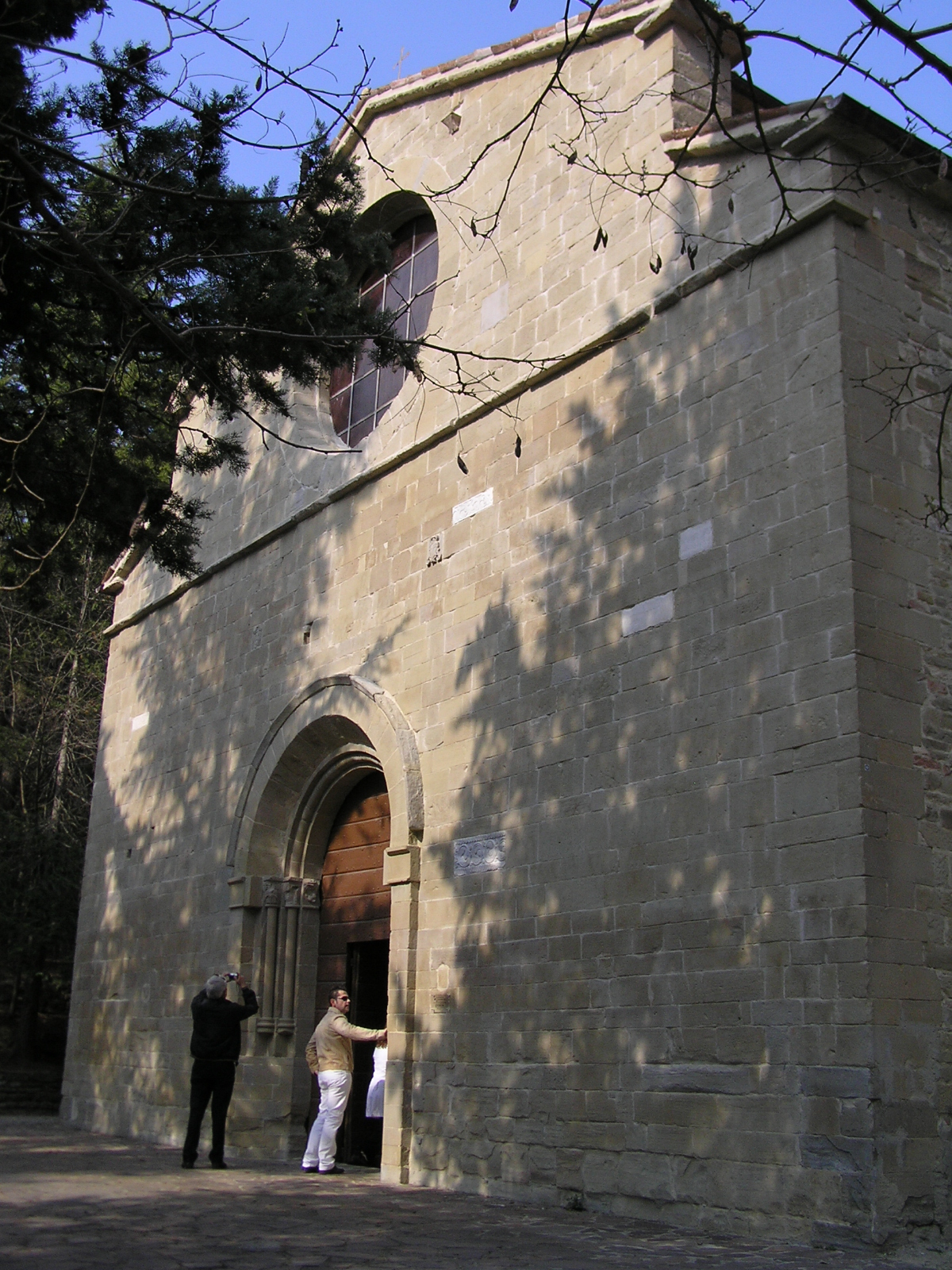
Foreste Casentinesi, Monte Falterona, and Campigna National Park:
- This national park is a highlight for hikers in the area, with numerous trails ranging from easy walks to more challenging hikes. The park features diverse ecosystems, ancient beech forests, and the opportunity to spot various wildlife.
-
Sentiero degli Dei (Path of the Gods):
- This scenic trail offers breathtaking views and is known for its beautiful landscapes. It connects different hamlets and provides an excellent opportunity to experience the local culture and nature.
-
Hiking to Lago di Brasimone:
- A hike to this lake offers not only relaxation by the water but also beautiful views of the surrounding mountains. The paths around the lake are suitable for all skill levels.
-
Monte Pescara:
- For those looking for a more challenging hike, ascending Monte Pescara provides rewarding panoramas of the Apennines. The trail can be steep in sections but is well-marked and offers a sense of adventure.
Tips for Hiking in Santa Sofia
-
Best Time to Visit: The hiking season typically spans from late spring to early autumn (May to October) when the weather is mild and the landscape is lush.
-
Preparation: Always check the weather forecast and wear appropriate hiking shoes. Carry sufficient water and snacks, especially for longer hikes.
-
Trail Maps: It’s advisable to have a detailed map or hiking app as some trails can be lesser-known and not well-marked.
-
Local Guides: Consider joining guided hikes available in the area to enhance your experience and learn more about the local flora and fauna.
-
Respect the Environment: Stay on designated trails, take all litter with you, and respect wildlife and fellow hikers.
Overall, hiking in Santa Sofia offers a mix of natural beauty, cultural heritage, and opportunities for adventure, making it a great destination for both casual and seasoned hikers.
- Страна:

- Почтовый код: 47018
- Телефонный код: 0543
- Код автомобильного номера: FC
- Координаты: 43° 57' 0" N, 11° 54' 0" E


- GPS треки (wikiloc): [Ссылка]
- Высота над уровнем моря: 257 м m
- Площадь: 148.56 кв.км
- Население: 4120
- Веб сайт: http://www.comune.santa-sofia.fo.it/
- Википедия русская: wiki(ru)
- Википедия английская: wiki(en)
- Википедия национальная: wiki(it)
- Хранилище Wikidata: Wikidata: Q99955
- Катеория в википедии: [Ссылка]
- код Freebase: [/m/0gkm86]
- код GeoNames: Альт: [6539949]
- ID отношения в OpenStreetMap: [42694]
- UN/LOCODE: [ITSFA]
- код ISTAT: 040043
- кадастровый код Италии: I310
Граничит с регионами:
Сан-Годенцо
- коммуна Италии
Hiking in Сан-Годенцо
San Godenzo is a charming village located in the Tuscan region of Italy, within the province of Florence. It's nestled in the Apennine Mountains, providing a beautiful setting for hiking enthusiasts. Here’s a guide to hiking in the area:...
- Страна:
- Почтовый код: 50060
- Телефонный код: 055
- Код автомобильного номера: FI
- Координаты: 43° 55' 0" N, 11° 37' 0" E
- GPS треки (wikiloc): [Ссылка]
- Высота над уровнем моря: 404 м m
- Площадь: 99.21 кв.км
- Население: 1129
- Веб сайт: [Ссылка]

Баньо-ди-Романья
- коммуна регионе Эмилия-Романья, Италия
Hiking in Баньо-ди-Романья
Bagno di Romagna, located in the Emilia-Romagna region of Italy, is a beautiful destination for hiking enthusiasts. Nestled in the Casentino Forests, Monte Falterona, and Campigna National Park, this area offers a variety of trails that cater to different skill levels and interests, all within stunning natural surroundings....
- Страна:
- Почтовый код: 47021
- Телефонный код: 0543
- Код автомобильного номера: FC
- Координаты: 43° 50' 0" N, 11° 58' 0" E
- GPS треки (wikiloc): [Ссылка]
- Высота над уровнем моря: 491 м m
- Площадь: 233.52 кв.км
- Население: 5874
- Веб сайт: [Ссылка]

Чивителла-Ди-Романья
- коммуна Италии
Hiking in Чивителла-Ди-Романья
Civitella di Romagna is a charming village located in the Emilia-Romagna region of Italy, nestled in the heart of the Apennine mountains. The area offers stunning landscapes, beautiful trails, and a rich history, making it an excellent destination for hiking enthusiasts....
- Страна:
- Почтовый код: 47012
- Телефонный код: 0543
- Код автомобильного номера: FC
- Координаты: 44° 0' 0" N, 11° 56' 0" E
- GPS треки (wikiloc): [Ссылка]
- Высота над уровнем моря: 219 м m
- Площадь: 117.93 кв.км
- Население: 3758
- Веб сайт: [Ссылка]

Галеата
- коммуна регионе Эмилия-Романья, Италия
Hiking in Галеата
Galeata is a charming rural area located in the Emilia-Romagna region of Italy, known for its picturesque landscapes and rich natural heritage. Here are some insights into hiking in and around Galeata:...
- Страна:
- Почтовый код: 47010
- Телефонный код: 0543
- Код автомобильного номера: FC
- Координаты: 44° 0' 0" N, 11° 55' 0" E
- GPS треки (wikiloc): [Ссылка]
- Высота над уровнем моря: 237 м m
- Площадь: 63.13 кв.км
- Население: 2511
- Веб сайт: [Ссылка]

Премилькуоре
- коммуна Италии
Hiking in Премилькуоре
Premilcuore is a charming village situated in the Emilia-Romagna region of Italy, surrounded by the stunning landscapes of the Casentino Forests. This area is ideal for hiking enthusiasts due to its picturesque trails, rich biodiversity, and the tranquility of nature....
- Страна:
- Почтовый код: 47010
- Телефонный код: 0543
- Код автомобильного номера: FC
- Координаты: 43° 58' 58" N, 11° 47' 5" E
- GPS треки (wikiloc): [Ссылка]
- Высота над уровнем моря: 459 м m
- Площадь: 98.56 кв.км
- Население: 777
- Веб сайт: [Ссылка]


Сарсина
- коммуна Италии
Hiking in Сарсина
Sarsina, located in the Emilia-Romagna region of Italy, is a charming town that offers various hiking opportunities amidst beautiful landscapes and rich historical and cultural heritage. The surrounding area includes the Appenine Mountains, which provide a variety of trails suitable for different skill levels....
- Страна:
- Почтовый код: 47027
- Телефонный код: 0547
- Код автомобильного номера: FC
- Координаты: 43° 55' 0" N, 12° 9' 0" E
- GPS треки (wikiloc): [Ссылка]
- Высота над уровнем моря: 243 м m
- Площадь: 100 кв.км
- Население: 3662
- Веб сайт: [Ссылка]