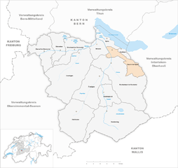
Заксетен (Saxeten, Saxeten)

 Hiking in Заксетен
Saxeten is a picturesque village located in the Bernese Oberland region of Switzerland, near the popular tourist town of Interlaken. It is surrounded by stunning mountainous landscapes, lush forests, and beautiful lakes, making it an excellent destination for hiking enthusiasts. Here are some key points about hiking in Saxeten:
Hiking Trails
-
Varied Difficulty Levels: The region offers a range of trails suitable for all experience levels, from leisurely walks to challenging hikes.
-
Scenic Routes: Many trails provide breathtaking views of the Eiger, Mönch, Jungfrau mountains, and the picturesque valleys. You can also enjoy views of the nearby lakes such as Lake Brienz and Lake Thun.
-
Local Trails: The "Saxeten area" features local trails that often pass through meadows and forests, and may also lead to traditional Swiss chalets, offering delightful experiences of Swiss culture and hospitality along the way.
-
Access to Peaks: There are several hikes that can take you closer to the higher peaks, where you might encounter glaciers and alpine wildlife.
Practical Information
-
Season: The best times for hiking in Saxeten are during the late spring to early autumn months (May to October), when the weather is generally mild and the trails are clear of snow.
-
Trail Conditions: Check trail conditions before heading out, especially in spring and early summer when snow may still be present at higher elevations.
-
Maps and Guides: Consider using local hiking maps or guides for detailed trail information. The Swiss hiking network is well-marked, and many trails are available in various languages.
Tips for Hiking in Saxeten
- Stay Hydrated: Carry sufficient water with you, especially on longer hikes.
- Dress Appropriately: Swiss weather can change rapidly in the mountains, so dress in layers and bring rain gear.
- Safety First: Make sure someone knows your hiking plans and estimated return time. Cell service can be patchy in remote areas.
Local Attractions
-
Aside from hiking, Saxeten and its surroundings also offer opportunities for other outdoor activities like biking, paragliding, and even swimming in the nearby lakes during summer months.
-
Don’t miss the chance to explore nearby attractions such as the charming town of Interlaken, or take a cable car ride up to the higher mountains for panoramic views.
Overall, hiking in Saxeten encompasses stunning natural beauty, diverse trail options, and the chance to experience the serenity of the Swiss Alps, making it a fantastic destination for hiking enthusiasts.
- Страна:

- Почтовый код: 3813
- Телефонный код: 033
- Код автомобильного номера: BE
- Координаты: 46° 37' 30" N, 7° 49' 39" E


- GPS треки (wikiloc): [Ссылка]
- Высота над уровнем моря: 1239 м m
- Площадь: 19.02 кв.км
- Население: 100
- Веб сайт: http://www.saxeten.ch
- Википедия русская: wiki(ru)
- Википедия английская: wiki(en)
- Википедия национальная: wiki(de)
- Хранилище Wikidata: Wikidata: Q66009
- Катеория в википедии: [Ссылка]
- код Freebase: [/m/0dhrj7]
- код GeoNames: Альт: [7287068]
- код VIAF: Альт: [233900404]
- ID отношения в OpenStreetMap: [1682646]
- идентификатор HDS: [345]
- код швейцарского муниципалитета: [0591]
Граничит с регионами:


Лаутербруннен
Hiking in Лаутербруннен
Lauterbrunnen is a stunning valley located in the Swiss Alps, known for its dramatic cliffs and impressive waterfalls. It serves as a gateway to the Jungfrau region and offers a variety of hiking opportunities, suitable for different skill levels. Here are some key highlights and tips for hiking in Lauterbrunnen:...
- Страна:
- Почтовый код: 3822
- Телефонный код: 033
- Код автомобильного номера: BE
- Координаты: 46° 33' 6" N, 7° 53' 37" E
- GPS треки (wikiloc): [Ссылка]
- Высота над уровнем моря: 1407 м m
- Площадь: 164.4 кв.км
- Население: 2732
- Веб сайт: [Ссылка]


Дерлиген
Hiking in Дерлиген
Därligen is a charming village located near Lake Thun in the Bernese Oberland region of Switzerland. It's a fantastic area for hiking, offering stunning views of the lake and surrounding mountains, while also providing access to a variety of trails suitable for different skill levels....
- Страна:
- Почтовый код: 3707
- Телефонный код: 033
- Код автомобильного номера: BE
- Координаты: 46° 39' 12" N, 7° 48' 46" E
- GPS треки (wikiloc): [Ссылка]
- Высота над уровнем моря: 823 м m
- Площадь: 6.91 кв.км
- Население: 429
- Веб сайт: [Ссылка]


Лайссиген
Hiking in Лайссиген
Leissigen is a picturesque village located in the Bernese Oberland region of Switzerland, near Lake Thun. It is an excellent destination for hiking enthusiasts, offering breathtaking views of the surrounding mountains, lush forests, and tranquil lake scenery. Here are some highlights of hiking in Leissigen:...
- Страна:
- Почтовый код: 3706
- Телефонный код: 033
- Код автомобильного номера: BE
- Координаты: 46° 38' 31" N, 7° 46' 46" E
- GPS треки (wikiloc): [Ссылка]
- Высота над уровнем моря: 1037 м m
- Площадь: 10.4 кв.км
- Население: 1079
- Веб сайт: [Ссылка]

Эши-Шпиц
Hiking in Эши-Шпиц
Aeschi bei Spiez is a charming village located in the Bernese Oberland region of Switzerland, offering a range of hiking opportunities with stunning views of the surrounding landscape, including Lake Thun and the majestic Alps. Here are some highlights for hiking in Aeschi bei Spiez:...
- Страна:
- Почтовый код: 3703
- Телефонный код: 033
- Код автомобильного номера: BE
- Координаты: 46° 37' 25" N, 7° 44' 55" E
- GPS треки (wikiloc): [Ссылка]
- Высота над уровнем моря: 1268 м m
- Площадь: 30.9 кв.км
- Население: 2285
- Веб сайт: [Ссылка]


Вильдерсвиль
Hiking in Вильдерсвиль
Wilderswil, located in the Bernese Oberland region of Switzerland, is a charming village nestled between the stunning mountains of the Alps and is a gateway to numerous hikes. Its proximity to Interlaken makes it a popular choice for both locals and tourists seeking outdoor adventures....
- Страна:
- Почтовый код: 3812
- Телефонный код: 033
- Код автомобильного номера: BE
- Координаты: 46° 39' 59" N, 7° 52' 0" E
- GPS треки (wikiloc): [Ссылка]
- Высота над уровнем моря: 884 м m
- Площадь: 13.5 кв.км
- Население: 2672
- Веб сайт: [Ссылка]