
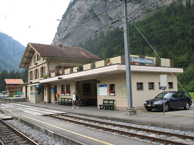
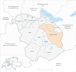
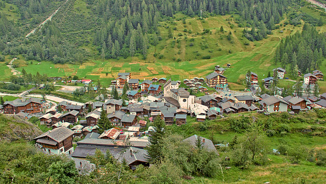
Лаутербруннен (Lauterbrunnen, Lauterbrunnen)

 Hiking in Лаутербруннен
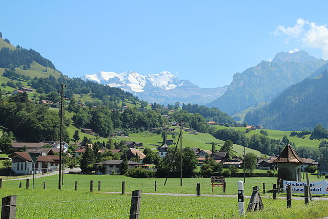
Lauterbrunnen is a stunning valley located in the Swiss Alps, known for its dramatic cliffs and impressive waterfalls. It serves as a gateway to the Jungfrau region and offers a variety of hiking opportunities, suitable for different skill levels. Here are some key highlights and tips for hiking in Lauterbrunnen:
Scenic Beauty
- Waterfalls: The valley boasts 72 waterfalls, with Staubbach Falls being one of the most famous. Hiking around the falls provides spectacular views and photo opportunities.
- Alpine Views: The scenic backdrop of towering peaks like the Eiger, Mönch, and Jungfrau makes every hike breathtaking.
Popular Hiking Trails
-
Lauterbrunnen to Mürren:
- Difficulty: Moderate
- Distance: Approximately 12 km (7.5 miles)
- Duration: About 4-5 hours
- Description: This trail follows a picturesque path through the valley and climbs up to the charming car-free village of Mürren, offering panoramic views along the way.
-
The Trümmelbach Falls:
- Access: Easily reachable from Lauterbrunnen, this series of impressive waterfalls is inside a mountain and can be explored through walking paths and tunnels.
- Duration: A short visit or a couple of hours can be spent here.
-
Mürren to Schilthorn:
- Difficulty: Moderate to challenging
- Distance: About 10 km (6.2 miles)
- Duration: Approximately 4-5 hours
- Description: This trail ascends to the Schilthorn, famous for its rotating restaurant and panoramic views. You can take a cable car back down, if preferred.
-
The Panorama Trail:
- Difficulty: Easy to moderate
- Description: This is a well-marked trail that allows hikers to enjoy stunning views of the Lauterbrunnen valley and surrounding mountains, often suitable for families and beginner hikers.
Tips for Hiking in Lauterbrunnen
- Weather: The weather can change rapidly in the Alps, so it's essential to check conditions before you head out. Bring layers, as temperatures can vary.
- Gear: Good hiking boots are a must. Trekking poles can also be beneficial, especially on steep or uneven terrain.
- Maps: Familiarize yourself with the trails using online resources or obtain physical maps from local tourist information centers.
- Water & Snacks: Carry enough water and snacks, as some trails may not have facilities.
- Public Transport: Lauterbrunnen has good public transport connections, making it easy to reach starting points for hikes.
Safety
- Always inform someone about your hiking plans.
- Hike with a buddy when possible, especially on more challenging trails.
- Check trail conditions and be aware of your physical limitations.
Hiking in Lauterbrunnen provides an incredible way to experience the stunning natural beauty of the Swiss Alps, whether you're trekking through lush valleys or admiring stunning waterfalls. Enjoy your adventure!
- Страна:

- Почтовый код: 3822
- Телефонный код: 033
- Код автомобильного номера: BE
- Координаты: 46° 33' 6" N, 7° 53' 37" E


- GPS треки (wikiloc): [Ссылка]
- Высота над уровнем моря: 1407 м m
- Площадь: 164.4 кв.км
- Население: 2732
- Веб сайт: http://www.lauterbrunnen.ch
- Википедия русская: wiki(ru)
- Википедия английская: wiki(en)
- Википедия национальная: wiki(de)
- Хранилище Wikidata: Wikidata: Q64011
- Катеория в википедии: [Ссылка]
- код Freebase: [/m/01qjl3]
- код GeoNames: Альт: [7286285]
- код VIAF: Альт: [236829665]
- ID отношения в OpenStreetMap: [1682529]
- идентификатор местоположения ArchINFORM: [5885]
- идентификатор HDS: [338]
- код швейцарского муниципалитета: [0584]
Граничит с регионами:


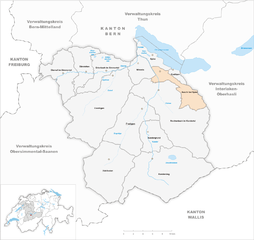
Гриндельвальд
Hiking in Гриндельвальд
Grindelwald is a stunning alpine village located in the Bernese Oberland region of Switzerland, known for its breathtaking landscapes, towering peaks, and diverse hiking trails. Here’s what you need to know about hiking in Grindelwald:...
- Страна:
- Почтовый код: 3818
- Телефонный код: 033
- Код автомобильного номера: BE
- Координаты: 46° 37' 9" N, 8° 3' 4" E
- GPS треки (wikiloc): [Ссылка]
- Высота над уровнем моря: 1142 м m
- Площадь: 171.28 кв.км
- Население: 4138
- Веб сайт: [Ссылка]
Гюндлишванд
Hiking in Гюндлишванд
Gündlischwand is a picturesque village located in the Bernese Oberland region of Switzerland, and it serves as a fantastic base for hiking enthusiasts. The area boasts stunning views of the surrounding mountains, lush valleys, and the iconic Eiger, Mönch, and Jungfrau peaks. Here are some highlights and tips for hiking in Gündlischwand:...
- Страна:
- Почтовый код: 3815
- Телефонный код: 033
- Код автомобильного номера: BE
- Координаты: 46° 36' 59" N, 7° 53' 59" E
- GPS треки (wikiloc): [Ссылка]
- Высота над уровнем моря: 1551 м m
- Площадь: 16.9 кв.км
- Население: 324
- Веб сайт: [Ссылка]

Заксетен
Hiking in Заксетен
Saxeten is a picturesque village located in the Bernese Oberland region of Switzerland, near the popular tourist town of Interlaken. It is surrounded by stunning mountainous landscapes, lush forests, and beautiful lakes, making it an excellent destination for hiking enthusiasts. Here are some key points about hiking in Saxeten:...
- Страна:
- Почтовый код: 3813
- Телефонный код: 033
- Код автомобильного номера: BE
- Координаты: 46° 37' 30" N, 7° 49' 39" E
- GPS треки (wikiloc): [Ссылка]
- Высота над уровнем моря: 1239 м m
- Площадь: 19.02 кв.км
- Население: 100
- Веб сайт: [Ссылка]


Люченталь
Hiking in Люченталь
Lütschental is a picturesque valley located in the Bernese Oberland region of Switzerland, known for its stunning alpine scenery and diverse hiking opportunities. Here are some highlights and tips for hiking in Lütschental:...
- Страна:
- Почтовый код: 3816
- Телефонный код: 033
- Код автомобильного номера: BE
- Координаты: 46° 38' 38" N, 7° 57' 8" E
- GPS треки (wikiloc): [Ссылка]
- Высота над уровнем моря: 1243 м m
- Площадь: 12.4 кв.км
- Население: 219
- Веб сайт: [Ссылка]


Кандерштег
Hiking in Кандерштег
Kandersteg is a picturesque village located in the Bernese Oberland region of Switzerland, surrounded by stunning mountain ranges, lush valleys, and enchanting alpine scenery. It's a fantastic destination for hiking enthusiasts of all levels, offering a variety of trails with breathtaking views....
- Страна:
- Почтовый код: 3718
- Телефонный код: 033
- Код автомобильного номера: BE
- Координаты: 46° 28' 9" N, 7° 42' 30" E
- GPS треки (wikiloc): [Ссылка]
- Высота над уровнем моря: 2662 м m
- Площадь: 134.5 кв.км
- Население: 1301
- Веб сайт: [Ссылка]
Райхенбах
- община швейцарии в Швейцарии, Берн
Hiking in Райхенбах
Reichenbach im Kandertal, located in Switzerland, is a beautiful destination for hiking enthusiasts. Situated in the Bernese Oberland, the area boasts stunning landscapes characterized by rolling hills, lush valleys, and impressive mountain views. Here are some key aspects of hiking in Reichenbach im Kandertal:...
- Страна:
- Почтовый код: 3713
- Телефонный код: 033
- Код автомобильного номера: BE
- Координаты: 46° 34' 31" N, 7° 44' 13" E
- GPS треки (wikiloc): [Ссылка]
- Высота над уровнем моря: 1081 м m
- Площадь: 125.8 кв.км
- Население: 3616
- Веб сайт: [Ссылка]

Blatten
Hiking in Blatten
Blatten, located in the Lötschen Valley of Switzerland, is a fantastic destination for hiking enthusiasts. This picturesque village is part of the municipality of Naters in the canton of Valais, offering stunning panoramic views of the surrounding mountains....
- Страна:
- Почтовый код: 3919
- Телефонный код: 027
- Код автомобильного номера: VS
- Координаты: 46° 25' 0" N, 7° 49' 0" E
- GPS треки (wikiloc): [Ссылка]
- Высота над уровнем моря: 1542 м m
- Площадь: 90.63 кв.км
- Население: 294
- Веб сайт: [Ссылка]

Эши-Шпиц
Hiking in Эши-Шпиц
Aeschi bei Spiez is a charming village located in the Bernese Oberland region of Switzerland, offering a range of hiking opportunities with stunning views of the surrounding landscape, including Lake Thun and the majestic Alps. Here are some highlights for hiking in Aeschi bei Spiez:...
- Страна:
- Почтовый код: 3703
- Телефонный код: 033
- Код автомобильного номера: BE
- Координаты: 46° 37' 25" N, 7° 44' 55" E
- GPS треки (wikiloc): [Ссылка]
- Высота над уровнем моря: 1268 м m
- Площадь: 30.9 кв.км
- Население: 2285
- Веб сайт: [Ссылка]


Вильдерсвиль
Hiking in Вильдерсвиль
Wilderswil, located in the Bernese Oberland region of Switzerland, is a charming village nestled between the stunning mountains of the Alps and is a gateway to numerous hikes. Its proximity to Interlaken makes it a popular choice for both locals and tourists seeking outdoor adventures....
- Страна:
- Почтовый код: 3812
- Телефонный код: 033
- Код автомобильного номера: BE
- Координаты: 46° 39' 59" N, 7° 52' 0" E
- GPS треки (wikiloc): [Ссылка]
- Высота над уровнем моря: 884 м m
- Площадь: 13.5 кв.км
- Население: 2672
- Веб сайт: [Ссылка]


Fieschertal
Hiking in Fieschertal
Fieschertal, located in the Swiss Alps in the municipality of Fiesch, is a picturesque destination for hiking enthusiasts. The region is renowned for its stunning landscapes, lush valleys, and breathtaking mountain views, making it an excellent choice for hikers of all levels....
- Страна:
- Почтовый код: 3984
- Телефонный код: 027
- Код автомобильного номера: VS
- Координаты: 46° 30' 0" N, 8° 8' 0" E
- GPS треки (wikiloc): [Ссылка]
- Высота над уровнем моря: 1108 м m
- Площадь: 172.96 кв.км
- Население: 334
- Веб сайт: [Ссылка]