
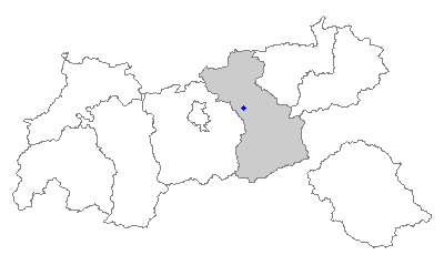
Швац (Schwaz, Schwaz)

 Hiking in Швац
Schwaz, located in the Tyrolean region of Austria, is a wonderful destination for hikers due to its stunning natural landscapes, rich history, and varied trails. The area offers numerous hiking opportunities that cater to all skill levels, from leisurely walks to challenging mountain treks.
Hiking Trails and Highlights:
-
Ski- & Freizeit-Arena Bergeralm: While primarily known for winter sports, this area has excellent summer hiking trails. The panoramic views from the peaks are fantastic.
-
Schwazer Silberberg: A hike to the Silver Mountain, which has historical significance due to its mining history. The trail leads through scenic woodlands and offers insight into the area’s mining past.
-
Vomp Valley: This picturesque valley offers various trails, allowing hikers to enjoy the serene environment, lush meadows, and beautiful river views.
-
Zillertal Alps: Just a short distance from Schwaz, you can access the Zillertal Alps. There are numerous challenging hikes, including routes that lead to stunning mountain huts and viewpoints.
-
Wanderweg (Hiking Path) MÖV: This trail is marked and offers varying levels of difficulty. It is also family-friendly, making it suitable for hikers of all ages.
Tips for Hiking in Schwaz:
- Weather Check: Always check the local weather conditions before heading out, as the weather can change quickly in the mountains.
- Gear: Wear appropriate footwear and clothing for hiking. Carry a daypack with water, snacks, a first-aid kit, and a map or GPS device.
- Trail Markings: Pay attention to the trail markers. The region is well signposted, but it's good to know the route you are following.
- Respect Nature: Stay on marked paths and follow Leave No Trace principles to preserve the environment.
- Local Culture: Take time to explore the local culture, including visiting historic sites in Schwaz, such as the Schwaz Silver Mine and St. Mary’s Basilica.
Accessibility:
Schwaz is well-connected by public transport, making it easy to access trailheads. Local tourist offices can provide maps and additional information about the trails.
Whether you’re a casual walker or a seasoned hiker, Schwaz offers a unique blend of natural beauty, cultural heritage, and enjoyable hiking experiences.
- Страна:

- Почтовый код: 6130
- Телефонный код: 05242
- Код автомобильного номера: SZ
- Координаты: 47° 21' 0" N, 11° 42' 0" E


- GPS треки (wikiloc): [Ссылка]
- Высота над уровнем моря: 545 м m
- Площадь: 20 кв.км
- Население: 13728
- Веб сайт: http://www.schwaz.at/
- Википедия русская: wiki(ru)
- Википедия английская: wiki(en)
- Википедия национальная: wiki(de)
- Хранилище Wikidata: Wikidata: Q583485
- Катеория в википедии: [Ссылка]
- код Freebase: [/m/06tb64]
- код GeoNames: Альт: [2765390]
- код VIAF: Альт: [129027809]
- код GND: Альт: [4053810-2]
- идентификатор местоположения ArchINFORM: [6226]
- код LCNAF: Альт: [n82085612]
- место в MusicBrainz: [5c9c9433-5418-4c19-a649-2c081ee80e36]
- код австрийского муниципалитета: [70926]
- код GAMEO: [Schwaz (Tyrol, Austria)]
Граничит с регионами:


Фомп
Hiking in Фомп
Vomp, located in the Tyrol region of Austria, is a charming village that serves as a gateway to stunning hiking experiences in the surrounding mountains. Here are some key points about hiking in and around Vomp:...
- Страна:
- Код автомобильного номера: SZ
- Координаты: 47° 20' 32" N, 11° 41' 0" E
- GPS треки (wikiloc): [Ссылка]
- Высота над уровнем моря: 563 м m
- Площадь: 182.61 кв.км
- Население: 5146
- Веб сайт: [Ссылка]

Штанс
Hiking in Штанс
Stans, a picturesque village located in the Tyrol region of Austria, offers a variety of hiking opportunities that cater to different skill levels and preferences. Nestled in the foothills of the Alps, the area is known for its stunning landscapes, lush forests, and breathtaking mountain views....
- Страна:
- Почтовый код: 6135
- Телефонный код: 05242
- Код автомобильного номера: SZ
- Координаты: 47° 22' 8" N, 11° 43' 8" E
- GPS треки (wikiloc): [Ссылка]
- Высота над уровнем моря: 563 м m
- Площадь: 20.1 кв.км
- Население: 2035
- Веб сайт: [Ссылка]

Бух-Йенбах
Hiking in Бух-Йенбах
Buch in Tirol is a charming village located in the Tyrol region of Austria, surrounded by stunning alpine landscapes that offer a variety of hiking opportunities. Here are some highlights and tips for hiking in and around Buch:...
- Страна:
- Почтовый код: 6220
- Телефонный код: 05244
- Код автомобильного номера: SZ
- Координаты: 47° 22' 41" N, 11° 46' 8" E
- GPS треки (wikiloc): [Ссылка]
- Высота над уровнем моря: 545 м m
- Площадь: 9.49 кв.км
- Население: 2548
- Веб сайт: [Ссылка]

Пилль
Hiking in Пилль
Pill, a charming village in the Tyrol region of Austria, offers a splendid base for hiking enthusiasts looking to explore the stunning landscapes of the Alps. Nestled near the Inn River and surrounded by lush greenery, Pill is characterized by its picturesque mountain views, making it an ideal location for various hiking trails....
- Страна:
- Почтовый код: 6136
- Телефонный код: 05242
- Код автомобильного номера: SZ
- Координаты: 47° 19' 15" N, 11° 40' 57" E
- GPS треки (wikiloc): [Ссылка]
- Высота над уровнем моря: 556 м m
- Площадь: 20.9 кв.км
- Население: 1174
- Веб сайт: [Ссылка]
Гальцайн
Hiking in Гальцайн
Gallzein is a charming village located in the Austrian state of Tyrol, near the Zillertal Alps, known for its stunning scenery and extensive hiking opportunities. Here are some highlights about hiking in Gallzein:...
- Страна:
- Почтовый код: 6222
- Телефонный код: 05244
- Код автомобильного номера: SZ
- Координаты: 47° 22' 0" N, 11° 46' 0" E
- GPS треки (wikiloc): [Ссылка]
- Высота над уровнем моря: 825 м m
- Площадь: 10.10 кв.км
- Население: 668
- Веб сайт: [Ссылка]

Фюгенберг
Hiking in Фюгенберг
Fügenberg is a beautiful hiking destination located in the Zillertal Valley of Tyrol, Austria. Known for its stunning landscapes, lush forests, and panoramic mountain views, it offers a range of hiking trails suitable for various skill levels, from easy walks to more challenging hikes....
- Страна:
- Почтовый код: 6264
- Телефонный код: 05288
- Код автомобильного номера: SZ
- Координаты: 47° 20' 17" N, 11° 50' 40" E
- GPS треки (wikiloc): [Ссылка]
- Высота над уровнем моря: 681 м m
- Площадь: 58.5 кв.км
- Население: 1405
- Веб сайт: [Ссылка]